Gilbert River, Queensland

Last updated

Map all coordinates using: OpenStreetMap  
Download coordinates as: KML
Gilbert River
Queensland
Australia Queensland location map.svg
Red pog.svg
Gilbert River
Coordinates 18°15′21″S142°45′11″E / 18.2559°S 142.7530°E / -18.2559; 142.7530 (Gilbert River (centre of locality)) Coordinates: 18°15′21″S142°45′11″E / 18.2559°S 142.7530°E / -18.2559; 142.7530 (Gilbert River (centre of locality))
Population38 (2016 census) [1]
 • Density0.01593/km2 (0.0413/sq mi)
Postcode(s) 4871
Area2,385.4 km2 (921.0 sq mi)
Time zone AEST (UTC+10:00)
LGA(s) Shire of Etheridge
State electorate(s) Traeger
Federal division(s) Kennedy
Suburbs around Gilbert River:
Croydon Strathmore Strathmore
Croydon Gilbert River Georgetown
Esmeralda Northhead Georgetown

Gilbert River is a rural locality in the Shire of Etheridge, Queensland, Australia. [2] In the 2016 census Gilbert River had a population of 38 people. [1]

Contents

Geography

The locality is roughly bounded to the south by the Gregory Range ( 18°29′15″S142°38′36″E / 18.4876°S 142.6433°E / -18.4876; 142.6433 (Gregory Range) ) which extends into neighbouring Croydon, Esmeralda and Northhead and beyond. [3]

Gilbert River has the following mountains:

The western part of the locality is a protected area being within the Littleton National Park and the Littleton Resources Reserve. [6] The remainder of the land is used for grazing on native vegetation with a small amount of pasture around the Gilbert River. [3]

Road infrastructure

The Richmond–Croydon Road runs through the south-western corner. [7]

History

Jangga, also known as Yangga, is a language of Central Queensland. The Jangga language region includes the landscape within the local government boundaries of the Etheridge Shire Council. [8]

The locality takes its name from the Gilbert River which flows through the locality. [9]

Gilbert River Provisional School opened on 8 May 1899. On 1 January 1909 it became Gilbert River State School. It closed in 1923. It reopened in 1954 and then closed in 1961. [10]

In the 2016 census Gilbert River had a population of 38 people. [1]

Economy

There are a number of homesteads in the locality, including: [11]

Transport

Littleton Airstrip (also known as Inorunie) is an airstrip just inside the national park and immediately south of the Inorunie homestead ( 18°12′49″S142°39′19″E / 18.2137°S 142.6554°E / -18.2137; 142.6554 (Littleton Airstrip) ). [12]

Related Research Articles

Hebel, Queensland Town in Queensland, Australia

Hebel is a rural town and locality in the Shire of Balonne, Queensland, Australia. It is on the border of Queensland and New South Wales. In the 2016 census, Hebel had a population of 67 people.

Camooweal Town in Queensland, Australia

Camooweal is an outback town and locality in the City of Mount Isa, Queensland, Australia. The locality is on the Queensland border with the Northern Territory. In the 2016 census, the locality of Camooweal had a population of 208 people.

Normanton, Queensland Town in Queensland, Australia

Normanton is an outback town and coastal locality in the Shire of Carpentaria, Queensland, Australia. In the 2016 census the locality of Normanton had a population of 1,257 people, of whom 750 (60%) identified as Aboriginal and/or Torres Strait Islander people, while the town of Normanton had a population of 1,210 people, of whom 743 (62%) identified as Aboriginal and/or Torres Strait Islander people.

Shire of Etheridge Local government area in Queensland, Australia

The Shire of Etheridge is a local government area in Far North Queensland, Australia in what is known as the Savannah Gulf region. Its economy is based on cattle grazing and mining.

Hungerford, Queensland Town in Queensland, Australia

Hungerford is an outback town in the Shire of Bulloo and a locality in the Shire of Bulloo and Shire of Paroo, South West Queensland, Australia. At the 2016 census, Hungerford and the surrounding area within Queensland had a population of 23. The locality of Hungerford on the New South Wales side of the border had a population of 15.

Einasleigh, Queensland Town in Queensland, Australia

Einasleigh is a town and a locality in the Shire of Etheridge, Queensland, Australia. In the 2016 census, the locality of Einasleigh had a population of 92 people.

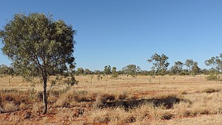
Gilberton is a rural locality in the Shire of Etheridge, Queensland, Australia. In the 2016 census, Gilberton had a population of 4 people.

Yarraden is a coastal rural locality in the Shire of Cook, Queensland, Australia. In the 2016 census Yarraden had a population of 11 people.

Tanbar, Queensland Suburb of Shire of Barcoo, Queensland, Australia

Tanbar is an outback locality in the Shire of Barcoo, Queensland, Australia. It is on the corner of Queensland's southern and western border with South Australia. In the 2016 census Tanbar had a population of 3 people.

North Bungunya is a rural locality in the Goondiwindi Region, Queensland, Australia. In the 2016 census North Bungunya had a population of 39 people.

Abingdon Downs is a rural locality in the Shire of Etheridge, Queensland, Australia. In the 2016 census, Abingdon Downs had a population of 0 people.

Linden is a rural locality in the Shire of Paroo, Queensland, Australia. In the 2016 census Linden had a population of 20 people.

Spring Creek is a rural locality in the Shire of Banana, Queensland, Australia. In the 2016 census Spring Creek had a population of 15 people.

Strathmore is a locality split between the Shire of Mareeba and the Shire of Etheridge, in Queensland, Australia. In the 2016 census Strathmore had a population of 12 people.

Nychum is a rural locality in the Shire of Mareeba, Queensland, Australia. In the 2016 census Nychum had a population of 0 people.

Lyndhurst is a locality in the Shire of Etheridge, Queensland, Australia. In the 2016 census, Lyndhurst had a population of 8 people.

Kinnoul is a rural locality in the Shire of Banana, Queensland, Australia. In the 2016 census Kinnoul had a population of 69 people.

Mantuan Downs is a rural locality in the Central Highlands Region, Queensland, Australia. In the 2016 census Mantuan Downs had a population of 31 people.

Hidden Valley is a rural locality in the Livingstone Shire, Queensland, Australia. In the 2016 census, Hidden Valley had a population of 421 people.

Taldora, Queensland Suburb of Shire of Mckinlay, Queensland, Australia

Taldora is an outback locality in the Shire of Mckinlay, Queensland, Australia. In the 2016 census Taldora had a population of 37 people.

References

  1. 1 2 3 Australian Bureau of Statistics (27 June 2017). "Gilbert River (SSC)". 2016 Census QuickStats. Retrieved 20 October 2018. OOjs UI icon edit-ltr-progressive.svg
  2. "Gilbert River – locality in Shire of Etheridge (entry 41664)". Queensland Place Names. Queensland Government . Retrieved 27 December 2020.
  3. 1 2 3 4 "Queensland Globe". State of Queensland . Retrieved 31 December 2020.
  4. 1 2 "Mountain peaks and capes - Queensland". Queensland Open Data. Queensland Government. 12 November 2020. Archived from the original on 25 November 2020. Retrieved 25 November 2020.
  5. "Brennans Knob – mountain in Etheridge Shire (entry 4441)". Queensland Place Names. Queensland Government . Retrieved 25 November 2020.
  6. "Littleton National Park and Littleton Resources Reserve" (PDF). Queensland Government. 2016. Archived (PDF) from the original on 31 December 2020. Retrieved 1 January 2021.
  7. Gilbert River, Queensland (Map). OpenStreetMap. Retrieved 13 April 2022.
  8. CC BY icon-80x15.png This Wikipedia article incorporates CC-BY-4.0 licensed text from: "Queensland Aboriginal and Torres Strait Islander languages map". State Library of Queensland. State Library of Queensland . Retrieved 30 January 2020.
  9. "Queensland Globe". State of Queensland . Retrieved 5 January 2018.
  10. Queensland Family History Society (2010), Queensland schools past and present (Version 1.01 ed.), Queensland Family History Society, ISBN   978-1-921171-26-0
  11. "Homesteads - Queensland". Queensland Open Data. Queensland Government. 18 November 2020. Archived from the original on 24 November 2020. Retrieved 24 November 2020.
  12. "Heliports and landing grounds - Queensland". Queensland Open Data. Queensland Government. 22 October 2020. Archived from the original on 16 November 2020. Retrieved 3 November 2020.