Conjuboy, Queensland

Last updated

Conjuboy
Queensland
Australia Queensland location map.svg
Red pog.svg
Conjuboy
Coordinates 18°43′10″S144°36′07″E / 18.7195°S 144.6019°E / -18.7195; 144.6019 (Conjuboy (centre of locality)) Coordinates: 18°43′10″S144°36′07″E / 18.7195°S 144.6019°E / -18.7195; 144.6019 (Conjuboy (centre of locality))
Population3 (2016 census) [1]
 • Density0.00180/km2 (0.0047/sq mi)
Postcode(s) 4871
Area1,663.8 km2 (642.4 sq mi)
Time zone AEST (UTC+10:00)
Location
LGA(s) Shire of Etheridge
State electorate(s) Traeger
Federal Division(s) Kennedy
Suburbs around Conjuboy:
Einasleigh Mount Surprise Greenvale
Einasleigh Conjuboy Greenvale
Lyndhurst Greenvale Greenvale

Conjuboy is a remote rural locality in the Shire of Etheridge, Queensland, Australia. [2] In the 2016 census, Conjuboy had a population of 3 people. [1]

Contents

Geography

The Gregory Developmental Road passes through the locality from the south-west to the south-east, while the Kennedy Developmental Road passes through the locality from the east to the south; they intersect in the south of the locality. [3]

The ridge of the Great Dividing Range runs from north to south through Conjuboy creating a watershed. Dry River rises in the east of the locality and flows into the Herbert River and ultimately into the Ross River towards the Coral Sea. Spring Creek rises in the north-west of the locality and flows into the Einasleigh River and ultimately into the Gilbert River into the Gulf of Carpentaria. [3]

The predominant land use is grazing on native vegetation. [3]

History

The locality was officially named and bounded on 23 June 2000; however the name has been in use as a pastoral station since at least 1934 when it was operated by Arthur Darcy Wilson. [2] [4]

In the 2016 census, Conjuboy had a population of 3 people. [1]

Education

There are no schools in Conjuboy. The nearest primary schools are Greenvale State School in neighbouring Greenvale to the south-east and Mount Surprise State School in neighbouring Mount Surprise to the north-west. There are no secondary schools near Conjuboy; distance education and boarding schools are the only options. [3]

Related Research Articles

Georgetown, Queensland Town in Queensland, Australia

Georgetown is a town and locality in the Shire of Etheridge, Queensland, Australia. In the 2016 census, Georgetown had a population of 348 people.

Cooran, Queensland Town in Queensland, Australia

Cooran is a small hinterland town and locality in the Shire of Noosa in Queensland, Australia. Between 2008 and 2013 it was within Sunshine Coast Region.

Mount Surprise, Queensland Town in Queensland, Australia

Mount Surprise is a town and locality in the Shire of Etheridge, Queensland, Australia.

Duchess, Queensland Town in Queensland, Australia

Duchess is a rural town and locality in the Shire of Cloncurry, Queensland, Australia. In the 2016 census, Duchess had a population of 23 people.

Minnamoolka, Queensland Suburb of Tablelands Region, Queensland, Australia

Minnamoolka is a locality in the Tablelands Region, Queensland, Australia. In the 2016 census, Minnamoolka had a population of 38 people.

Archer River, Queensland Suburb of Shire of Cook, Queensland, Australia

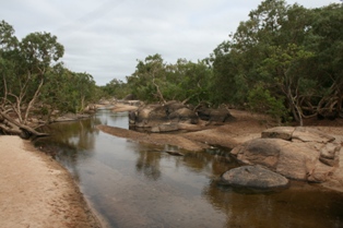
Archer River is a rural locality in the Shire of Cook, Queensland, Australia. In the 2016 census, Archer River had a population of 22 people.

Bungunya, Queensland Suburb of Goondiwindi Region, Queensland, Australia

Bungunya is a rural town and locality in the Goondiwindi Region, Queensland, Australia. The locality is on the border of Queensland and New South Wales. In the 2016 census, Bungunya had a population of 75 people.

Abingdon Downs, Queensland Suburb of Shire of Etheridge, Queensland, Australia

Abingdon Downs is a rural locality in the Shire of Etheridge, Queensland, Australia. In the 2016 census, Abingdon Downs had a population of 0 people.

Four Ways, Queensland Suburb of Shire of Cloncurry, Queensland, Australia

Four Ways is a locality in the Shire of Cloncurry, Queensland, Australia.

Stokes, Queensland Suburb of Shire of Carpentaria, Queensland, Australia

Stokes is a locality in the Shire of Carpentaria, Queensland, Australia. In the 2016 census, Stokes had a population of 84 people.

Mowbray, Queensland Suburb of Shire of Douglas, Queensland, Australia

Mowbray is a coastal locality in the Shire of Douglas, Queensland, Australia. In the 2016 census, Mowbray had a population of 321 people.

Porcupine, Queensland Suburb of Shire of Flinders, Queensland, Australia

Porcupine is a locality in the Shire of Finders, Queensland, Australia. In the 2016 census, Porcupine had a population of 49 people.

Amaroo, Queensland Suburb of Shire of Boulia, Queensland, Australia

Amaroo is an outback locality split between the Shire of Boulia and the Shire of Diamantina, both in Central Western Queensland, Australia. In the 2016 census, Amaroo had a population of 22 people.

Lyndhurst, Queensland Suburb of Shire of Etheridge, Queensland, Australia

Lyndhurst is a locality in the Shire of Etheridge, Queensland, Australia. In the 2016 census, Lyndhurst had a population of 8 people.

Talaroo, Queensland Suburb of Shire of Etheridge, Queensland, Australia

Talaroo is a locality in the Shire of Etheridge, Queensland, Australia. In the 2016 census, Talaroo had no population.

Cona Creek, Queensland Suburb of Central Highlands Region, Queensland, Australia

Cona Creek is a locality in the Central Highlands Region, Queensland, Australia. In the 2016 census, Cona Creek had a population of 83 people.

Farrars Creek, Queensland Suburb of Shire of Barcoo, Queensland, Australia

Farrars Creek is a rural locality in the Shire of Barcoo, Queensland, Australia. In the 2016 census, Farrars Creek had a population of 0 people.

Carrandotta, Queensland Suburb of Shire of Boulia, Queensland, Australia

Carrandotta is a locality in the Shire of Boulia, Queensland, Australia. In the 2016 census, Carrandotta had a population of 0 people.

Isis River, Queensland Suburb of Bundaberg Region, Queensland, Australia

Isis River is a locality in the Bundaberg Region, Queensland, Australia. In the 2016 census, Isis River had a population of 110 people.

Bogie, Queensland Suburb of Whitsunday Region, Queensland, Australia

Bogie is a rural locality in the Whitsunday Region, Queensland, Australia. In the 2016 census, Bogie had a population of 161 people.

References

  1. 1 2 3 Australian Bureau of Statistics (27 June 2017). "Conjuboy (SSC)". 2016 Census QuickStats. Retrieved 20 October 2018. OOjs UI icon edit-ltr-progressive.svg
  2. 1 2 "Conjuboy - locality in Shire of Etheridge (entry 41669)". Queensland Place Names. Queensland Government . Retrieved 18 September 2020.
  3. 1 2 3 4 "Queensland Globe". State of Queensland . Retrieved 25 July 2017.
  4. Commonwealth electoral roll (Queensland) 1934 (Version 1.01 with QFHSdatasearch 1.9 ed.), Queensland Family History Society, 2007, ISBN   978-1-921171-12-3