The municipality was absorbed by Madrid in the 1950s as a result of the plans that the Franco government made to simplify the structure of big city administrations. Since then, is a district. It was in those years when it experimented a massive growth caused by the rural flight in Spain. This is the reason that made Villaverde a typical working class neighbourhood.
This condition leaves a heavy footprint in the district, because it has conditioned the current population composition, with many retired people (some of them returning to their towns in Andalusia, Castile-León, ...) and immigrants attracted by the cheap housing prices.
The district is administratively divided into five wards (barrios):
Getafe is a municipality and a city in Spain belonging to the Community of Madrid. As of 2018, it has a population of 180,747, the region's sixth most populated municipality.
Aluche is a barrio of the city of Madrid, situated in the southwest of the city, in the Latina district. It is bounded by the barrios of Campamento, Las Águilas, Lucero, Los Cármenes, and the Carabanchel district. Casa de Campo is also nearby. Aluche takes its name from the Luche creek that formerly flowed through the neighbourhood.
Latina is a district of Madrid located in the southwestern corner of the municipality.
Centro is a district of Madrid, Spain. It is approximately 5.23 km2 (2.02 sq mi) in size. It has a population of 149,718 people and a population density of 28,587 people/km2. It roughly corresponds to the bulk of the housing formerly enclosed by the so-called Walls of Philip IV. The district is made up of the neighbourhoods of Cortes, Embajadores, Justicia, Universidad, Palacio and Sol.
San Blas-Canillejas is a district to the east of Madrid's city centre. The population of the district is estimated in 149,909.
Chamberí is a district of Madrid, Spain. It is further subdivided into six neighborhoods. The district junta is headquartered at the plaza de Chamberí. The current urban outline was born as part of the Ensanche plan drafted by Carlos María de Castro.
Line 3 is a rapid transit line of the Madrid Metro in Madrid. It contains 18 stations across 16.424 kilometres (10.205 mi).
Paseo de la Castellana, commonly known as La Castellana, is a major thoroughfare in Madrid, Spain. Cutting across the city from south to north, it has been described as the "true structuring axis" of the city.
The M-40, in Spanish transport, is a Madrid orbital motorway. It is the second-outermost of the Madrid orbital highways, the M-30 being the closest to the centre of Madrid. It surrounds 17 out of the 21 districts of Madrid and the contiguous town of Pozuelo de Alarcón. In terms of length and surface surrounded, it may be compared to London's North and South circular roads, or Paris' A86 super-périphérique.
Vicálvaro is a district in the southeast of Madrid, Spain. It is named after the former municipality absorbed into the municipality of Madrid in 1951.
Luna is a municipality located in the province of Zaragoza, in Aragon, Spain. It is in the judicial district of Ejea de los Caballeros in the northeast of the province. It is 65 km from Zaragoza. According to the 2009 census (INE), the municipality has a population of 861 inhabitants.
Usera is a district of Madrid, Spain. It lies on the southern (right) bank of the Manzanares. It is home to about 10% of the Chinese citizens who live in the Madrid region.
Torre Titania is the twelfth-tallest skyscraper in Madrid, Spain and has become the country's largest mall.
Prosperidad is an administrative neighborhood of Madrid belonging to the district of Chamartín. Its boundaries are: to the west the street Príncipe de Vergara, south: the Calle de María de Molina and Avenida de América, east: the M-30 and north: the street Lopez de Hoyos Padre Claret street and avenue Ramon y Cajal.1
Cuatro Caminos is an administrative neighborhood of Madrid belonging to the district of Tetuán. It has an area of 1.193509 km2 (0.460816 sq mi). As of 1 February 2020, it has a population of 35,395. It was created as slum of the north of the city, on the east side of the Road of France, currently the calle de Bravo Murillo.
Villaverde Alto, casco histórico de Villaverde, or just Villaverde Alto is a ward (barrio) of Madrid belonging to the district of Villaverde.
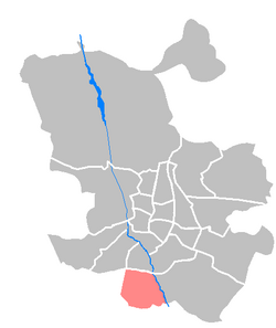
Butarque is an administrative neighborhood (barrio) of Madrid belonging to the district of Villaverde.
Los Rosales is a ward (barrio) of Madrid belonging to the district of Villaverde.
Los Ángeles is a ward (barrio) of Madrid belonging to the district of Villaverde.
Ambroz was an administrative neighborhood of Madrid belonging to the district of Vicálvaro. In 2017, through approval of Madrid's city council, the territory became part of the Casco Histórico de Vicálvaro neighborhood.
This page is based on this Wikipedia article Text is available under the CC BY-SA 4.0 license; additional terms may apply. Images, videos and audio are available under their respective licenses.