Walton Township, Harvey County, Kansas

Last updated

Walton Township
Harvey County, Kansas
Map highlighting Walton Township, Harvey County, Kansas.svg
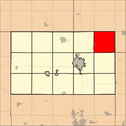
Location within Harvey County
Coordinates: 38°07′51″N97°12′32″W / 38.1307472°N 97.2088825°W / 38.1307472; -97.2088825 [1]
Country United States
State Kansas
County Harvey
Area
  Total
36.69 sq mi (95.02 km2)
  Land36.66 sq mi (94.96 km2)
  Water0.02 sq mi (0.06 km2)  0.06%
Elevation
[1]
1,467 ft (447 m)
Population
 (2000)
  Total
552
  Density15.1/sq mi (5.8/km2)
Time zone UTC-6 (CST)
  Summer (DST) UTC-5 (CDT)
Area code 620
FIPS code 20-75225 [1]
GNIS ID 477771 [1]
Website County website

Walton Township is a township in Harvey County, Kansas, United States. [1] As of the 2000 census, its population was 552.

Contents

Geography

Walton Township covers an area of 36.69 square miles (95.0 km2) and contains one incorporated settlement, Walton.

Cemeteries

According to the USGS, it contains one cemetery, Walton.

Transportation

A major highway, US-50 and a railroad, BNSF Railway pass through Walton Township. US-50 was originally the New Santa Fe Trail and roughly parallels the BNSF Railway.

The Amtrak Southwest Chief stops in nearby Newton twice each day and provides passenger rail service towards Los Angeles and Chicago. See Newton (Amtrak station).

References

  1. 1 2 3 4 5 "Walton Township, Harvey County, Kansas", Geographic Names Information System , United States Geological Survey, United States Department of the Interior

Further reading