
Port Augusta is a small city in South Australia. Formerly a seaport, it is now a road traffic and railway junction city mainly located on the east coast of the Spencer Gulf immediately south of the gulf's head and about 322 kilometres (200 mi) north of the state capital, Adelaide. The suburb of Port Augusta West is located on the west side of the gulf on the Eyre Peninsula. Other major industries included, up until the mid-2010s, electricity generation. At June 2018, the estimated urban population was 13,799, having declined at an average annual rate of -0.53% over the preceding five years.
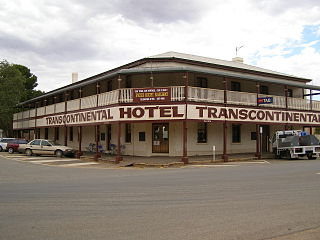
Quorn is a small town and railhead in the Flinders Ranges in the north of South Australia, 39 kilometres (24 mi) northeast of Port Augusta. At the 2016 census, the locality had a population of 1,230, of which 1,131 lived in its town centre.

Osborne is a suburb in the Australian state of South Australia located on the LeFevre Peninsula in the west of Adelaide about 21 kilometres north-west of the Adelaide city centre.

The City of Port Augusta is a local government area located at the northern end of Spencer Gulf in South Australia. It is centred on the town of Port Augusta. The city was the site of South Australia's main power supplier, the Port Augusta powerhouse, located on the coast of the Spencer Gulf.

North Haven is a north-western suburb of Adelaide 20 km from the CBD, in the state of South Australia, Australia and falls under the City of Port Adelaide Enfield. It is adjacent to Osborne and Outer Harbor. The postcode for North Haven is 5018. It is bounded to the north and east by Oliver Rogers and Victoria Road, to the south by Marmora Terrace and the west by Gulf St Vincent.

Largs Bay is a suburb in the Australian state of South Australia located on the Lefevre Peninsula in the west of Adelaide about 16 kilometres (9.9 mi) northwest of the Adelaide city centre.
Stirling North is a town located 8 kilometres (5.0 mi) east of Port Augusta in South Australia. The obsolete Leigh Creek coal rail line which runs between Port Augusta and Stirling North is the official border line separating the two towns. It acts primarily as a satellite town to Port Augusta with the town's railway station lying at a major rail junction linking the Port Augusta power station and the main east-west rail link to the coal rail link to Leigh Creek. It also lies on the junction of the Augusta Highway and the Flinders Ranges Way. At the 2016 census, Stirling North had a population of 2,673.

Milang is a town and locality located in the Australian state of South Australia on the west coast of Lake Alexandrina about 71 kilometres (44 mi) south-east of the state capital of Adelaide and about 20 kilometres (12 mi) north-east of the municipal seat of Goolwa.
Boston is a locality on the Eyre Peninsula of South Australia, situated in the District Council of Lower Eyre Peninsula. It consists of a coastal section immediately north of Port Lincoln and a broader area inland; while it is residential along the coast, much of the locality remains semi-rural. The name and boundaries were formalised in October 2003 for the long established local name. On 15 October 2009, sections of Boston were severed and added to North Shields and the new locality of Tiatukia, while a portion of adjacent Hawson was added to Boston.

Port Augusta West is a suburb of Port Augusta, South Australia.
Winninowie is a locality in the Mid North of South Australia. It is traversed by the Augusta Highway which is part of the Australian National Highway on Highway 1. It includes the intersection of Horrocks Pass Road, also known as Main North Road with the main highway. Winninowie is 21 kilometres (13 mi) southeast of Port Augusta, on the plain between Spencer Gulf on the west and the southern Flinders Ranges on the east.
Yarrah is a rural locality in the Far North region of South Australia. The eastern section of Yarrah lies within the Flinders Ranges Council, while the western section lies in the Pastoral Unincorporated Area.

Stuarts Creek is a remote locality in the Australian state of South Australia in the states's Far North region. The name and boundaries were formalised on 26 April 2013, named after Stuart Creek Station, in respect of the long established local name.
Miranda is a coastal locality in the Far North region of South Australia, situated within the southeastern corner of the City of Port Augusta. It comprises the section of the cadastral Hundred of Winninowie between the Adelaide-Port Augusta railway line and the coast. The Augusta Highway runs along the Miranda side of the railway line.
Davenport is a suburb in the Australian state of South Australia located about 282 kilometres (175 mi) north of the state capital of Adelaide and about 4 kilometres (2.5 mi) north-east of the municipal seat in Port Augusta.
Port Paterson is a locality in the Australian state of South Australia located on the east coast of Spencer Gulf at the gulf's northern end about 237.4 kilometres north of the state capital of Adelaide and about 9 kilometres south of the centre of Port Augusta.
Emeroo is a locality in the Australian state of South Australia about 295 kilometres north of the state capital of Adelaide and about 18 kilometres northeast of Port Augusta in the state’s Far North region.

Saltia is a locality in the Australian state of South Australia located on the western side of the Flinders Ranges about 279 kilometres (173 mi) north of the state capital of Adelaide and about 19 kilometres (12 mi) east of the city of Port Augusta.
The Hundred of Davenport is a cadastral hundred within the County of Frome in South Australia, proclaimed in 1860.
The Bungala Solar Power Project is a solar power farm in Emeroo and Wami Kata near Port Augusta in South Australia. Stage One was connected to the grid in May 2018. The second and final stage was connected to the grid in early November 2018. The project gradually reached full power in 2020.
