
The City of Port Augusta is a local government area located at the northern end of Spencer Gulf in South Australia. It is centred on the town of Port Augusta.

Hallett Cove is a coastal suburb of Adelaide, South Australia located in the City of Marion 21 kilometres south of the Adelaide city centre. It has a population of more than 12,000 people. Adjoining suburbs are Marino to the north, Trott Park and Sheidow Park to the east and Lonsdale to the south.
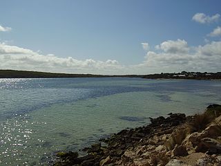
Coffin Bay, originally Coffin's Bay, is a town at the southern extremity of the Eyre Peninsula, a wheat growing area of South Australia. At the 2016 census, Coffin Bay had a population of 611.
Big Bend in South Australia is the longest single bend in the Murray River. The area is known for its spectacular riverside cliffs, which are the tallest along the Murray River. The limestone cliffs are rich with millions of ocean fossils and are home to colonies of bats. Caves in the area have been continuously occupied for at least 8,000 years and are sacred to the local aboriginal community. There is a collection of holiday shacks located on the banks.
Stirling North is a town located 8 kilometres east of Port Augusta in the Australian state of South Australia. The now abandoned Marree railway line forms the official border line separating the two towns. Primarily, Stirling North is a satellite town to Port Augusta, in part because the Stirling North railway station was a rail junction at various times for four railway lines. Married railway employees from the station and Port Augusta were accommodated in about 100 houses near the station, and facilities such as a recreation hall were built by the Commonwealth Railways. A junction of the Augusta Highway and the Flinders Ranges Way also adjoins the town. At the 2016 census, Stirling North had a population of 2,673.
Boston is a locality on the Eyre Peninsula of South Australia, situated in the District Council of Lower Eyre Peninsula. It consists of a coastal section immediately north of Port Lincoln and a broader area inland; while it is residential along the coast, much of the locality remains semi-rural. The name and boundaries were formalised in October 2003 for the long established local name. On 15 October 2009, sections of Boston were severed and added to North Shields and the new locality of Tiatukia, while a portion of adjacent Hawson was added to Boston.
Mambray Creek is a locality in the Australian state of South Australia located on the east coast of Spencer Gulf about 240 kilometres (150 mi) north of the state capital of Adelaide and about 40 kilometres (25 mi) north of the city of Port Pirie.

Port Augusta West is a suburb of Port Augusta, South Australia.
Winninowie Conservation Park is a protected area in the Australian state of South Australia located on the east coast of Upper Spencer Gulf about 20 kilometres south by east of Port Augusta and 25 kilometres northwest of Port Germein, in the locality of Miranda. The conservation park was proclaimed in 1990 for the purpose of conserving ‘excellent examples of several coastal and marine ecosystems with sub-tropical affiliations in a temperate environment’ including ‘significant stands of the grey mangrove, Avicennia marina var. resinifera, seagrass and samphire salt marsh communities’. The conservation park's boundaries overlap with those of the Yatala Harbour Upper Spencer Gulf Aquatic Reserve. The conservation park is classified as an IUCN Category Ia protected area.
Winninowie is a locality in the Mid North of South Australia. It is traversed by the Augusta Highway which is part of the Australian National Highway on Highway 1. It includes the intersection of Horrocks Pass Road, also known as Main North Road with the main highway. Winninowie is 21 kilometres (13 mi) southeast of Port Augusta, on the plain between Spencer Gulf on the west and the southern Flinders Ranges on the east.
Cocata is a rural locality in the Eyre and Western region of South Australia.

Mount Dutton Bay is a coastal locality in the Eyre and Western region of South Australia, situated in the District Council of Lower Eyre Peninsula. The name and boundaries were formalised in October 2003 in respect of the long established local name which is derived from the body of water known as Mount Dutton Bay. The locality incorporates three older residential "shack sites": Mount Dutton Bay West, on Dolphin Drive, Mount Dutton Bay East, on Woolshed Drive, and Shelley Beach/Salt Creek, on Shelly Beach Road. It is part of the cadastral Hundred of Lake Wangary.
Blanche Harbor is a locality in South Australia located on the east coast of the Eyre Peninsula overlooking Spencer Gulf about 260 kilometres north north-west of the Adelaide city centre and about 20 kilometres south of the centre of Port Augusta.
Commissariat Point is a locality in the Australian state of South Australia located on the east coast of the Eyre Peninsula overlooking Spencer Gulf about 270 kilometres north north-west of the state capital of Adelaide and about 11 kilometres south of the municipal seat in Port Augusta.
Port Paterson is a locality in the Australian state of South Australia located on the east coast of Spencer Gulf at the gulf's northern end about 237.4 kilometres north of the state capital of Adelaide and about 9 kilometres south of the centre of Port Augusta.
Baroota is a locality in the Australian state of South Australia located on the east coast of Spencer Gulf about 230 kilometres north of the state capital of Adelaide and about 29 kilometres (18 mi) north-east of the city of Port Pirie.

Flinders Ranges is a locality in the Australian state of South Australia located in the mountain range of the same name, about 380 km (240 mi) north of the state capital of Adelaide, about 86 km (53 mi) north-east of the municipal seat in Quorn and about 131 km (81 mi) north-east of the regional centre of Port Augusta.
Nora Creina is a locality in the Australian state of South Australia located on the state’s south-east coast overlooking the Southern Ocean. It is about 99 kilometres to the north-west of the city of Mount Gambier and about 290 kilometres south-east of the state capital of Adelaide.

The County of Frome is one of the 49 cadastral counties of South Australia in straddling the Mid North and Flinders Ranges regions. It was proclaimed in 1851 by Governor Henry Young and was named for the former Surveyor-General of South Australia, Edward Charles Frome. The iconic Mount Remarkable in the Hundred of Gregory is at the centre of the county.
Kellidie Bay is a locality in the Australian state of South Australia located on the Eyre Peninsula in the state’s west overlooking parts of the body of water known as Coffin Bay about 290 kilometres (180 mi) west of the state capital of Adelaide and about 42 kilometres (26 mi) south-west of the municipal seat of Cummins.
