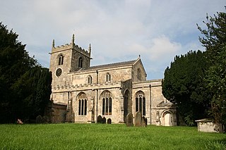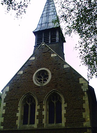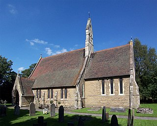
Walton Hall is a country house in Walton near Wakefield in West Yorkshire, England. It was built on the site of a former moated medieval hall in the Palladian style in 1767 on an island in a 26-acre (11 ha) lake. It was the ancestral home of the naturalist and traveller Charles Waterton, who made Walton Hall into the world's first wildfowl and nature reserve. Waterton's son, Edmund, sold the estate.

Epworth is a town and civil parish on the Isle of Axholme, in the North Lincolnshire unitary authority of Lincolnshire, England. The town lies on the A161, about halfway between Goole and Gainsborough. As the birthplace of John Wesley and Charles Wesley, it has given its name to many institutions associated with Methodism. Their father, Samuel Wesley, was the rector from 1695 to 1735.

Crowle is a market town in the civil parish of Crowle and Ealand, on the Isle of Axholme in the North Lincolnshire unitary authority of Lincolnshire, England. The civil parish had a population at the 2011 census of 4,828. The town lies on the Stainforth and Keadby Canal.

The Parts of Lindsey are a traditional division of Lincolnshire, England, covering the northern part of the county. The Isle of Axholme, which is on the west side of the River Trent, has normally formed part of it. The district's name originated from the Kingdom of Lindsey of Anglo-Saxon times, whose territories were merged with that of Stamford to form Lincolnshire.

The Isle of Axholme is a geographical area in England: a part of North Lincolnshire that adjoins South Yorkshire. It is located between the towns of Scunthorpe and Gainsborough, both of which are in the traditional West Riding of Lindsey, and Doncaster.

Flixborough is a village and civil parish in North Lincolnshire, England. The population of the civil parish at the 2011 census was 1,664. It is situated near the River Trent, approximately 3 miles (5 km) north-west from Scunthorpe. The village is noted for the 1974 Flixborough disaster.

Althorpe is a small village and former civil parish, now in the parish of Keadby with Althorpe, in the North Lincolnshire district, in the ceremonial county of Lincolnshire, England. It is four miles (6 km) west of Scunthorpe and the same distance south-east of Crowle, on the A18 road.

Amcotts is a village and civil parish in the North Lincolnshire district of Lincolnshire, England, and on the Isle of Axholme. The village is situated north-west from Scunthorpe, and on the west bank of the River Trent facing Flixborough on the east bank. The 2001 Census recorded a population of 219 for the parish, increasing to 262 at the 2011 census.

The Borough of Boothferry was, from 1 April 1974 to 1 April 1996, a local government district with borough status within the non-metropolitan county of Humberside. The district is now split between the East Riding of Yorkshire and North Lincolnshire.

Luddington is a village and former civil parish, now in the parish of Luddington with Haldenby, on the Isle of Axholme in the North Lincolnshire district, in the ceremonial county of Lincolnshire, England. The population of the civil parish of "Luddington with Haldenby" at the 2011 census was 419. It is 6 miles (10 km) north-west from Scunthorpe, 6 miles south-east from Goole and 18 miles (29 km) north-east from Doncaster.

Eastoft is a village and civil parish in North Lincolnshire, England. It is situated within the Isle of Axholme, 3 miles (5 km) north-east from Crowle, and on the A161 road.

Owston Ferry is a village and civil parish in North Lincolnshire, England. It is situated on the west bank of the River Trent, and 9 miles (14 km) north from Gainsborough. It had a total resident population of 1,128 in 2001 including Kelfield. This increased to 1,328 at the 2011 census. Sometimes referred to as Owston or Ferry, the village forms part of the Isle of Axholme. It is bounded to the west by the A161 road and the village of Haxey. The River Trent is directly to the east. To the north, beyond a number of hamlets and villages, lies the Humber estuary. West Butterwick was originally a part of the township of Owston.

Garthorpe is a village and former civil parish, now in the parish of Garthorpe and Fockerby, in the North Lincolnshire district, in the ceremonial county of Lincolnshire, England. It is situated approximately 8 miles (13 km) south-east from Goole, 1 mile (1.6 km) west from the River Trent, and in the Isle of Axholme. Together with Fockerby, which is contiguous with the village, Garthorpe forms a civil parish of about 500 inhabitants, measured as 418 in the 2011 census.

Graizelound is a hamlet in the civil parish of Haxey in North Lincolnshire, England. It is approximately 22 miles (35 km) to the north-west from the city and county town of Lincoln, and centred on the crossroad junction of Haxey Lane, Station Road, Akeferry Road and Ferry Road. The village of Haxey is less than 1 mile (1.6 km) to the north. Owston Ferry on the River Trent is 2.5 miles (4.0 km) to the north-east. Graizelound forms part of the Isle of Axholme.

Gautby is a village in the East Lindsey district of Lincolnshire, England. The village is situated 6 miles (10 km) north-west from the town of Horncastle, and is part of the Minting civil parish.
Warping was the former practice of letting turbid river water flood onto agricultural land, so that its suspended sediment could form a layer, before letting the water drain away. In this way poor soils were covered with fertile fine silt, and their rentable value was increased.

Hirst Priory is an 18th-century country house in Belton on the Isle of Axholme, North Lincolnshire, United Kingdom. The current house was built on the site of a 12th-century Augustinian priory.
Sir Hugh Waterton, was a trusted servant of the House of Lancaster.

East Lound is a hamlet in the civil parish of Haxey in North Lincolnshire, England. It is situated approximately 22 miles (35 km) to the north-west from the city and county town of Lincoln, and on Brackenhill Road within the parish of Haxey, a village less than 1 mile (1.6 km) to the west. Owston Ferry on the River Trent is 1.5 miles (2.4 km) to the east. East Lound forms part of the Isle of Axholme.


