41°49′48″N71°23′16″W / 41.830106°N 71.387779°W
Contents


Wayland Square is an area on the East Side of Providence, Rhode Island United States near Brown University and the Rhode Island School of Design.
41°49′48″N71°23′16″W / 41.830106°N 71.387779°W
Wayland Square is an area on the East Side of Providence, Rhode Island United States near Brown University and the Rhode Island School of Design.

The square and Wayland Avenue are named after Francis Wayland, a Baptist pastor and president of Brown University. [1] Most of the area was developed in the early twentieth century with many Queen Anne style apartment buildings. [2] The area remained largely undeveloped until the twentieth century because of the marshy environment adjacent to the river. Today, the square features numerous businesses, houses of worship, and restaurants. It is also home to the Red Bridge, which crosses the Seekonk River. [3]

Warwick is a city in Kent County, Rhode Island, United States, and is the third largest city in the state with a population of 82,823 at the 2020 census. Warwick is located approximately 12 miles (19 km) south of downtown Providence, Rhode Island, 63 miles (101 km) southwest of Boston, Massachusetts, and 171 miles (275 km) northeast of New York City.

North Smithfield is a town in Providence County, Rhode Island, United States, settled as a farming community in 1666 and incorporated into its present form in 1871. North Smithfield includes the historic villages of Forestdale, Primrose, Waterford, Branch Village, Union Village, Park Square, and Slatersville. The population was 12,588 at the 2020 census.

The Warren Alpert Medical School is the medical school of Brown University, located in Providence, Rhode Island. Originally established in 1811, it was the third medical school to be founded in New England after only Harvard and Dartmouth. However, the original program was suspended in 1827, and the four-year medical program was re-established almost 150 years later in 1972, granting the first MD degrees in 1975.

Francis Wayland was an American Baptist minister, educator and economist. He was president of Brown University and pastor of the First Baptist Church in America in Providence, Rhode Island. In Washington, D.C., Wayland Seminary was established in 1867, primarily to educate former slaves, and was named in his honor.

Union Station describes two distinct, defunct train stations in Providence, Rhode Island. Parts of the latter one were renovated and the building contains offices and restaurants.

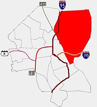
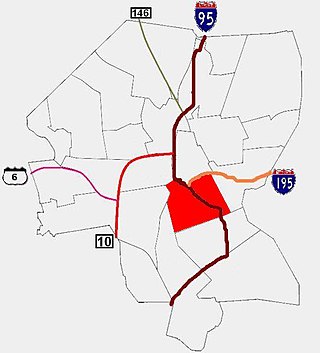
Smith Hill is a neighborhood in Providence, Rhode Island. Its traditional bounds are the Woonasquatucket River, the Chad Brown public housing complex, Interstate 95 and West River.

Blackstone is a predominantly residential neighborhood in Providence, Rhode Island. It is in the northeast corner of the city and is bounded to the south and west by Lloyd Avenue and Hope Street respectively. It is one of six neighborhoods comprising the East Side of Providence.

College Hill is a historic neighborhood of Providence, Rhode Island, and one of six neighborhoods comprising the city's East Side. It is roughly bounded by South and North Main Street to the west, Power Street to the south, Governor Street and Arlington Avenue to the east and Olney Street to the north. The neighborhood's primary commercial area extends along Thayer Street, a strip frequented by students in the Providence area.

Fox Point is a neighborhood in the East Side of Providence, Rhode Island. It is bounded by the Providence and Seekonk rivers, Interstate 195 and the College Hill and Wayland neighborhoods. Fox Point is the southernmost neighborhood in the East Side area of Providence.

Charles is a neighborhood in northern Providence, Rhode Island. Along with Wanskuck, it comprises what is sometimes referred to as the North End. To the west Charles is partitioned from Wanskuck by Route 146, while the Chad Brown public housing complex separates Charles from Smith Hill to the south, and the West River and Interstate 95 bounds the area to the east. The city limits abutting the city of North Providence bound Charles to the north.
The East Side is a collection of neighborhoods in the eastern part of the city of Providence, Rhode Island. It officially comprises the neighborhoods of Blackstone, Hope, Mount Hope, College Hill, Wayland, and Fox Point.
Upper South Providence is an official neighborhood in the South Side in the city of Providence, Rhode Island. It is bound to the north by Interstate 95, the east by the Providence River, to the south by Public Street, and the west by Broad Street. Often associated with Lower South Providence directly to its south, Upper South Providence is a distinct neighborhood.

Park Square is an area on Rhode Island Route 146A in North Smithfield and Woonsocket, Rhode Island, near the intersection of Park Avenue and Route 146A. It is 12 miles from Providence and near Union Village.
Wickenden Street in Fox Point, Providence, Rhode Island is a popular destination for students of the area's colleges and schools. The street is surrounded by schools and universities on the East Side of Providence's College Hill, including Brown University, RISD, Moses Brown School, & The Wheeler School.

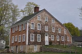
The Wayland Historic District is a predominantly residential historic district on the east side of Providence, Rhode Island. It is a large area, covering about 122 acres (49 ha), bounded roughly on the north by Everett and Laurel Avenues, on the east by Blackstone Boulevard and Butler Avenue, on the west by Arlington Avenue, and on the south by Angell and South Angell Streets. This area, which was in the 19th century part of the Moses Brown farm, was platted for development in 1891, with most of the construction taking place in the early decades of the 20th century. Most of the residential properties in the district are single-family houses, typically built in revival styles popular at the time. They are set on similarly sized lots with fairly uniform setbacks, and were typically built without garages. There are a number of two-family houses, and a small number of apartment buildings, most of which are found on the arterial roads of the area. There are several religious buildings, including several churches; the most architecturally distinctive religious building is the Jewish Temple Beth El, built 1951–54.

Providence is the capital and most populous city of the U.S. state of Rhode Island. The county seat of Providence County, it is one of the oldest cities in New England, founded in 1636 by Roger Williams, a Reformed Baptist theologian and religious exile from the Massachusetts Bay Colony. He named the area in honor of "God's merciful Providence" which he believed was responsible for revealing such a haven for him and his followers. The city developed as a busy port, as it is situated at the mouth of the Providence River at the head of Narragansett Bay.

The Brown University Graduate School is the graduate school of Brown University in Providence, Rhode Island. The school offers 51 doctoral programs and 33 master's programs.
Washington is a village within the town of Coventry in Kent County, Rhode Island, and is part of the Pawtuxet River Valley.

Angell Street is a major one-way thoroughfare on the East Side of Providence, Rhode Island. It was named for Thomas Angell, an early settler in Providence.

Bold Point is an area of East Providence, Rhode Island protruding into the Providence River. It was home to Providence Dry Dock and Marine Railway Co. around the turn of the 20th century, and today is home to Bold Point Park.