Olneyville, Providence, Rhode Island

Last updated
Olneyville
Weybosset Mills 1.jpg
Provneigh-olney.JPG
Location of Olneyville within Providence
Coordinates: 41°49′17″N71°26′46″W / 41.821424°N 71.445977°W / 41.821424; -71.445977
CountryFlag of the United States.svg  United States
StateFlag of Rhode Island.svg  Rhode Island
City Providence

Olneyville is a neighborhood in Providence, Rhode Island bordered by Atwells Avenue to the north, U.S. Route 6 to the south and Rhode Island Route 10 to the east. The Woonasquatucket River runs through the southern portion of the neighborhood. The area is roughly triangular.

Contents

Olneyville Square is a major traffic intersection in Olneyville, defined by the intersection of Westminster Street, Broadway, Hartford Ave, Plainfield Street, and Manton Avenue.

History

Cotton mill workers in a home in Olneyville, 1912 Overcrowded home of workers in cotton mill.jpg
Cotton mill workers in a home in Olneyville, 1912

Native Americans were the first people to live on the land that is now Olneyville. The Narragansett tribe established their presence on the land long before Roger Williams consulted them and founded Providence Plantations, which came to be known as Providence, RI. [1] [ circular reference ] Settlement in Olneyville began at Olneyville Square in the early 18th century as a center of trade with a nearby Narragansett village. The settlement grew significantly around 1785, after Christopher Olney, for whom Olneyville is named, founded a grist mill and a paper mill on a wide part of the Woonasquatucket River. Olney was a captain during the Revolutionary War and owned a 95-acre farm in the area. By the end of the American Revolutionary War, a forge and foundry and other small industries operated in Olneyville. [2]

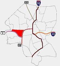
Through the mid-19th century, Olneyville developed as a railroad junction and a mill district, with much available employment. This helped attract many immigrants from overseas, including Guatemalans, Mexicans, Irish, Italians, Dominicans, Africans, Chinese, Vietnamese, and many others. However, the mill industries declined after World War II, causing economic decline. The construction of the Route 6 - Route 10 connector in the 1950s exacerbated these problems by separating Olneyville and other neighborhoods from the rest of the city. In the two decades that followed, Olneyville witnessed a substantial drop in its population.

On May 15, 1900, Olneyville was the site of one of the few occasions of "raining fish", when a late afternoon thunderstorm brought perch and bullspouts falling from the skies. [3]

In the 1990s, Olneyville became nationally recognized as the home of the Fort Thunder artists collective and the Providence noise rock scene that included groups such as Lightning Bolt, Black Dice and Arab on Radar.

Redevelopment

National and Providence Worsted Mills ProvidenceRI RisingSunMill 1.jpg
National and Providence Worsted Mills
Woonasquatucket River Greenway Woonasquatucket River Greenway Providence.jpg
Woonasquatucket River Greenway

Former warehouses and mill buildings in Olneyville were home to a number of artist collectives including Fort Thunder in the 1990s. Since 2000, many vacant lots and abandoned buildings have been purchased by developers who hope to rejuvenate the area.

However, proposals to redevelop the Olneyville area have met some local opposition, caused by fears of gentrification. In March 2007, the Olneyville Neighborhood Association (ONA) declared its opposition to plans from the United Way to move their headquarters from the East Side to 50 Valley Street in Olneyville. [4] In July 2007, during a meeting of the Providence City Council, the ONA declared a "tax strike" to protest a proposed property tax increase. Residents of Olneyville and Silver Lake expressed concerns that the proposed tax increase would force poorer residents from their homes and declared that they would not pay the amount of any property tax increase. [5]

Demographics

Olneyville's population, 6,495 in the 2000 US Census, is very diverse. As of the 2010 US Census, the racial and ethnic breakdown of Olneyville was 61% Hispanic; 16% White; 13% Black or African American; 4% Asian; 6% Other. [6]

63% of public school children speak a language other than English as their primary language. [7]

The housing stock is 18% owner-occupied and 12% single-family housing units, compared with 35% and 26%, respectively, for Providence overall (US Census 2000) [6]

The median family income is $19,046, well below the citywide average of $32,058. 41.1% of families live in poverty while nearly one in four families receives some form of public assistance.

Rates of lead poisoning 14% of children younger than age 6 had elevated blood lead levels, some of the highest in Providence (2004–2008 RI Department of Health, KIDSNET data). [6]

Of Olneyville's households, 41% report not owning a car (US Census 2000) [6]

Only 3% of total births were less than 2500 g, one of the best rates in Providence (2007 RI Department of Health, KIDSNET data). [6]

Of total births, 88% from 2006 to 2008 were to mothers with public insurance, which is one of the highest rates in Providence (1997–2008 RI Department of Health, KIDSNET data). [6]

Government

Olneyville is divided west to east between Ward 6 and Ward 15. They are represented in the Providence City Council by Democrats Sabina Matos and Council President Pro Tempore. [7]

Arts and culture

Olneyville is a number of art galleries and artists' studios, including Yellow Peril and GRIN, both of which are contemporary art galleries at The Plant, 60 Valley Street, as well as performance venues like Fete Music Hall and The Dirt Palace.

The Wilbury Theatre Group moved to its new space in Olneyville in the summer of 2017, where they perform a season of new and established plays. [8]

The Manton Avenue Project, [9] a play writing program for young people, has been based in Olneyville since 2004.[ citation needed ]

Parks

Olneyville has three parks, connected by the Woonasquatucket River Greenway and Bike Path. The three parks are: John Donigian Memorial Park on Valley Street, Riverside Park on Aleppo Street, and Joslin Park & Recreational area, on Florence Street. [10]

Olneyville also has at least three community gardens and one school garden. Locals plan to organize a regular, seasonal farmer's market, as well.[ citation needed ]

Sports

Messer Street Grounds was home to the Providence Grays baseball team of the National League from 1878 to 1885.[ citation needed ]

See also

Related Research Articles

<span class="mw-page-title-main">Rhode Island</span> U.S. state

Rhode Island is a state in the New England region of the Northeastern United States. It borders Connecticut to its west; Massachusetts to its north and east; and the Atlantic Ocean to its south via Rhode Island Sound and Block Island Sound; and shares a small maritime border with New York, east of Long Island. Rhode Island is the smallest U.S. state by area and the seventh-least populous, with slightly fewer than 1.1 million residents as of 2020; but it has grown at every decennial count since 1790 and is the second-most densely populated state, after New Jersey. The state takes its name from the eponymous island, though nearly all its land area is on the mainland. Providence is its capital and most populous city.

<span class="mw-page-title-main">Pawtucket, Rhode Island</span> City in Rhode Island

Pawtucket is a city in Providence County, Rhode Island. The population was 75,604 at the 2020 census, making the city the fourth-largest in the state. Pawtucket borders Providence and East Providence to the south, Central Falls and Lincoln to the north, and North Providence to the west. The city also borders the Massachusetts municipalities of Seekonk and Attleboro.

<span class="mw-page-title-main">North Providence, Rhode Island</span> Town in Rhode Island, United States

North Providence is a town in Providence County, Rhode Island, United States. The population was 34,114 at the 2020 census.

<span class="mw-page-title-main">Rhode Island Route 10</span> State highway in Providence County, Rhode Island, US

Route 10 is a numbered state highway connector in the U.S. state of Rhode Island, traveling along the Huntington Expressway, the first freeway in the state. It connects Route 12 on the Cranston–Providence city line with Interstate 95 (I-95), U.S. Route 6 (US 6), and Memorial Boulevard in downtown Providence, passing just east of the Olneyville area of Providence. It provides an alternate route to I-95 south of downtown, and connects it with the US 6 freeway west from Olneyville towards I-295 and Connecticut.

<span class="mw-page-title-main">Moshassuck River</span> River in Rhode Island, United States

The Moshassuck River is a river in the U.S. state of Rhode Island. It flows 8.9 miles (14.3 km) from the town of Lincoln to the city of Providence. There are six dams along the river's length.

<span class="mw-page-title-main">Woonasquatucket River</span> River in Rhode Island, United States

The Woonasquatucket River is a river in the U.S. state of Rhode Island. It flows approximately 15.8 miles (25.4 km) and drains a watershed of 130 km2 (50 sq mi).

<span class="mw-page-title-main">Federal Hill, Providence, Rhode Island</span> Neighborhood of Providence in Providence County, Rhode Island, United States

Federal Hill is a neighborhood in Providence, Rhode Island. It lies immediately west of the city's Downtown, across Interstate 95. Since the late 19th century, Federal Hill has been an enclave of Providence's Italian American community; today the neighborhood is known as Providence's Little Italy and is noted for its abundance of Italian restaurants, markets, and cultural establishments.

<span class="mw-page-title-main">Smith Hill, Providence, Rhode Island</span> United States historic place

Smith Hill is a neighborhood in Providence, Rhode Island. Its traditional bounds are the Woonasquatucket River, the Chad Brown public housing complex, Interstate 95 and West River.

<span class="mw-page-title-main">Fox Point, Providence, Rhode Island</span> Neighborhood of Providence in Rhode Island, United States

Fox Point is a neighborhood in the East Side of Providence, Rhode Island. It is bounded by the Providence and Seekonk rivers, Interstate 195 and the College Hill and Wayland neighborhoods. Fox Point is the southernmost neighborhood in the East Side area of Providence.

<span class="mw-page-title-main">East Side, Providence, Rhode Island</span> Collection of neighborhoods

The East Side is a collection of neighborhoods in the eastern part of the city of Providence, Rhode Island. It officially comprises the neighborhoods of Blackstone, Hope, Mount Hope, College Hill, Wayland, and Fox Point.

<span class="mw-page-title-main">Silver Lake, Providence, Rhode Island</span>

Silver Lake is a neighborhood on the western edge of Providence, Rhode Island. It is bordered by the Hartford neighborhood to the north, Route 10 to the east, Johnston and Cranston on the West and separated from Olneyville by Route 6.

<span class="mw-page-title-main">Hartford, Providence, Rhode Island</span> Neighborhood in Providence, Rhode Island

Hartford is a neighborhood located along the western edge of Providence, Rhode Island. Route 6 and the Woonasquatucket River separates it from Olneyville.

<span class="mw-page-title-main">Neighborhoods in Providence, Rhode Island</span>

The city of Providence, Rhode Island has 25 official neighborhoods.

<span class="mw-page-title-main">Manton, Providence, Rhode Island</span> Residential neighborhood

Manton is a residential neighborhood in Providence, Rhode Island and part of Johnston, Rhode Island. It is in the westernmost part of the city. of Providence The town of North Providence borders it to the north, Johnston to the west, while the neighborhoods of Hartford, Olneyville, and Mount Pleasant border it inside Providence. Separating it from other Providence neighborhoods to its east are Rushmore Ave, Chalkstone Ave, Smith Street, and the Triggs Memorial Golf Course. The Woonasquatucket River separates it from Johnston to the west.

<span class="mw-page-title-main">National and Providence Worsted Mills</span> United States historic place

The Rising Sun Mill, formerly the National and Providence Worsted Mills, are a historic textile mill complex located at 166 Valley Street in Providence, Rhode Island. The complex consists of thirteen brick and stone structures, ranging in height from one to four stories, located on the banks of the Woonasquatucket River in the Olneyville neighborhood of the city. Most of them were built between 1880 and 1890, with a small number from 1907 and later. The National and Providence Company and its successors operated here from 1881 into the 1950s, a time period when Providence was a leading manufacturer of worsted wool material.

<span class="mw-page-title-main">Providence, Rhode Island</span> Capital city of Rhode Island, United States

Providence is the capital and most populous city of the U.S. state of Rhode Island. The county seat of Providence County, it is one of the oldest cities in New England, founded in 1636 by Roger Williams, a Reformed Baptist theologian and religious exile from the Massachusetts Bay Colony. He named the area in honor of "God's merciful Providence" which he believed was responsible for revealing such a haven for him and his followers. The city developed as a busy port, as it is situated at the mouth of the Providence River at the head of Narragansett Bay.

<span class="mw-page-title-main">Mount Pleasant, Providence, Rhode Island</span>

Mount Pleasant is a working-class residential neighborhood situated in the northwest of the city of Providence, Rhode Island. It is bordered by Olneyville to the south, Valley to the east, Manton to the west, and Elmhurst to the northeast, and the Town of North Providence to the north. The major street boundaries that define Mount Pleasant are Academy Avenue to the east, Smith Street to the northeast, Atwells Avenue to the south, and portions of Bullock, Chalkstone, Mera, and Rushmore Avenues to the west.

<span class="mw-page-title-main">Earnscliffe Woolen-Paragon Worsted Company Mill Complex</span> United States historic place

The Earnscliffe Woolen-Paragon Worsted Company Mill Complex is a historic mill at 25 and 39 Manton Avenue in Providence, Rhode Island. It consists of a grouping of eleven industrial buildings on 4.4 acres (1.8 ha) in the Olneyville neighborhood of Providence, on the banks of the Woonasquatucket River. The buildings were built between 1898 and about 1939. Building 1, the oldest building, began in 1898 as a two-story rectangular brick structure with a three-story tower and a monitor roof, but was expanded over the years, obscuring both the tower and the monitor. The complex was begun by the Earnscliff Woolen Company, which failed in 1909. The Paragon Worsted Company purchased the property, and operated on the premises until 1960, when the company closed the mill.

<span class="mw-page-title-main">Wanskuck, Providence, Rhode Island</span>

Wanskuck is a neighborhood in the northern part of Providence, Rhode Island. Along with Charles, it is one of two neighborhoods comprising what is often referred to as the North End. Wanskuck is bounded to the east by Route 146, to the west by Providence College, Admiral Street, Route 7, and Huxley Avenue, and to the south roughly by Fillmore Street. Parts of Wanskuck north of Branch Avenue are the Wanskuck Historic District.

Mashapaug Pond is the largest freshwater pond in the city of Providence, Rhode Island.

References

  1. Rhode Island at Wikipedia
  2. Providence Neighborhoods: Olneyville
  3. "Rained Fish" . The Sun . Lowell, Massachusetts. Associated Press. May 16, 1900. p. 4.
  4. "United Way's move into Olneyville meets neighbors’ resistance", The Providence Journal
  5. "Residents revolt over tax hike", The Providence Journal
  6. 1 2 3 4 5 6 Healthier Olneyville Assessment Report | ONE Neighborhood Builders | About Olneyville
  7. 1 2 "Olneyville". Providence Neighborhood Profiles. The Providence Plan. 21 March 2007. Archived from the original on 2008-11-20. Retrieved 2009-05-18.
  8. McDonald, Susan. "New season, new spaces for 2 R.I. theater companies". The Providence Journal . Retrieved 2018-02-13.
  9. The Manton Avenue Project
  10. Olneyville Parks & Public Spaces