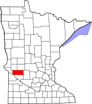
McKinley Township is a township in Cass County, Minnesota, United States. The population was 130 at the 2000 census. McKinley Township was named for William McKinley, 25th President of the United States.

Mandt Township is a township in Chippewa County, Minnesota, United States. The population was 175 at the 2000 census.

Holy Cross Township is a township in Clay County, Minnesota, United States. The population was 129 at the 2000 census.

Wyanett Township is a township in Isanti County, Minnesota, United States. The population was 1,698 at the 2000 census.

Alvwood Township is a township in Itasca County, Minnesota, United States. The population was 42 at the 2010 census.

Sago Township is a township in Itasca County, Minnesota, United States. The population was 176 at the 2010 census.

St. Vincent Township is a township in Kittson County, Minnesota, United States. The population was 74 at the 2000 census.

Lac qui Parle Township is a township in Lac qui Parle County, Minnesota, United States. The population was 183 at the 2000 census.

Walter Township is a township in Lac qui Parle County, Minnesota, United States. The population was 186 at the 2000 census.

Westerheim Township is a township in Lyon County, Minnesota, United States. The population was 286 at the 2000 census.

Grand Plain Township is a township in Marshall County, Minnesota, United States. The population was 55 at the 2000 census.

Cedar Township is a township in Martin County, Minnesota, United States. The population was 260 at the 2000 census.

Nicollet Township is a township in Nicollet County, Minnesota, United States. The population was 511 at the 2000 census.

Lee Township is a township in Norman County, Minnesota, United States. The population was 159 at the 2000 census.

Parnell Township is a township in Polk County, Minnesota, United States. It is part of the Grand Forks-ND-MN Metropolitan Statistical Area. The population was 87 at the 2000 census.

Roome Township is a township in Polk County, Minnesota, United States. It is part of the Grand Forks-ND-MN Metropolitan Statistical Area. The population of the township was 185 at the 2000 census. The unincorporated community of Eldred is located within Roome Township.

Tara Township is a township in Traverse County, Minnesota, United States. The population was 126 at the 2000 census.

Normania Township is a township in Yellow Medicine County, Minnesota, United States. The population was 188 at the 2000 census.

Agassiz Township is a township in Lac qui Parle County, Minnesota, United States. The population was 104 at the 2000 census.

Augusta Township is a township in Lac qui Parle County, Minnesota, United States. The population was 119 at the 2000 census.


