De Graff | |
---|---|
Coordinates: 45°15′36″N95°28′06″W / 45.26000°N 95.46833°W | |
Country | United States |
State | Minnesota |
County | Swift |
Area | |
• Total | 0.84 sq mi (2.17 km2) |
• Land | 0.84 sq mi (2.17 km2) |
• Water | 0.00 sq mi (0.00 km2) |
Elevation | 1,056 ft (322 m) |
Population (2020) | |
• Total | 110 |
• Density | 131.42/sq mi (50.76/km2) |
Time zone | UTC-6 (Central (CST)) |
• Summer (DST) | UTC-5 (CDT) |
ZIP code | 56271 |
Area code | 320 |
FIPS code | 27-15418 [3] |
GNIS feature ID | 2394473 [2] |
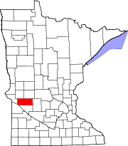
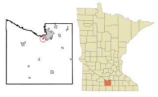
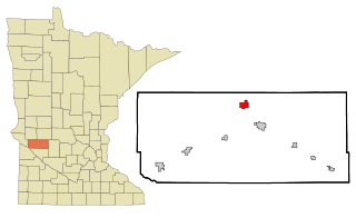
De Graff is a city in Swift County, Minnesota, United States. The population was 115 at the 2010 census. [4]
De Graff was laid out in 1875, and named for Andrew De Graff, a railroad agent. [5] A post office was established at De Graff in 1873, and remained in operation until 1996. [6] De Graff was incorporated in 1881. [5]
According to the United States Census Bureau, the city has a total area of 0.81 square miles (2.10 km2), all land. [7]
U.S. Route 12 serves as a main route in the community.
Census | Pop. | Note | %± |
---|---|---|---|
1900 | 165 | — | |
1910 | 215 | 30.3% | |
1920 | 246 | 14.4% | |
1930 | 274 | 11.4% | |
1940 | 291 | 6.2% | |
1950 | 270 | −7.2% | |
1960 | 196 | −27.4% | |
1970 | 195 | −0.5% | |
1980 | 179 | −8.2% | |
1990 | 149 | −16.8% | |
2000 | 133 | −10.7% | |
2010 | 115 | −13.5% | |
2020 | 110 | −4.3% | |
U.S. Decennial Census [8] |
As of the census [9] of 2010, there were 115 people, 53 households, and 34 families residing in the city. The population density was 142.0 inhabitants per square mile (54.8/km2). There were 67 housing units at an average density of 82.7 per square mile (31.9/km2). The racial makeup of the city was 94.8% White, 4.3% African American, and 0.9% from two or more races.
There were 53 households, of which 26.4% had children under the age of 18 living with them, 54.7% were married couples living together, 5.7% had a female householder with no husband present, 3.8% had a male householder with no wife present, and 35.8% were non-families. 34.0% of all households were made up of individuals, and 17% had someone living alone who was 65 years of age or older. The average household size was 2.17 and the average family size was 2.71.
The median age in the city was 45.3 years. 15.7% of residents were under the age of 18; 10.4% were between the ages of 18 and 24; 23.4% were from 25 to 44; 40.1% were from 45 to 64; and 10.4% were 65 years of age or older. The gender makeup of the city was 53.9% male and 46.1% female.
As of the census [3] of 2000, there were 133 people, 60 households, and 31 families residing in the city. The population density was 164.8 inhabitants per square mile (63.6/km2). There were 67 housing units at an average density of 83.0 per square mile (32.0/km2). The racial makeup of the city was 99.25% White, and 0.75% from two or more races. Hispanic or Latino of any race were 2.26% of the population.
There were 60 households, out of which 28.3% had children under the age of 18 living with them, 43.3% were married couples living together, 5.0% had a female householder with no husband present, and 46.7% were non-families. 43.3% of all households were made up of individuals, and 21.7% had someone living alone who was 65 years of age or older. The average household size was 2.22 and the average family size was 3.13.
In the city, the population was spread out, with 29.3% under the age of 18, 5.3% from 18 to 24, 30.1% from 25 to 44, 21.1% from 45 to 64, and 14.3% who were 65 years of age or older. The median age was 36 years. For every 100 females, there were 107.8 males. For every 100 females age 18 and over, there were 108.9 males.
The median income for a household in the city was $38,000, and the median income for a family was $40,625. Males had a median income of $29,286 versus $22,813 for females. The per capita income for the city was $14,987. There were 9.8% of families and 9.7% of the population living below the poverty line, including 3.4% of under eighteens and 18.2% of those over 64.
Skyline is a city in Blue Earth County, Minnesota, United States. The population was 288 at the 2020 census. It is adjacent to the city of Mankato and is part of the Mankato-North Mankato Metropolitan Statistical Area.
Emily is a city in Crow Wing County, Minnesota, United States. The population was 813 at the 2010 census. It is part of the Brainerd Micropolitan Statistical Area.
Ironton is a city in Crow Wing County, Minnesota, United States. The population was 572 at the 2010 census. It is part of the Brainerd Micropolitan Statistical Area.
Warba is a city in Itasca County, Minnesota, United States. The population was 181 at the 2010 census.
Bluffton is a city in Otter Tail County, Minnesota, United States, along the Leaf River. The population was 210 at the 2020 census.
Deer Creek is a city in Otter Tail County, Minnesota, United States. The population was 330 at the 2020 census.
Erhard is a city in Otter Tail County, Minnesota, United States. The population was 132 at the 2020 census.
Henning is a city in Otter Tail County, Minnesota, United States. The population was 854 at the 2020 census.
Ottertail is a city in Otter Tail County, Minnesota, United States. The population was 629 at the 2020 census.
Lowry is a city in Pope County, Minnesota, United States. The population was 334 at the 2020 census.
Prairie Lake Township is a township in Saint Louis County, Minnesota, United States. The population was 50 at the 2010 census.
Greenwald is a city in Stearns County, Minnesota, United States. The population was 222 at the 2010 census. It is part of the St. Cloud Metropolitan Statistical Area.
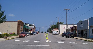
Kimball is a city in Stearns County, Minnesota, United States. The population was 799 at the 2020 census. It is part of the St. Cloud Metropolitan Statistical Area.
Lake Henry is a city in Stearns County, Minnesota, United States. The population was 103 at the 2010 census. It is part of the St. Cloud Metropolitan Statistical Area.
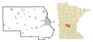
Saint Rosa is a city in Stearns County, Minnesota, United States. The population was 68 at the 2010 census. It is part of the St. Cloud Metropolitan Statistical Area.
Clontarf is a city in Swift County, Minnesota, United States. The population was 164 at the 2010 census.
Fifty Lakes is a city in Crow Wing County, Minnesota, United States. The population was 387 at the 2010 census. It is part of the Brainerd Micropolitan Statistical Area.
Minnesota Lake is a city in Blue Earth and Faribault counties in the State of Minnesota. The population was 661 at the 2020 census. The bulk of the city is in Faribault County; a small part extends into Blue Earth County.
Dennison is a city in Goodhue and Rice counties in the U.S. state of Minnesota. The population was 212 at the 2010 census. Most of Dennison is in Goodhue County, with only a small part that extends into Rice County.
Minneiska is a city in Wabasha and Winona counties in the U.S. state of Minnesota. The population was 111 at the 2010 census.