Westmoreland | |
---|---|
Westmoreland, Tennessee | |
Coordinates: 36°33′43″N86°14′53″W / 36.5619881°N 86.2480443°W | |
Country | United States |
State | Tennessee |
County | Sumner |
Incorporated | 1901 [1] |
Named for | Westmoreland (lumberman) [2] |
Area | |
• Total | 4.36 sq mi (11.29 km2) |
• Land | 4.34 sq mi (11.24 km2) |
• Water | 0.02 sq mi (0.05 km2) |
Elevation | 925 ft (282 m) |
Population | |
• Total | 2,718 |
• Density | 626.27/sq mi (241.78/km2) |
Time zone | UTC-6 (Central (CST)) |
• Summer (DST) | UTC-5 (CDT) |
ZIP code | 37186 |
Area code | 615 |
FIPS code | 47-79420 [6] |
GNIS feature ID | 1304492 [4] |
Website | westmorelandtn.gov |
Westmoreland is a town in Sumner County, Tennessee, United States, and is bordering southern Kentucky.The population was 2,093 at the 2000 census and 2,206 at the 2010 census. The town name was inspired by a wealthy lumberman from North Carolina, sharing the same name. [7]
Westmoreland is notable for a few things in its history, including having been an old railroad town and containing one of the smallest railroad tunnels there is.[ citation needed ]
Originally created in 1901 by a state charter, the town was officially incorporated to the State of Tennessee in February 1901. [8] In the years that followed, it slowly grew to the albeit small population it had today.
In the early 2000s, the Westmoreland Elementary school shut down, and relocated to a school closer to the Middle and High schools. The building today stands as Westmoreland Dream Center, and is a hub for can food drives and some boy scout activities.
The town has the smallest railroad tunnel in the world, smaller than the average American living room. It was built sometime during the early to mid 1900s and today is known as Little Tunnel. A mural in Town Square depicts the tunnel, along with a few other notable buildings and places.
According to the United States Census Bureau, the town has a total area of 3.8 square miles (9.8 km2), of which 3.8 square miles (9.8 km2) is land and 0.04 square miles (0.10 km2) (0.52%) is water.
Census | Pop. | Note | %± |
---|---|---|---|
1960 | 865 | — | |
1970 | 1,423 | 64.5% | |
1980 | 1,754 | 23.3% | |
1990 | 1,726 | −1.6% | |
2000 | 2,093 | 21.3% | |
2010 | 2,206 | 5.4% | |
2020 | 2,718 | 23.2% | |
Sources: [9] [10] [5] |
Race | Number | Percentage |
---|---|---|
White (non-Hispanic) | 2,449 | 90.1% |
Black or African American (non-Hispanic) | 36 | 1.32% |
Native American | 4 | 0.15% |
Asian | 26 | 0.96% |
Other/Mixed | 128 | 4.71% |
Hispanic or Latino | 75 | 2.76% |
As of the 2020 United States census, there were 2,718 people, 990 households, and 646 families residing in the town.
As of the census [6] of 2000, there were 2,093 people, 804 households, and 561 families residing in the town. The population density was 547.5 inhabitants per square mile (211.4/km2). There were 874 housing units at an average density of 228.6 units per square mile (88.3 units/km2). The racial makeup of the town was 98.85% White, 0.55% African American, 0.24% Native American, 0.05% Asian, 0.05% Pacific Islander, 0.29% from other races, and 0.48% from two or more races. Hispanic or Latino of any race were 0.13% of the population.
There were 804 households, out of which 34.7% had children under the age of 18 living with them, 54.4% were married couples living together, 11.3% had a female householder with no husband present, and 30.2% were non-families. 27.1% of all households were made up of individuals, and 14.6% had someone living alone who was 65 years of age or older. The average household size was 2.48 and the average family size was 3.01.
In the town, the population was spread out, with 25.3% under the age of 18, 8.3% from 18 to 24, 26.9% from 25 to 44, 22.5% from 45 to 64, and 17.0% who were 65 years of age or older. The median age was 36 years. For every 100 females, there were 80.6 males. For every 100 females age 18 and over, there were 77.4 males.
The median income for a household in the town was $28,958, and the median income for a family was $36,944. Males had a median income of $25,795 versus $19,366 for females. The per capita income for the town was $13,185. About 8.7% of families and 13.2% of the population were below the poverty line, including 13.7% of those under age 18 and 17.6% of those age 65 or over.
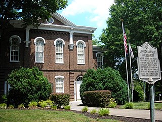
Loudon County is a county in the U.S. state of Tennessee. It is located in the central part of East Tennessee. As of the 2020 census, the population was 54,886. Its county seat is Loudon. Loudon County is included in the Knoxville, TN Metropolitan Statistical Area.
Lisbon is a town in New London County, Connecticut, United States, 7.3 miles (11.7 km) by road northeast of Norwich. The town is part of the Southeastern Connecticut Planning Region. The population was 4,195 at the 2020 census. The town center is also known as the village of Newent. The town school is Lisbon Central School. Its only postal code, 06351, is Jewett City, Connecticut, which is a village of the town of Griswold, Connecticut and encompasses all of Lisbon and Griswold.
Tunnel Hill is a city in northwest Whitfield County and southern Catoosa County, Georgia, United States. It is part of the Dalton Metropolitan Statistical Area. The population was 963 at the 2020 census. The city is named for the Chetoogeta Mountain Tunnel, a 1,497-foot (456 m) railroad tunnel built in the late 1840s.
Westmoreland is a town in Oneida County, New York, United States. The population was 6,138 at the 2010 census.
Sugarcreek is a borough in Venango County, Pennsylvania, United States. The population was 4,824 at the 2020 census. It is the largest borough by total area in all Venango County.
Crabtree is a census-designated place (CDP) and former coal town in Salem Township, Westmoreland County, Pennsylvania, United States. The population was 277 at the 2010 census. It has its own post office, with postal code 15624.
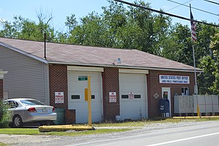
Donegal Township is a township in Westmoreland County, Pennsylvania, United States. The population was 2,192 at the 2020 census, a decrease of 9% compared to 2010.
Hyde Park is a borough in Westmoreland County, Pennsylvania, United States. The population was 509 at the 2020 census.
Loyalhanna Township is a township in Westmoreland County, Pennsylvania, United States. As of the 2020 census, the township's total population was 2,093.
Mount Pleasant Township is a township in Westmoreland County, Pennsylvania, United States. As of the 2020 census, the township population was 10,119. Mount Pleasant Township should not be confused with the Borough of Mount Pleasant, which is a separate municipality and comprises the town of that name.
Salem Township is a township in Westmoreland County, Pennsylvania, United States. The population was 6,083 at the 2020 census.
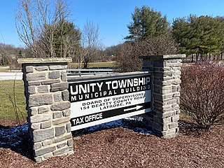
Unity Township is a township in Westmoreland County, Pennsylvania, United States. The population was 21,724 at the 2020 census, a decline of approximately 4% compared to the 2010 census.
Youngwood is a borough in Westmoreland County, Pennsylvania, United States.
North Codorus Township is a township in York County, Pennsylvania, United States. The population was 9,149 at the 2020 census.
Cowan is a city in Franklin County, Tennessee, United States. The population was 1,737 at the 2010 census. It is part of the Tullahoma, Tennessee Micropolitan Statistical Area.
Portland is a city in Sumner and Robertson counties in Tennessee. The population was 11,486 in 2010 according to estimates by the U.S. census bureau and in 2020 the population was 13,156. Portland is a part of the Nashville Metropolitan Statistical Area.
Tunnelton is a town in southwestern Preston County, West Virginia, United States. The population was 307 at the 2020 census. It is part of the Morgantown metropolitan area.
Union is a town in Waupaca County, Wisconsin, United States. The population was 804 at the 2000 census. The unincorporated community of Symco is located in the town. The ghost town of Marble was also located in the town.
Tunnelhill is a borough that is located in Cambria and Blair counties in Pennsylvania, United States. The population was 363 at the 2010 census. Of these, 245 were in Cambria County, and 118 were in Blair County. It is part of the Altoona, PA Metropolitan Statistical Area. Tunnelhill is named after the many railroad tunnels of the Pennsylvania Railroad near here known as the Gallitzin Tunnels.
Ridgetop is a city in Davidson and Robertson counties in the U.S. state of Tennessee. The population was 1,874 at the 2010 census.