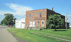
Wever, Iowa | |
---|---|
Coordinates: 40°42′38″N91°13′52″W / 40.71056°N 91.23111°W | |
Country | United States |
State | Iowa |
County | Lee |
Area | |
• Total | 1.48 sq mi (3.82 km2) |
• Land | 1.48 sq mi (3.82 km2) |
• Water | 0.00 sq mi (0.00 km2) |
Elevation | 561 ft (171 m) |
Population (2020) | |
• Total | 101 |
• Density | 68.43/sq mi (26.42/km2) |
Time zone | UTC-6 (Central (CST)) |
• Summer (DST) | UTC-5 (CDT) |
ZIP codes | 52658 |
FIPS code | 19-84855 |
GNIS feature ID | 462957 [2] |
Wever is an unincorporated community in northeastern Lee County, in the southeastern corner of Iowa, United States. As of the 2020 census, its population was 101. [3]
Wever lies along U.S. Route 61, approximately eight miles northeast of the city of Fort Madison, one of two county seats in Lee County. It is just South of the Iowa Army Ammunition Plant and the Skunk River, which empties further east into the Mississippi River. [4] Its elevation is 561 feet (171 m). [2]
Census | Pop. | Note | %± |
---|---|---|---|
2020 | 101 | — | |
U.S. Decennial Census [5] |
As of the census of 2020, [6] there were 101 people, 47 households, and 23 families residing in the community. The population density was 68.4 inhabitants per square mile (26.4/km2). There were 55 housing units at an average density of 37.3 per square mile (14.4/km2). The racial makeup of the community was 92.1% White, 1.0% Black or African American, 0.0% Native American, 0.0% Asian, 0.0% Pacific Islander, 0.0% from other races and 6.9% from two or more races. Hispanic or Latino persons of any race comprised 5.0% of the population.
Of the 47 households, 21.3% of which had children under the age of 18 living with them, 38.3% were married couples living together, 4.3% were cohabitating couples, 10.6% had a female householder with no spouse or partner present and 46.8% had a male householder with no spouse or partner present. 51.1% of all households were non-families. 48.9% of all households were made up of individuals, 17.0% had someone living alone who was 65 years old or older.
The median age in the community was 50.3 years. 17.8% of the residents were under the age of 20; 0.0% were between the ages of 20 and 24; 19.8% were from 25 and 44; 37.6% were from 45 and 64; and 24.8% were 65 years of age or older. The gender makeup of the community was 53.5% male and 46.5% female.
Wever was a station on the Chicago, Burlington and Quincy Railroad. [7]
Although Wever is unincorporated, it has a post office, which opened on May 1, 1837. This post office has a complicated name history: it opened as 'Sand Ridge', changed to 'Green Bay' on September 17, 1849, to 'Jollyville' on January 28, 1859, and finally to Wever on October 17, 1870. [8] Its ZIP code is 52658. [9]
Wever was built around a station of the Chicago, Burlington and Quincy Railroad within Green Bay Township, and superseded the nearby town of Jollyville. It had 300 inhabitants when mentioned in the 1879 History of Lee County and was enjoying "good trade" because of the surrounding very fertile country. [10] Wever's population was 66 in 1902, [11] and had increased to 212 by 1925. [12]
The community is a part of the Fort Madison-Keokuk μSA.
In 1971, Mr. James Cook submitted the following statement about the fertilizer plant which Atlantic Richfield Company (ARCO) was operating in Green Bay Bottoms to produce anhydrous ammonia and diammonium phosphate fertilizers, to a US Senate committee: "ARCO Chemical Co., Division of Atlantic Richfield Co., Fort Madison, Iowa, May 20, 1971. To the U.S. House of Representatives, Committee on Appropriations, Subcommittee of Public Works, the U.S. Senate, Committee on Appropriations, Subcommittee of Public Works:
ARCO Chemical Company, a division of Atlantic Richfield Company, operates and maintains a fertilizer manufacturing complex adjacent to the Mississippi River in an area known as Green Bay bottoms. The capital cost of the complex was in excess of $60,000,000 and is entirely protected from the Mississippi River by levees. The plant significantly contributes to the economy of Fort Madison, Burlington, and surrounding communities. This complex of ARCO Chemical Company does employ approximately 1,000 people who are engaged in the manufacture, distribution and marketing of fertilizers, almost all of which are manufactured at this one facility. Any flooding of the Mississippi River at this point would have a detrimental effect to the company, an economic impact on the aforementioned communities and the earnings of a significant number of employees. Therefore, ARCO Chemical Company supports the continuing study by the Corps of Engineers in regard to the raising of the levees along the Mississippi River. G. T. Stocking, Vice President" [13]
In 1976, the EPA reported that the ARCO Chemical Co. fertilizer plant in Fort Madison, IA, had a wet-process phosphoric acid unit, which had come on stream in 1968, had an annual capacity of 225,000 short tons, expressed as P2O5 [14]
In 2012, plans were announced to build a $1.4 billion fertilizer plant in Wever. The plant will use natural gas and is built by Orascom. Groundbreaking occurred in November 2012. [15] The WSJ wrote that US economic rebound and cheap energy from the shale-oil boom was luring investment from companies such as Egypt's Orascom. [16]
ARCO is a brand of gasoline stations owned by Marathon Petroleum. BP, which formerly owned the brand, uses it in Northern California, Oregon and Washington, while Marathon has rights for the rest of the United States and Mexico.
Lee County is the southernmost county in the U.S. state of Iowa. As of the 2020 census, the population was 33,555. The county seats are Fort Madison and Keokuk. Lee County is part of the Fort Madison–Keokuk, IA–IL–MO Micropolitan Statistical Area. It was established in 1836.
Sauget is a village in St. Clair County, Illinois, United States. It is part of Greater St. Louis. The population was 141 at the 2020 census, down from 159 in 2010.
Fort Madison is a city and a county seat of Lee County, Iowa, United States along with Keokuk. Of Iowa's 99 counties, Lee County is the only one with two county seats. The population was 10,270 at the time of the 2020 census. Located along the Mississippi River in the state's southeast corner, it lies between small bluffs along one of the widest portions of the river.
Keokuk is a city in and a county seat of Lee County, Iowa, United States. It is Iowa's southernmost city. The population was 9,900 at the time of the 2020 census. The city is named after the Sauk chief Keokuk, who is recognized with a statue in Rand Park. It is in the extreme southeast corner of Iowa, where the Des Moines River meets the Mississippi. It is at the junction of U.S. Routes 61, 136 and 218. Just across the rivers are the towns of Hamilton and Warsaw, Illinois, and Alexandria, Missouri. Keokuk, along with the city of Fort Madison, is a principal city of the Fort Madison-Keokuk micropolitan area, which includes all of Lee County, Iowa, Hancock County, Illinois and Clark County, Missouri.
Muscatine is a city in and the county seat of Muscatine County, Iowa, United States. The population was 23,797 at the time of the 2020 census, an increase from 22,697 in 2000. It is located along the Mississippi River. The local business association states that the name Muscatine is not used by any other community.
Luling is a census-designated place (CDP) in St. Charles Parish, Louisiana. The population was 11,512 at the 2000 census and 12,119 at the 2010 census. At the 2020 census, 13,716 people lived in Luling. It is located on the west bank of the Mississippi River. Luling is part of the New Orleans—Metairie—Kenner metropolitan statistical area.
Richfield is a city in Hennepin County, Minnesota. An inner-ring suburb of Minneapolis, Richfield is bordered by Minneapolis to the north, Minneapolis–Saint Paul International Airport and Fort Snelling to the east, Bloomington to the south, and Edina to the west. The population was 36,994 at the 2020 census.
Nitro is a city in Kanawha and Putnam counties in the U.S. state of West Virginia. It takes its name from a World War I era nitrocellulose plant. The population was 6,618 according to the 2020 census. It is part of the Charleston metropolitan area.
Koch, Inc. is an American multinational conglomerate corporation based in Wichita, Kansas, and is the second-largest privately held company in the United States, after Cargill. Its subsidiaries are involved in the manufacturing, refining, and distribution of petroleum, chemicals, energy, fiber, intermediates and polymers, minerals, fertilizer, pulp and paper, chemical technology equipment, cloud computing, finance, raw materials trading, and investments. Koch owns Flint Hills Resources, Georgia-Pacific, Guardian Industries, Infor, Invista, KBX, Koch Ag & Energy Solutions, Koch Engineered Solutions, Koch Investments Group, Koch Minerals & Trading, and Molex. The firm employs 122,000 people in 60 countries, with about half of its business in the United States.
American Cyanamid Company was an American manufacturing conglomerate. It began as a fertilizer company and added many additional lines of business before merging with American Home Products in 1994. The combined company sold off most of its divisions, adopted the name of its remaining Wyeth division, and was bought by Pfizer in 2009, becoming defunct as a separate concern.
Augusta is an unincorporated community and census-designated place situated on the Skunk River in Des Moines County, Iowa, United States. It is located 10 miles southwest of Burlington and nine miles north of Fort Madison, off U.S. Route 61 and Iowa Highway 16. The community is part of the Burlington, IA–IL Micropolitan Statistical Area.
Denmark is an unincorporated community and census-designated place in northeastern Lee County, Iowa, United States. It lies along Iowa Highway 16, north of the city of Fort Madison, the county seat of Lee County. Its elevation is 722 feet (220 m) above sea level. Although Denmark is unincorporated, it has a post office with the ZIP code of 52624, that opened on April 7, 1846. The town also has a branch of Farmers Savings Bank that opened in 1935. The community is part of the Fort Madison–Keokuk, IA-MO Micropolitan Statistical Area. As of the 2020 census, its population was 425.
Argyle is an unincorporated community in southwestern Lee County, Iowa, United States. As of the 2020 census, its population was 91.
Pilot Grove is an unincorporated community in northern Lee County, Iowa, United States. It lies along local roads northwest of the city of Fort Madison, the county seat of Lee County. Its elevation is 643 feet (196 m).
The Fort Madison–Keokuk, IA-IL-MO Micropolitan Statistical Area, as defined by the United States Census Bureau, locally known as the "Tri-State" area, was an area consisting of three counties – one in southeast Iowa, one in northeast Missouri, and one in west central Illinois, anchored by the cities of Fort Madison, Iowa and Keokuk, Iowa. As of the 2010 census, the μSA had a population of 62,105. An estimate by the Census Bureau, as of July 1, 2012, placed the population at 61,477, a decrease of 1.01%. When the 2023 definitions were released this area was dissolved with Lee County, Iowa being included as part of the Burlington–Fort Madison, IA–IL Combined Statistical Area.
Niota is an unincorporated community in Appanoose Township, Hancock County, in the U.S. state of Illinois. The community is located on the bank of the Mississippi River and is at the eastern end of the Fort Madison Toll Bridge, which connects Niota to Fort Madison, Iowa. Niota is the western terminus of Illinois Route 9 and is also served by Illinois Route 96, which is part of the Great River Road.
New Boston is an unincorporated community in central Lee County, Iowa, United States. It lies in the southeast corner of Iowa, along U.S. Highway 218 and southwest of the city of Fort Madison, the county seat of Lee County. New Boston is located nearby to the unincorporated communities of Argyle, Iowa and Charleston, Iowa. The community is part of the Fort Madison–Keokuk, IA-MO Micropolitan Statistical Area. There are no commercial establishments in New Boston, although this is the home of Liberty Baptist Church.
Iowa is a state in the upper Midwestern region of the United States. It borders the Mississippi River to the east and the Missouri River and Big Sioux River to the west; Wisconsin to the northeast, Illinois to the east and southeast, Missouri to the south, Nebraska to the west, South Dakota to the northwest, and Minnesota to the north.
The Port Neal fertilizer plant explosion occurred on December 13, 1994 in the ammonium nitrate plant at the Terra International, Inc., Port Neal Complex, 16 mi (26 km) south of Sioux City, Iowa, United States. Four workers at the plant were killed by the explosion, and eighteen others were injured. The seven-story building at the seat of the blast was completely destroyed, leaving only a crater, and significant damage was inflicted to the surrounding structures. Four nearby electricity generating stations were disabled by the explosion, and the effects of the blast were felt up to 30 miles away. A high-voltage line running adjacent to the plant and over the Missouri River was damaged, disrupting power in the neighboring state of Nebraska. Two 15,000-ton refrigerated ammonia storage tanks were ruptured, releasing liquid ammonia and ammonia vapors which forced the evacuation of 1,700 residents from the surrounding area.