Nether Poppleton is a village and civil parish in the unitary authority of the City of York in North Yorkshire, England. It is by the west bank of the River Ouse and is adjacent to Upper Poppleton west of York. It is close to the A59 road from York to Harrogate. The village is served by Poppleton railway station on the Harrogate Line.
Upper Poppleton is a village and civil parish in the unitary authority of the City of York in North Yorkshire, England. It is situated by the west bank of the River Ouse adjacent to Nether Poppleton, and west of York close to the A59 from York to Harrogate. The village is served by Poppleton railway station on the Harrogate Line. According to the 2001 census, the parish had a population of 1,961, increasing to 1,997 at the 2011 Census. Before 1996, it was part of the Borough of Harrogate.

Bishop Monkton is a village and civil parish in the former Harrogate district of North Yorkshire, England, about five miles south of Ripon. According to the 2001 census it had a population of 775, increasing slightly to 778 at the 2011 Census. In 2015, North Yorkshire County Council estimated the population to be 760.

Burton Leonard is a village and civil parish in the Harrogate district of North Yorkshire, England, and approximately 7 miles (11 km) south from Ripon. In the 2001 Census, the population of the village was 654, which had risen to 690 by the time of the 2011 Census. In 2015, North Yorkshire County Council estimated the population had dropped to 670.

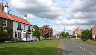
Spofforth is a village in the civil parish of Spofforth with Stockeld in the Harrogate district of North Yorkshire, England, about 3 miles (4.8 km) north west of Wetherby and 5 miles (8 km) south of Harrogate on the River Crimple, a tributary of the River Nidd.

Claro was a wapentake of the West Riding of Yorkshire, England. It was split into two divisions. The Upper Division included the parishes of Farnham, Fewston, Hampsthwaite, Kirkby Malzeard and Pannal and parts of Aldborough, Knaresborough, Otley, Little Ouseburn, Ripley, Ripon, Wetherby and Whixley, many of which formed exclaves. The Lower Division included the parishes of Allerton Mauleverer, Goldsborough, Hunsingore, Kirk Deighton, Kirkby Overblow, Leathley, Spofforth with Stockeld, Weston and parts of Addingham, Aldborough, Harewood, Ilkley, Kirk Hammerton, Otley, Ripley and Whixley.

Killinghall is a village and civil parish in the Harrogate district of North Yorkshire, England. The civil parish population taken at the 2011 census was 4,132.

Allerton Mauleverer is a village in North Yorkshire, England. It is part of the Allerton Mauleverer with Hopperton parish. The parish is in the district of Harrogate, and lies just 5 miles (8 km) east of the town Knaresborough. From 1947 to 1998, Allerton Mauleverer was part of the Claro Registration District, until it was abolished. The A1(M) runs through the area connecting London and Edinburgh.

Thornborough is a village in Hambleton District of North Yorkshire, England. It is about 7 miles (11 km) south of Bedale and 3 miles (5 km) west of the A1(M) motorway. Thornborough is in the West Tanfield parish. The Thornborough Henges ancient monuments are situated south and west of the village. The village lies just to the south of the B6267 road, which connects the A6055 in the east, with the A6108 road at Masham. The village is served by two buses a day in each direction between Ripon and Masham. When the Masham Branch of the North Eastern Railway was open, Tanfield station would have been the nearest railway station to Thornborough. Now the nearest railway station is at Thirsk.

Farnham is a village and civil parish in the Harrogate district of North Yorkshire, England. It is situated 2 miles (3.2 km) north of Knaresborough.

Kirk Hammerton is a village and civil parish in the Harrogate district of North Yorkshire, England. It is near the River Nidd and the A59 road, 10 miles (16 km) west of York. The village suffix refers to the Hamerton family who owned the land until the 16th century.

Kirby-on-the-Moor, also called Kirby, is a village in the Kirby Hill civil parish about 1 mile (1.6 km) north of the market town of Boroughbridge, in North Yorkshire, England. It was formerly in the Harrogate district until 2023.

Little Ouseburn is a small village and civil parish in the Harrogate district of North Yorkshire, England. It is situated near the A1(M) motorway and 6 miles (9.7 km) south-east of Boroughbridge. It consists of two roads, Main Street which is the residential area, and Church Lane which contains a Holy Trinity Church that is a grade I listed building. It also has a small brick bridge over a stream which leads to Great Ouseburn. According to the 2011 census data the total population of Little Ouseburn is 264.
Marton-le-Moor is a village and civil parish in the Harrogate district of North Yorkshire, England. It is very near the A1(M) motorway, 4 miles (6.4 km) east of Ripon and 3 miles (4.8 km) west of Boroughbridge. The name of the village derives from a mixture of Latin, Old English and Old Norse; Marr tūn super mōr, which means marsh farm on the moor.

Milby is a hamlet and civil parish in North Yorkshire, England. It is situated to the immediate north of Boroughbridge.
Moor Monkton is a village and civil parish in the former Harrogate District of North Yorkshire, England. It is situated on the River Nidd and 7 miles (11 km) north-west from York city centre.
Pannal is a village in the Harrogate district of North Yorkshire, England. Historically part of the West Riding of Yorkshire, it is situated to the immediate south of Harrogate. Since 2016 it has formed part of the new civil parish of Pannal and Burn Bridge. The village is served by Pannal railway station on the Harrogate (Railway) Line between Leeds and York.

Mickley is a village in the Harrogate District of North Yorkshire, England. The village is on the south bank of the River Ure between Masham and West Tanfield.

Marton cum Grafton is a civil parish in the Borough of Harrogate of North Yorkshire, England. The parish has only two settlements, and has a magnesian limestone and sandstone geography, which has been used for quarrying. The landform is broadly flat, though there are some small hills with the Marton and Grafton being separated by 98 feet (30 m) despite being only 0.5 miles (0.8 km) apart.

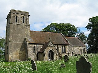
The Church of the Ascension is an Anglican church in the village of Whixley, North Yorkshire, England. Whilst the Domesday Book entry for Whixley mentions the presence of a church, the main fabric of the existing church dates to the 14th century. Up until it was renovated in the 19th century, it was dedicated to St James, but was rededicated as the Church of the Ascension, and it is now a grade II* listed building. Nikolaus Pevsner notes that it is unusual for a village church to be composed of mostly the same style of architecture (Decorated).


