
A postal code is a series of letters or digits or both, sometimes including spaces or punctuation, included in a postal address for the purpose of sorting mail.

A ZIP Code is a postal code used by the United States Postal Service (USPS). Introduced on July 1, 1963, the basic format consisted of five digits. In 1983, an extended ZIP+4 code was introduced; it included the five digits of the ZIP Code, followed by a hyphen and four digits that designated a more specific location.
POSTNET is a barcode symbology used by the United States Postal Service to assist in directing mail. The ZIP Code or ZIP+4 code is encoded in half- and full-height bars. Most often, the delivery point is added, usually being the last two digits of the address or PO box number.
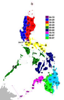
In the Philippines, a ZIP code is used by the Philippine Postal Corporation (PhlPost) to simplify the distribution of mail. While its function similar with the ZIP Codes used in the United States, its form and usage are quite different. Its use is not mandatory but highly recommended by the PhlPost. A ZIP code is composed of a four-digit number representing a locality. Usually, more than one code is issued for areas within Metro Manila, and a single code for each municipality and city in provincial areas, with some rare exceptions such as Dasmariñas in Cavite, which has three ZIP codes, Los Baños in Laguna, which has two ZIP codes, and Angeles City, which has two ZIP codes.
ZIP Code Tabulation Areas (ZCTAs) are statistical entities developed by the United States Census Bureau for tabulating summary statistics. These were introduced with the Census 2000 and continued with the 2010 Census and 5 year American Community Survey data sets. This new entity was developed to overcome the difficulties in precisely defining the land area covered by each ZIP code. Defining the extent of an area is necessary in order to tabulate census data for that area.

The following properties in Newton, Massachusetts are listed on the National Register of Historic Places. They are a subset of all properties in Middlesex County. There are over 180 places listed in Newton.
Browntown is an unincorporated community located within Old Bridge Township in Middlesex County, New Jersey, United States. The area is served as United States Postal Service ZIP code 08857.
Zionhill is an unincorporated community located in Springfield Township, Bucks County, Pennsylvania, on Old Bethlehem Pike east of the Unami Creek. While the village has its own box post office with the ZIP code of 18981, surrounding areas use the Coopersburg ZIP code of 18036 or the Quakertown ZIP code of 18951.
Allaire is an unincorporated community located within Wall Township in Monmouth County, New Jersey, United States. As of the 2010 United States Census, the ZIP Code Tabulation Area for ZIP Code 07727 had a population of 7,050.
Venetia is an unincorporated community in Peters Township, Washington County, Pennsylvania, United States. It has a post office with the ZIP code 15367. This ZIP code covers most of the area between McMurray and Gastonville. The population was 8,731 at the 2010 census.

Pleasant Unity is an unincorporated community in a rural part of Unity Township, Westmoreland County, Pennsylvania, United States. It is located at the junction of Pennsylvania Route 130 and Pennsylvania Route 981 6.3 miles (10.1 km) southeast of Greensburg.
Rillton is an unincorporated community in Westmoreland County, Pennsylvania, United States. The community is 2.9 miles (4.7 km) southwest of Irwin. Rillton has a post office with ZIP code 15678.
Monocacy Station is an unincorporated community in Amity Township in Berks County, Pennsylvania, United States. Monocacy Station is located along North Main Street to the north of the Schuylkill River and east of Birdsboro. Monocacy Station previously had a post office with a ZIP code of 19542; however, this ZIP code was retired in 2016 and the community is now served by the Douglassville ZIP code of 19518.
Gilman is an unincorporated community and census-designated place (CDP) in the town of Lunenburg, Essex County, Vermont, United States. It was first listed as a CDP prior to the 2020 census. The community has a post office with ZIP code 05904.
Bunola is an unincorporated community in Allegheny County, Pennsylvania, United States. The community is located along the Monongahela River 14.2 miles (22.9 km) south of Pittsburgh. Bunola has a post office with ZIP code 15020, which opened on May 26, 1888. They had a Volunteer Fire Department up until January 2018, Such services have been taken over by the Elizabeth Borough Volunteer Fire Department. Elizabeth, Pennsylvania. [4]
Morgan is an unincorporated community in South Fayette Township, Allegheny County, Pennsylvania, United States. The community is located along Pennsylvania Route 50 9.7 miles (15.6 km) southwest of Pittsburgh. Morgan has a post office with ZIP code 15064.
Strabane is an unincorporated community in Washington County, Pennsylvania, United States. The community is located along the southern border of Canonsburg and the eastern border of Houston. Strabane has a post office with ZIP code 15363.
Whitney is an unincorporated community in Westmoreland County, Pennsylvania, United States. The community is 5 miles (8.0 km) south-southwest of Latrobe. Whitney has a post office with ZIP code 15693.
Wales Center is a hamlet in Erie County, New York, United States. The community is located along U.S. Route 20A, 4.2 miles (6.8 km) east of East Aurora. Wales Center has a post office with ZIP code 14169, which opened on November 9, 1842.


