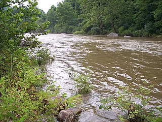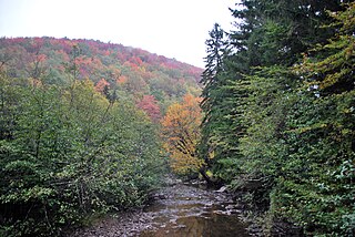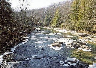
The Monongahela River — often referred to locally as the Mon — is a 130-mile-long (210 km) river on the Allegheny Plateau in north-central West Virginia and southwestern Pennsylvania. The river flows from the confluence of its west and east forks in north central West Virginia northeasterly into southwestern Pennsylvania, then northerly to Pittsburgh and its confluence with the Allegheny River to form the Ohio River. The river is navigable its entire length via a series of locks and dams.

The Greenbrier River is a tributary of the New River, 162 miles (261 km) long, in southeastern West Virginia, in the United States. Via the New, Kanawha and Ohio rivers, it is part of the watershed of the Mississippi River, draining an area of 1,656 square miles (4,290 km2). It is one of the longest rivers in West Virginia.

The Elk River is a tributary of the Kanawha River, 172 miles (277 km) long, in central West Virginia in the United States. Via the Kanawha and Ohio rivers, it is part of the watershed of the Mississippi River.

The Hughes River is a tributary of the Little Kanawha River in western West Virginia in the United States. Via the Little Kanawha and Ohio Rivers, it is part of the watershed of the Mississippi River. As measured from the confluence of its north and south forks, the Hughes is 18 mi (29 km) long, and drains a rural area of the unglaciated portion of the Allegheny Plateau.

The West Fork River is a principal tributary of the Monongahela River, 103 miles (166 km) long, in north-central West Virginia in the United States. Via the Monongahela and Ohio Rivers, it is part of the watershed of the Mississippi River, draining an area of 881 square miles (2,284 km²) on the unglaciated portion of the Allegheny Plateau.

The Tygart Valley River — also known as the Tygart River — is a principal tributary of the Monongahela River, approximately 135 miles (217 km) long, in east-central West Virginia in the United States. Via the Monongahela and Ohio rivers, it is part of the watershed of the Mississippi River, draining an area of 1,329 square miles (3,440 km2) in the Allegheny Mountains and the unglaciated portion of the Allegheny Plateau.

The Black Fork is a principal tributary of the Cheat River in the Allegheny Mountains of eastern West Virginia, USA. It is a short stream, about four miles (6 km) in length, formed by the confluence of two other streams not far above its mouth. It was traditionally considered one of the five Forks of Cheat.

The Blackwater River is a 34.3-mile-long (55.2 km) river in the Allegheny Mountains of eastern West Virginia, USA. Via the Black Fork, it is a principal tributary of the Cheat River. Via the Cheat, the Monongahela and the Ohio rivers, it is part of the watershed of the Mississippi River and drains an area of 142 square miles (370 km2). It is a true blackwater stream, owing to spruce and hemlock trees in its watershed, the tannins of which impart a tea or amber color to its water.

Shavers Fork of the Cheat River is situated in the Allegheny Mountains of eastern West Virginia, USA. It is 88.5 mi (142.5 km) long and forms the Cheat at its confluence with Black Fork at Parsons. It was traditionally considered one of the five Forks of Cheat and its upper reaches constitute the highest river in the eastern United States.

The Dry Fork is a 39.1-mile-long (62.9 km) tributary of the Black Fork of the Cheat River in the Allegheny Mountains of eastern West Virginia, USA. Via the Black Fork, the Cheat, and the Monongahela and Ohio rivers, it is part of the watershed of the Mississippi River. The Dry Fork flows for much of its length in the Monongahela National Forest and drains mostly rural and forested areas. It was traditionally considered one of the five Forks of Cheat.

The Cherry River is a tributary of the Gauley River in southeastern West Virginia in the United States. Via the Gauley, Kanawha and Ohio rivers, it is part of the watershed of the Mississippi River. The Cherry River drains mostly rural and forested areas and flows for much of its length through the Monongahela National Forest. Throughout its entire length the Cherry goes over a series of whitewater rapids in a mountainous setting.

The Cranberry River is a tributary of the Gauley River located in southeastern West Virginia in the United States. It is a part of the Mississippi River watershed, by way of the Gauley, Kanawha, and Ohio Rivers, draining an area of 74 square miles (192 km2).

Glady Fork is a 31.9-mile-long (51.3 km) river in the Allegheny Mountains of eastern West Virginia, USA. It is considered one of the five principal headwaters tributaries of the Cheat River — known as the Forks of Cheat.

Laurel Fork is a 37.8-mile-long (60.8 km) river in eastern West Virginia, USA. It is a tributary of the Dry Fork; via the Dry Fork, the Black Fork, and the Cheat, Monongahela and Ohio rivers, it is part of the watershed of the Mississippi River, draining an area of 60 square miles (160 km2) in the Allegheny Mountains. With the Dry Fork, the Glady Fork, the Shavers Fork and the Blackwater River, it is considered to be one of the five principal headwaters tributaries of the Cheat River.

The Middle Fork River is a 35.4-mile-long (57.0 km) tributary of the Tygart Valley River in north-central West Virginia, USA. Via the Tygart Valley, Monongahela and Ohio rivers, it is part of the watershed of the Mississippi River, draining an area of 152 square miles (390 km2) on the easternmost part of the unglaciated portion of the Allegheny Plateau. According to the Geographic Names Information System, the Middle Fork River has also been known simply as "Middle Fork" and as "Middlefork."

Wheeling Creek is a tributary of the Ohio River, 25 miles (40 km) long, in the Northern Panhandle of West Virginia in the United States, with a watershed extending into southwestern Pennsylvania. Via the Ohio River, it is part of the watershed of the Mississippi River, draining an area of approximately 300 square miles (780 km2) on the unglaciated portion of the Allegheny Plateau. It flows into the Ohio River in downtown Wheeling, just downstream of Ohio's Wheeling Creek on the opposite bank. A variant name is Big Wheeling Creek.

The Cranberry Wilderness is a 47,815-acre (19,350 ha) U.S. wilderness area in the Monongahela National Forest of southeast West Virginia, United States. Its name derives from the nearby Cranberry Glades as well as from the Cranberry River and Cranberry Mountain. In addition to being wilderness, it is a designated black bear sanctuary.

Buffalo Creek is a tributary of the Monongahela River, 30.2 miles (48.6 km) long, in northern West Virginia, in the United States. Via the Monongahela and Ohio rivers, it is part of the watershed of the Mississippi River, draining an area of 125 square miles (320 km2) on the unglaciated portion of the Allegheny Plateau. The stream's entire course and drainage basin are in Marion County.


