
County of Bentheim is a district (Landkreis) in Lower Saxony, Germany. It is bounded by the Dutch provinces of Overijssel and Drenthe, the district of Emsland, and the districts of Steinfurt and Borken in North Rhine-Westphalia.

Nordhorn is a town in Lower Saxony, Germany. It is the district seat of Grafschaft Bentheim in Lower Saxony's southwesternmost corner near the border with the Netherlands and the boundary with North Rhine-Westphalia.

Bad Bentheim is a town in the southwestern part of Lower Saxony, Germany, in the district of Grafschaft Bentheim on the borders of North Rhine-Westphalia and the Netherlands roughly 15 km south of Nordhorn and 20 km northeast of Enschede. It is also a state-recognized thermal brine and sulphur spa town, hence the designation Bad (“Bath”). Also to be found in Bad Bentheim is the castle Burg Bentheim, the town's emblem.

The County of Bentheim was a state of the Holy Roman Empire, located in the south-west corner of today's Lower Saxony, Germany. The county's borders corresponded largely to those of the modern administrative district (Landkreis) of Grafschaft Bentheim.

Emlichheim is a municipality in the district of Grafschaft Bentheim in Lower Saxony, Germany, roughly 20 km south of Emmen, and 25 km northwest of Nordhorn.

Neuenhaus is a town in the district of Grafschaft Bentheim in Lower Saxony, and is the seat of a like-named collective municipality Neuenhaus. Neuenhaus lies on the rivers Dinkel and Vechte near the border with the Netherlands and is roughly 10 km northwest of Nordhorn, and 30 km north of Enschede.

Schüttorf is a town in the district of Grafschaft Bentheim in southwesternmost Lower Saxony near the Dutch border and the boundary with Westphalia. The town of Schüttorf forms with the surrounding communities the Joint Community (Samtgemeinde) of Schüttorf. It is the district's oldest town. It lies on the river Vechte, roughly 5 km east of Bad Bentheim, and 20 km southeast of Nordhorn.

Uelsen is a community in the district of Grafschaft Bentheim in Lower Saxony.

Wietmarschen is a unitary community (Einheitsgemeinde) in the county of Grafschaft Bentheim in Lower Saxony, Germany. It is split into the villages of Wietmarschen, Füchtenfeld, Schwartenpohl, Lohnerbruch, Nordlohne and Lohne with Lohne being the biggest and having the town hall while Wietmarschen, which is the second biggest, having the name.

Esche is a community in the district of Grafschaft Bentheim in Lower Saxony.
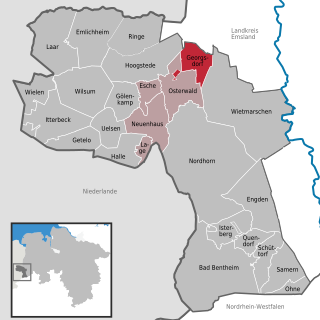
Georgsdorf is a community in the district of Grafschaft Bentheim in Lower Saxony.
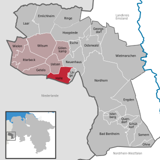
Halle is a village in the Joint Community (Samtgemeinde) of Uelsen, in the district of Grafschaft Bentheim in Lower Saxony.
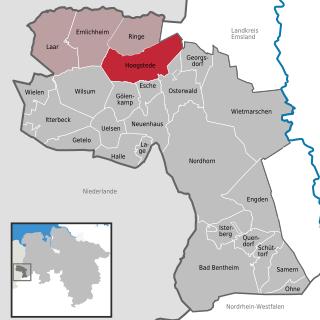
Hoogstede is a community in the district of Grafschaft Bentheim in Lower Saxony.
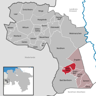
The community of Isterberg in Lower Saxony’s district of Grafschaft Bentheim came into being in the 1970s through the amalgamation of the two former communities of Wengsel and Neerlage. It lies between Bad Bentheim and Nordhorn and belongs to the Joint Community (Samtgemeinde) of Schüttorf, whose administrative seat is in the like-named town.
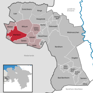
Itterbeck in the district of Grafschaft Bentheim in Lower Saxony is an old farming community that has developed into an independent community with almost 1,800 inhabitants (2005). Itterbeck belongs to the Joint Community (Samtgemeinde) of Uelsen, whose administrative seat is in the like-named community.

Laar is a community in the district of Grafschaft Bentheim in Lower Saxony. The community’s name comes from the Old Dutch for “glade in the woods”.
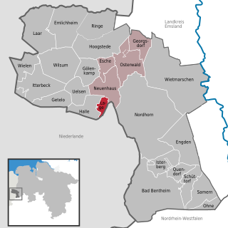
Lage is a community on the river Dinkel in the district of Grafschaft Bentheim in Lower Saxony with roughly 1,000 inhabitants. It belongs to the Joint Community (Samtgemeinde) of Neuenhaus.

Ohne is a community in the district of Grafschaft Bentheim in Lower Saxony, Germany.
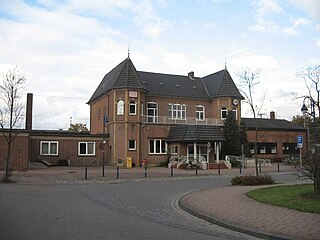
Bad Bentheim is a railway station located in Bad Bentheim, Germany. The station was opened on 18 October 1865 and is located on the Almelo - Salzbergen railway. The train services are operated by Deutsche Bahn with NS International and the WestfalenBahn.


