Steinfurt is a city in North Rhine-Westphalia, Germany. It is the capital of the district of Steinfurt.

Heidesheim am Rhein is a former Ortsbezirk – a municipality belonging to a Verbandsgemeinde, a kind of collective municipality – in the Mainz-Bingen district in Rhineland-Palatinate, Germany. Since July 2019, it is part of the town Ingelheim am Rhein. It was the administrative seat of the former Verbandsgemeinde of Heidesheim am Rhein, which also included the Ortsgemeinde of Wackernheim. Heidesheim was one of the biggest municipalities in Rhenish Hesse.

The River Eden is a tributary of the River Medway in south east England. It rises at the foot of the North Downs escarpment near Titsey in Surrey and runs initially southwards through Oxted before turning eastwards to enter Kent. After flowing through Edenbridge and passing Hever Castle, the Eden meets the Medway at Penshurst.

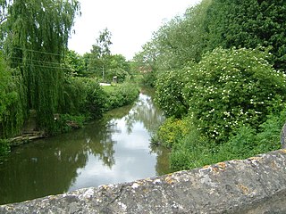
The Darent is a Kentish tributary of the River Thames and takes the waters of the River Cray as a tributary in the tidal portion of the Darent near Crayford, as illustrated by the adjacent photograph, snapped at high tide. 'Darenth' is frequently found in the spelling of the river's name in older books and maps, Bartholomew's "Canal's and River of England" being one example. Bartholomew's Gazetteer (1954) demonstrates that Darent means "clear water" and separately explains the other name. Considering the River Darent runs on a bed of chalk and its springs rise through chalk, this is not surprising. The original purity of the water was a major reason for the development of paper and pharmaceuticals in the area.

Nordhorn is a town in Lower Saxony, Germany. It is the district seat of Grafschaft Bentheim in Lower Saxony's southwesternmost corner near the border with the Netherlands and the boundary with North Rhine-Westphalia.

Philipsburg Manor House is a historic house in the Upper Mills section of the former sprawling Colonial-era estate known as Philipsburg Manor. Together with a water mill and trading site the house is operated as a non-profit museum by Historic Hudson Valley. It is located on US 9 in the village of Sleepy Hollow, New York.

Neuenhaus is a town in the district of Grafschaft Bentheim in Lower Saxony, and is the seat of a like-named collective municipality Neuenhaus. Neuenhaus lies on the rivers Dinkel and Vechte near the border with the Netherlands and is roughly 10 km northwest of Nordhorn, and 30 km north of Enschede.

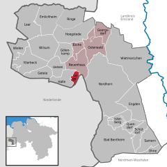
Uelsen is a community in the district of Grafschaft Bentheim in Lower Saxony.

Heeswijk Castle is a moated castle near Heeswijk in the Dutch province of North Brabant.

The house of Limburg Stirum, which adopted its name in the 12th century from the immediate county of Limburg an der Lenne in what is now Germany, is one of the oldest families in Europe. It is the eldest and only surviving branch of the House of Berg, which was among the most powerful dynasties in the region of the lower Rhine during the Middle Ages. Some historians link them to an even older dynasty, the Ezzonen, going back to the 9th century.

The River Len is a river in Kent, England. It rises at a spring in Bluebell Woods to the southeast of the village centre of Lenham 0.6 miles (0.97 km) from the source of the River Great Stour; both rise on the Greensand Ridge. Its length is c10 miles (16 km). It enters the River Medway at Maidstone.
The River Beult is a tributary of the River Medway in South East England.
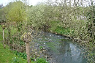
The Bybrook, also known as the By Brook, is a small river in England. It is a tributary of the Bristol Avon and is some 12 miles (19 km) long. Its sources are the Burton Brook and the Broadmead Brook, which rise in South Gloucestershire at Tormarton and Cold Ashton respectively, and join just north of Castle Combe in Wiltshire. The river has a mean flow rate of 57.25 cubic feet per second (1.621 m3/s) as recorded at Middlehill near Box. A variety of flora and fauna is supported by the river including the endangered white-clawed crayfish. Twenty watermill sites have been identified on the river but none now remain in use.
The Medway and its tributaries and sub-tributaries have been used for over 1,150 years as a source of power. There are over two hundred sites where the use of water power is known. These uses included corn milling, fulling, paper making, iron smelting, pumping water, making gunpowder, vegetable oil extraction, and electricity generation. Today, there is just one watermill working for trade. Those that remain have mostly been converted. Such conversions include a garage, dwellings, restaurants, museums and a wedding venue. Some watermills are mere derelict shells, lower walls or lesser remains. Of the majority, there is nothing to be seen. A large number of tributaries feed into the River Medway. The tributaries that powered watermills will be described in the order that they feed in. The mills are described in oder from source to mouth. Left bank and right bank are referred to as though the reader is facing downstream. This article covers the tributaries that feed in above Penshurst.
The River Medway and its tributaries and sub-tributaries have been used for more than 1,150 years as a source of power. There are over two hundred sites where the use of water power is known. Many different processes were performed by the use of water power:- corn milling, fulling, paper making, iron smelting, pumping water, making gunpowder, vegetable-oil extraction, and electricity generation. Today, there is just one watermill working for trade. Those that remain have mostly been converted. Such conversions include a garage, dwellings, restaurants, museums and a wedding venue. Some watermills are mere derelict shells, lower walls or lesser remains. Of the majority, there is nothing to be seen. A large number of tributaries feed into the River Medway. The tributaries that powered watermills will be described in the order that they feed in. The mills are described in order from source to mouth. Left bank and right bank are referred to as though the reader is facing downstream. This article deals with the watermills on the tributaries that feed in below Yalding.

Wilbrand of Oldenburg was a bishop of Paderborn and of Utrecht.

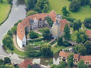
Bentheim Castle is an early medieval hill castle in Bad Bentheim, Lower Saxony, Germany. The castle is first mentioned in the 11th century under the name binithem.