Princetown is a village located within Dartmoor national park in the English county of Devon. It is the principal settlement of the civil parish of Dartmoor Forest.

Carterton is a town in West Oxfordshire district in the county of Oxfordshire, England and is 4 miles (6.4 km) south-west of Witney. The 2011 Census recorded the parish's population as 15,769.

Pickering is a market town and civil parish in North Yorkshire, England, on the border of the North York Moors National Park. Historically part of the North Riding of Yorkshire, it is at the foot of the moors, overlooking the Vale of Pickering to the south.
Belmont is a suburb forming the north-eastern parts of the city of Durham, England. Belmont Parish covers four old coal mining villages of Belmont, Carrville, Broomside and Gilesgate Moor, which have been joined together by industrial and suburban developments since the 1950s. As such Belmont can be used either to refer narrowly to the old village area, or the wider parish, particularly the parts to the east of the A1(M) motorway which bisects the area. At the 2011 census, the parish had a population of 8,881.

Nordhorn is a town in Lower Saxony, Germany. It is the district seat of Grafschaft Bentheim in Lower Saxony's southwesternmost corner near the border with the Netherlands and the boundary with North Rhine-Westphalia.

Cheadle is a market town and civil parish in the Staffordshire Moorlands District of Staffordshire, England, with a population of 12,165 at the 2011 census. It is located between Uttoxeter, Leek, Ashbourne and Stoke-on-Trent.
Bonaly is an area on the south-western outskirts of Edinburgh and the northern slopes of the Pentland Hills, lying within the Parish of Colinton. It is a mix of mainly post-war housing, woodland, pasture-land and heather moorland. Bonaly Burn has its sources in the hills above Bonaly and flows towards Oxgangs, where it becomes the Braid Burn. The Edinburgh City Bypass passes through Bonaly.

Brocton is a village and civil parish in the English county of Staffordshire. It is within the borough of Stafford. The village describes itself as the Gateway to Cannock Chase, an Area of Outstanding Natural Beauty and a Site of Special Scientific Interest.
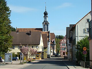
Adelsheim is a small village in northern Baden-Württemberg, about 30 km north of Heilbronn. The state-recognized resort of Adelsheim in the Neckar-Odenwald-Kreis looks back on a 1,200-year heritage.
Ardler is an area in the north-west of Dundee, Scotland, built on land previously owned by Downfield Golf Club. The housing scheme was completed in the late 1960s and originally included six 17-storey multi-storey blocks that formed the northern part of the scheme. These were demolished between 1993 and 2007 as part of a major programme of regeneration due to finish in 2011.

Żelechów(listen) is a town in east Poland in Masovian Voivodeship in Garwolin County. It is the seat of Gmina Żelechów. Żelechów is 85 kilometres from Warsaw and 85 kilometres far from Lublin. More than 4000 people live in the town. It is a local centre, supporting nearby farmers and housing a few high schools.

Bransholme is an area and a housing estate on the north side of Kingston upon Hull, East Riding of Yorkshire, England. The name Bransholme comes from an old Scandinavian word meaning Brand's water meadow.
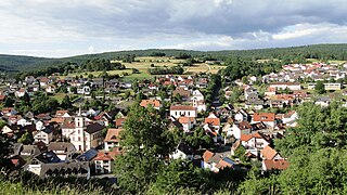
Partenstein is a community in the Main-Spessart district in the Regierungsbezirk of Lower Franconia (Unterfranken) in Bavaria, Germany and the seat of the Verwaltungsgemeinschaft of Partenstein. Partenstein is located on Bundesstraße 276.
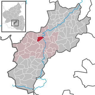
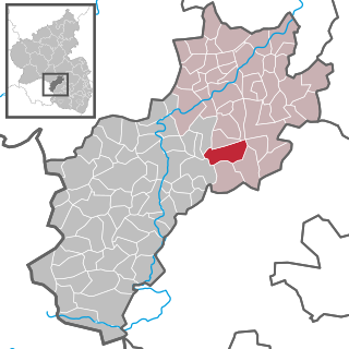
Erdesbach is an Ortsgemeinde – a municipality belonging to a Verbandsgemeinde, a kind of collective municipality – in the Kusel district in Rhineland-Palatinate, Germany. It belongs to the Verbandsgemeinde of Kusel-Altenglan, whose seat is in Kusel.
Eßweiler is an Ortsgemeinde – a municipality belonging to a Verbandsgemeinde, a kind of collective municipality – in the Kusel district in Rhineland-Palatinate, Germany. It belongs to the Verbandsgemeinde Lauterecken-Wolfstein.

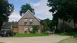
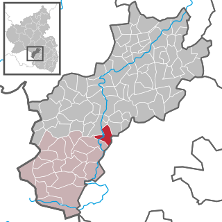
Gries is an Ortsgemeinde – a municipality belonging to a Verbandsgemeinde, a kind of collective municipality – in the Kusel district in Rhineland-Palatinate, Germany. It belongs to the Verbandsgemeinde of Oberes Glantal, whose seat is in Schönenberg-Kübelberg.

Langenbach in the Palatinate is an Ortsgemeinde – a municipality belonging to a Verbandsgemeinde, a kind of collective municipality – in the Kusel district in Rhineland-Palatinate, Germany. It belongs to the Verbandsgemeinde of Oberes Glantal.

Niederalben is an Ortsgemeinde – a municipality belonging to a Verbandsgemeinde, a kind of collective municipality – in the Kusel district in Rhineland-Palatinate, Germany. It belongs to the Verbandsgemeinde of Kusel-Altenglan, whose seat is in Kusel.
Matzenbach is an Ortsgemeinde – a municipality belonging to a Verbandsgemeinde, a kind of collective municipality – in the Kusel district in Rhineland-Palatinate, Germany. It belongs to the Verbandsgemeinde of Oberes Glantal.
The Lake Odessa Area Historical Society and Museum in downtown Lake Odessa, Michigan, is home to a variety of historical items pertaining to the Lake Odessa area including an impressive collection of artifacts from a German POW camp that existed near Lake Odessa area during World War II, a Pere Marquette Railroad Depot built in 1887, a restored Grand Trunk Caboose, various local historical displays, the Ionia County Genealogical Library, and the Hosford House. Operations are determined by a board of directors but the historical society is solely managed by the president, John Waite. The museum is a private, non-profit museum completely self-funded through various events and through philanthropists.