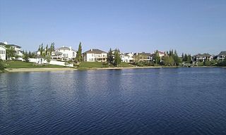
Twin Brooks is a residential neighbourhood in south Edmonton, Alberta, Canada. It is located at the confluence of the Whitemud Creek and the Blackmud Creek, hence the origin of the name Twin Brooks. An artificial lake is situated in the neighbourhood, with George P. Nicholson Elementary School located near it.
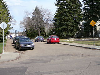
Belgravia is a residential neighbourhood located in Edmonton, Alberta. It is located southwest of the University of Alberta main campus. Named after the Belgravia area of 19th-century London, the neighbourhood was once the southern terminus of the Edmonton Radial Railway. The McKernan/Belgravia LRT Station is located adjacent to the neighbourhood at the northwest corner of 114 Street and 76 Avenue in neighbouring McKernan.
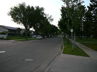
Elmwood is a neighbourhood in west Edmonton, Alberta, Canada that was a part of the Town of Jasper Place prior to Jasper Place's amalgamation with Edmonton in 1964. It is a residential neighbourhood located to the south east of West Edmonton Mall and to the south west of Meadowlark Health and Shopping Centre. Residents also have ready access to the Misericordia Community Hospital located just north of Elmwood in the neighbourhood of West Meadowlark Park.

Garneau is one of the oldest neighbourhoods in the city of Edmonton, Canada. Prior to 1912, it was part of the City of Strathcona. It is named after one of its first inhabitants, Laurent Garneau, a former Manitoba Métis rebel and Hudson's Bay Company employee who with his wife and family settled there around 1874.
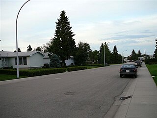
Lynnwood is a residential neighbourhood in west Edmonton, Alberta, Canada. Its location gives residents good access to downtown, the University of Alberta, MacEwan College, and West Edmonton Mall. It became a part of Edmonton when the Town of Jasper Place amalgamated with Edmonton in 1964.

Oliver is one of the oldest residential neighbourhoods in the City of Edmonton, Alberta, Canada. The neighbourhood is named after Frank Oliver, an early Edmonton resident, businessman, and politician. The south east portion of the neighbourhood is also known as Grandin, with both Grandin station (now known as Government Centre station and Grandin School located in this part of the neighbourhood.
Parkallen is a residential neighbourhood in south Edmonton, Alberta, Canada located just to the east of the University of Alberta farm and the Neil Crawford Centre. Most of the neighbourhood development occurred after the end of World War II with eight out of ten residences constructed by 1960 according to the 2005 municipal census.
Lansdowne is a neighbourhood in south west Edmonton, Alberta, Canada overlooking the Whitemud Creek Ravine. The Snow Valley Ski Hill is located near the neighbourhood. The neighbourhood is situated directly across from Michener Park, a residential complex for students staying at the University of Alberta.
Malmo Plains is a residential neighbourhood in south west Edmonton, Alberta, Canada. The University of Alberta family residences, called Michener Park, comprise the west end of the neighbourhood. The neighbourhood is named for a type of soil, malmo silty clay loam, common in the area.
Greenfield, also known as Petrolia, is a residential neighbourhood located in southwest Edmonton, Alberta, Canada. While the official name of the neighbourhood is Greenfield, some residents will refer to the area as Petrolia. There is a small shopping centre, Petrolia Shopping Centre, located in the neighbourhood. The neighbourhood was named for Herbert Greenfield, the Premier of Alberta from 1921 to 1925, during the reign of the United Farmers of Alberta political party.
Parkview is a residential neighbourhood in west Edmonton, Alberta, Canada. Parkview is one of the larger residential neighbourhoods in the city, and is located adjacent to the North Saskatchewan River Valley in the west portion of the City. The neighbourhood has good access to Whitemud Drive and Stony Plain Road, and the interior street layout is based on a modified grid network.
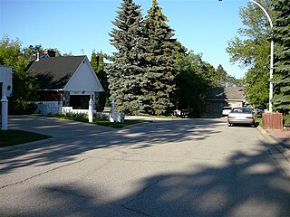
Laurier Heights is a residential neighbourhood in west Edmonton, Alberta, Canada overlooking the North Saskatchewan River valley. A portion of the neighbourhood along Buena Vista Road is located in the river valley, and this portion is sometimes called Buena Vista.
Westmount is an established central-west residential neighbourhood in Edmonton, Alberta, Canada. It is geographically close to the downtown core.
Royal Gardens is a residential neighbourhood in south west Edmonton, Alberta, Canada. The neighbourhood is bounded on the north by Whitemud Drive, on the east by 111 Street, on the south by 40 Avenue, and on the west by 119 Street/121 Street.
Bellevue is a smaller residential neighbourhood located in north east Edmonton, Alberta, Canada. The neighbourhood overlooks the North Saskatchewan River.
Empire Park is a residential neighbourhood in southwest Edmonton, Alberta, Canada. A major shopping centre, Southgate Centre, is located at the west end of the Neighbourhood.
Rideau Park is a residential neighbourhood in southwest Edmonton, Alberta, Canada. The name Rideau means curtain in the French Language.
Quesnell Heights is a neighbourhood in west Edmonton, Alberta, Canada. It is bounded by the Rio Terrace neighbourhood across 149 Street to the west, Whitemud Drive to the north and east, the North Saskatchewan River valley to the south, Quesnell Heights is also the smallest neighbourhood in Edmonton.
Rio Terrace is a neighbourhood in west Edmonton, Alberta, Canada. It is bounded by the Patricia Heights neighbourhood across 156 Street to the west, the Lynnwood neighbourhood across Whitemud Drive to the north, the Quesnell Heights neighbourhood across 149 Street to the east, and the North Saskatchewan River valley to the south.
Patricia Heights is a neighbourhood in west Edmonton, Alberta, Canada. It is bounded by the Patricia Ravine of the North Saskatchewan River valley and ravine system to the south and southwest, the Westridge neighbourhood to the west, the Elmwood and Lynnwood neighbourhoods across Whitemud Drive to the north, and the Rio Terrace neighbourhood across 156 Street to the east.


