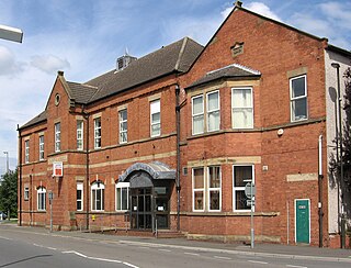
Staveley is a former mining town in the borough of Chesterfield, Derbyshire, England, alongside the River Rother, between Eckington to the north, Barlborough to the east, Sutton cum Duckmanton to the south and Brimington to the west.

Chesterfield is a large market town and unparished area in the Borough of Chesterfield in Derbyshire, England, 24 miles (39 km) north of Derby and 11 miles (18 km) south of Sheffield at the confluence of the River Rother and River Hipper. In 2011 the built-up-area subdivision had a population of 88,483, making it Derbyshire's second largest settlement after Derby. Its borough, including Whittington, Brimington and Staveley, had a population of 103,801 in 2011. In 2011 the unparished area had a population of 76,753. It has been traced to a transitory Roman fort of the 1st century CE. The name of the later Anglo-Saxon village comes from the Old English ceaster and feld (pasture). It has a sizeable street market three days a week. The town sits on an old coalfield, but little visual evidence of mining remains. Its main landmark is the crooked spire of the Church of St Mary and All Saints.

The Chesterfield Canal is a narrow canal in the East Midlands of England and it is known locally as 'Cuckoo Dyke'. It was one of the last of the canals designed by James Brindley, who died while it was being constructed. It was opened in 1777 and ran for 46 miles (74 km) from the River Trent at West Stockwith, Nottinghamshire to Chesterfield, Derbyshire, passing through the Norwood Tunnel at Kiveton Park, at the time one of the longest tunnels on the British canal system. The canal was built to export coal, limestone, and lead from Derbyshire, iron from Chesterfield, and corn, deals, timber, groceries and general merchandise into Derbyshire. The stone for the Palace of Westminster was quarried in North Anston, Rotherham, and transported via the canal.

Chesterfield railway station serves the town of Chesterfield in Derbyshire, England. It lies on the Midland Main Line. Four tracks pass through the station which has three platforms. It is currently operated by East Midlands Railway.
Chesterfield is a constituency represented in the House of Commons of the UK Parliament since 2010 by Toby Perkins of the Labour Party.

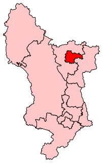
North East Derbyshire is a constituency created in 1885 represented in the House of Commons of the UK Parliament since 2017 by Lee Rowley of the Conservative Party. This was the first time a Conservative candidate had been elected since 1935.

Brimington is a civil parish within the Chesterfield Borough in north-east Derbyshire, England. The population of the civil parish including Hollingwood taken at the 2011 census was 8,788. The town of Staveley is to the east, and Hollingwood is nearby. The parish includes Brimington Common along the Calow Road, and New Brimington, a late 19th-century extension towards the Staveley Iron Works.
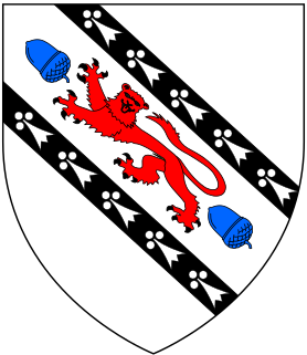
Sir Francis Rodes of Barlborough Hall in the parish of Barlborough, Derbyshire, was an English judge who took part in the trial of Mary, Queen of Scots. He built Barlborough Hall and was one of the founders of Netherthorpe School.

The Adelphi Canal was a small privately owned canal in Duckmanton, near Chesterfield, England, built in 1799. It was used to transport pig iron from an ironworks to a wharf by a road. It is not connected to any waterway. The iron was forwarded by road to the Chesterfield Canal.

Shuttlewood is a village situated about 2 miles north of Bolsover, in Bolsover District, Derbyshire, England. It is centred on the crossroads of two main roads; Bolsover-Mastin Moor and Clowne-Chesterfield.

Staveley Central is was a railway station serving the town of Staveley, Derbyshire, England.
Whittington railway station is a former railway station on the southern edge of New Whittington, Derbyshire, England.

Barrow Hill railway station is a former railway station in the village of Barrow Hill in northern Derbyshire, England.

Staveley Town is a disused railway station in Staveley near Chesterfield, Derbyshire, England.
The Clowne Branch is a disused railway line in north eastern Derbyshire, England. Which runs from Creswell to Staveley. Historically it ran to Chesterfield. It is now in use as a greenway.

St Peter and St Paul's Church, Old Brampton is a Grade I listed parish church in the Church of England in Brampton, Derbyshire.

New Whittington is a village located in Chesterfield, Derbyshire, England, near to Whittington Moor and Old Whittington. It is also to the west of Barrow Hill and Staveley. In 2001 it had a population of 3,919.
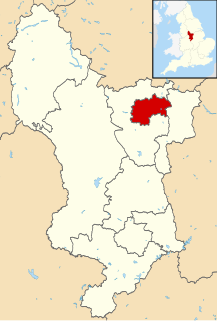
The Borough of Chesterfield is a local government borough in Derbyshire, England. It is named after its larger settlement of Chesterfield.
