
Roma Street railway station is a commuter and long-distance passenger train station located in the central business district of Brisbane, Queensland, Australia. It is the junction station for the North Coast, Main, Gold Coast and NSW North Coast lines. The station is one of four inner city stations that form a core corridor through the centre of Brisbane.

Bowen Hills railway station is located on the North Coast line in Queensland, Australia. It serves the Brisbane suburb of Bowen Hills. North of the station, the Ferny Grove line branches off. The station is one of four inner city stations that form a core corridor through the centre of Brisbane.

The Ipswich and Rosewood line refers to the section of the Main Line to Toowoomba that has a regular suburban rail service, extending southwest from the Brisbane central business district. It is part of the Queensland Rail City network.

South Bank railway station is located on the Gold Coast line in Brisbane, Queensland, Australia. It is one of two stations serving the South Brisbane area, the other being South Brisbane station. It was formerly known as Vulture Street station due to being located on Vulture Street.

Boggo Road / Park Road railway station, formerly Park Road railway station, is the junction station for the Cleveland and Gold Coast lines in Queensland, Australia. It is located in the Brisbane suburb of Dutton Park.

Buranda railway station is located on the Cleveland line in Queensland, Australia. It is one of two stations serving the Brisbane suburb of Woolloongabba, the other being Park Road.

The Beenleigh railway line is a suburban railway line extending 40.1 km from Boggo Road / Park Road to Beenleigh. It is part of the Queensland Rail Citytrain network.

Dutton Park railway station is located on the Beenleigh line in Queensland, Australia. It serves the Brisbane suburb of Dutton Park. The station is one of the oldest on the network.

Fairfield railway station is located on the Beenleigh line in Queensland, Australia. It serves the Brisbane suburb of Fairfield.

Yeronga railway station is located on the Beenleigh line in Queensland, Australia. It serves the Brisbane suburb of Yeronga.

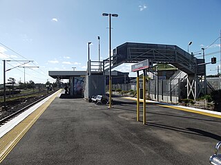
Corinda railway station is located on the Main line in Queensland, Australia. It serves the Brisbane suburb of Corinda.
Moorooka railway station is located on the Beenleigh line in Queensland, Australia. It serves the Brisbane suburb of Moorooka. The station opened in 1887.

Rocklea railway station is located on the Beenleigh line in Queensland, Australia. It serves the Brisbane suburb of Rocklea. The station opened in 1885 at the same time as the line.

Salisbury railway station is located on the Beenleigh Line in Queensland, Australia. It serves the Brisbane suburb of Salisbury. The station opened in 1885 at the same time as the line.

Kuraby railway station is located on the Beenleigh line in Queensland, Australia. It serves the Brisbane suburb of Kuraby. Kuraby is the final station on the Beenleigh Line in the City of Brisbane, with the next station, Trinder Park, located in Logan City.

Loganlea railway station is located on the Beenleigh line in Queensland, Australia. It serves the suburbs of Loganlea and Meadowbrook in Logan City. It is within a short distance of Logan Hospital, TAFE college, Griffith University, Loganlea State High School and Meadowbrook Shopping Centre.

Beenleigh railway station is located on the Beenleigh line in Queensland, Australia. It is one of two stations serving the suburb of Beenleigh in City of Logan, the other being Holmview.
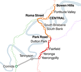
The Corinda–Yeerongpilly line is a railway line in Brisbane, the state capital of Queensland, Australia. It connects the Beenleigh and Ipswich lines for freight trains, but is no longer used for revenue passenger services in normal operation.

Railways in South East Queensland consist of a large passenger and freight rail network centred on Brisbane, the capital city of the Australian state of Queensland. Suburban and interurban passenger rail services are operated by Queensland Rail, which also operates long-distance services connecting Brisbane to the rest of the state. Aurizon and Pacific National are private companies which operate freight services. The passenger rail network in South East Queensland is known as the Citytrain network.
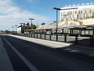
Boggo Road busway station is located in Brisbane, Australia serving the suburb of Dutton Park. It opened on 3 August 2009, as part of the Eastern Busway from UQ Lakes to Buranda.

