Zane's Tracts

Last updated
Zane's Trace in shown in southern Ohio. Zane's Trace.png
Zane's Trace in shown in southern Ohio.

Zane's Tracts were three parcels of land in the Northwest Territory of the United States, later Ohio, that the federal government granted to Ebenezer Zane late in the 18th century, as compensation for establishing a road with ferry service over several rivers.

Contents

History

Ebenezer Zane was born in the east in 1747. He traveled west in 1767, taking the Cumberland Trail to Brownsville, Pennsylvania. [1] In 1770, Zane and two brothers settled along Wheeling Creek along the Ohio River in Virginia, founding Wheeling, Virginia, later West Virginia. Zane and his brother Jonathan Zane gained considerable knowledge of the lands across the Ohio River, in what is now Ohio. [1] [2]

The late 1780s and early 1790s was a time of considerable bloodshed along the frontier during the Northwest Indian War, which formally ended with the 1795 Treaty of Greenville. With peace, settlement would accelerate. In March, 1796, Ebenezer Zane presented a petition to Congress to establish a road, (trace), between Wheeling and Limestone, Kentucky, (today Maysville). As compensation, Zane asked for a grant of land at three river crossings, where he would establish ferry service. A committee recommended action, and vouched for Zane's competence and character, and the general utility of the road. [1] [2]

Congressional Action

The congress approved the Act of May 17, 1796, [3] which said “…there shall be granted to Ebenezer Zane three tracts of land, not exceeding one mile square each, one on the Muskingum River, one on the Hockhocking river, and one on the north bank of the Sciota river, and in such situations as shall best promote the utility of a road to be opened by him on the most eligible route between Wheeling and Limestone…”, provided that Zane pay for his own surveys, and return plats to the Treasury department with military land bounty warrants for the surveyed number of acres. He also was required to have a road opened by Jan 1, 1797, and have ferries established at the river crossings, with rates approved by judges of the Northwest Territory.

Trace Established

The work of building the trace began in summer 1796, with Jonathan Zane, John McIntire (Ebenezer Zane's son-in-law) and a number of others doing the work. They followed Indian trails where possible, and previously established trails west of the Scioto river. They did not finish until some months after the January 1, 1797 agreement, in the summer of 1797, [1] but president Adams issued patents for the three tracts along the rivers anyway in 1800. [2] The surveys for the tracts Zane acquired were completed as indiscriminate surveys before the surrounding lands were surveyed, and so do not correspond to sections or township lines in the later surveys.

Surveys

Ebenezer Zane's Surveys
Muskingum RiverHocking RiverScioto River
Zane Survey on Muskingum River.png Zane Hocking River Survey.png Zane Scioto River Survey.png

Survey on Muskingum

The tract Zane chose for a ferry on the Muskingum River was at the confluence with the Licking river, where he laid out the town of Zanesville, Ohio in 1799. [2] The survey was directed by Rufus Putnam in 1797. [1] Zane gave this tract to his brother Jonathan, and son-in-law McIntire, with the deed finally signed in December 1800, for their services in laying out the road. They, in turn, leased it to William McCullough, (a relative), and Henry Crooks for five years, provided they operated the ferry. McCullough and Crooks became the first residents of Zanesville in fall 1797. [1] The tract lies partially in what would be the United States Military District, in township 1 range 7 (T1 R7), and T1 R8 and partially in the Congress Lands East of Scioto River in T12 R13 and T16 R14. 39°56′26″N82°00′51″W / 39.94056°N 82.01417°W / 39.94056; -82.01417 (Zane’s Survey on Muskingum) [4]

Survey on Hocking

The town of Lancaster, Ohio was laid out in 1800, [2] or 1799, [1] at the site of the Hocking river ferry, by Ebenezer's sons, John and Noah Zane. These two had power of attorney to sell lots for Ebenezer Zane, and he never visited Lancaster. [1] The tract lies in T14 R18 and T14 R19 of the Congress Lands East of Scioto River. 39°42′30″N82°36′14″W / 39.70833°N 82.60389°W / 39.70833; -82.60389 (Zane’s Survey on Hocking)

Survey on Scioto

Ebenezer Zane chose a site across from Chillicothe, Ohio, and about a half mile north of the town. [2] The survey lies in T8 R21 and T1 R22 of the Congress Lands East of Scioto River 39°20′53″N82°58′14″W / 39.34806°N 82.97056°W / 39.34806; -82.97056 (Zane’s Survey on Scioto)

Isaac Zane Tracts

Ebenezer Zane's youngest brother was called Isaac Zane. He was taken captive by Indians at age nine, and taken to Detroit. He grew up there, and, as an adult, acted as an intermediary between the United States and the Indians. By act of April 3, 1802, [5] Congress granted Isaac Zane three sections of land for his services, two of those sections reserved for his heirs at the time of his death. [6] [7] On August 28, 1806, patents were issued for section 15, T5, R12 in the Between the Miami Rivers Survey in fee, in Salem Township Champaign County, and in trust for the benefit of heirs at the time of his death for section 14, T5, R12 in the same township and section 2 T4 R12 in Concord Township, Champaign county. [6] [7]

See also

Notes

  1. 1 2 3 4 5 6 7 8 Martzloff, p. 297-331.
  2. 1 2 3 4 5 6 Peters, p. 184-193.
  3. 6  Stat.   27 - Text of Act of May 17, 1796 Library of Congress
  4. coordinates determined from USGS topographic maps at terraserver
  5. 6  Stat.   46 - Text of Act of April 3, 1802 Library of Congress
  6. 1 2 Knepper, p. 52-53.
  7. 1 2 Peters, p. 336-339.

Related Research Articles

<span class="mw-page-title-main">Lancaster, Ohio</span> City in Ohio, United States

Lancaster is a city in and the county seat of Fairfield County, Ohio, in the south-central part of the state. As of the 2020 census, the city population was 40,552. The city is near the Hocking River, about 33 miles (53 km) southeast of Columbus and 38 miles (61 km) southwest of Zanesville. It is part of the Columbus metropolitan area.

<span class="mw-page-title-main">Zanesfield, Ohio</span> Village in Ohio, United States

Zanesfield is a village in Logan County, Ohio, United States of America. The population was 194 at the 2020 census. It is the smallest incorporated village in Logan County.
<span class="mw-page-title-main">Northwest Territory</span> United States territory (1787–1803)

The Northwest Territory, also known as the Old Northwest and formally known as the Territory Northwest of the River Ohio, was formed from unorganized western territory of the United States after the American Revolution. Established in 1787 by the Congress of the Confederation through the Northwest Ordinance, it was the nation's first post-colonial organized incorporated territory.
<span class="mw-page-title-main">Ohio Company of Associates</span> 18th-century land company in Ohio

The Ohio Company of Associates, also known as the Ohio Company, was a land company whose members are today credited with becoming the first non-Native American group to permanently settle west of the Allegheny mountains. In 1788 they established Marietta, Ohio, as the first permanent settlement of the new United States in the newly organized Northwest Territory.

<span class="mw-page-title-main">Ohio Lands</span> Divisions of land made during the European settlement of Ohio, United States

The Ohio Lands were the several grants, tracts, districts and cessions which make up what is now the U.S. state of Ohio. The Ohio Country was one of the first settled parts of the Midwest, and indeed one of the first settled parts of the United States beyond the original Thirteen Colonies. The land that became first the anchor of the Northwest Territory and later Ohio was cobbled together from a variety of sources and owners.

<span class="mw-page-title-main">Ebenezer Zane</span> American politician

Ebenezer Zane was an American pioneer, soldier, politician, road builder and land speculator. Born in the Colony of Virginia, Zane established a settlement near Fort Henry which became Wheeling, on the Ohio River. He also blazed an early road through the Ohio Country to Limestone known as Zane's Trace.

<span class="mw-page-title-main">Zane's Trace</span> Frontier road in the Northwestern Territory of the U.S.

Zane's Trace is a frontier road constructed under the direction of Col. Ebenezer Zane through the Northwest Territory of the United States, in what is now the state of Ohio. Many portions were based on traditional Native American trails. Constructed during 1796 and 1797, the road ran from Wheeling, Virginia to Maysville, Kentucky, through the portion of the Northwest Territory that eventually became the southeastern quarter of the state of Ohio. It was more than 230 miles (370 km) long and was interrupted by several rivers.

The Refugee Tract is an area of land in Ohio, United States granted to people from British Canada who left home prior to July 4, 1776, stayed in the US until November 25, 1783 continuously, and aided the revolutionary cause.

<span class="mw-page-title-main">Seven Ranges</span> Land tract in eastern Ohio, US

The Seven Ranges was a land tract in eastern Ohio that was the first tract to be surveyed in what became the Public Land Survey System. The tract is 42 miles (68 km) across the northern edge, 91 miles (146 km) on the western edge, with the south and east sides along the Ohio River. It consists of all of Monroe, Harrison, Belmont and Jefferson, and portions of Carroll, Columbiana, Tuscarawas, Guernsey, Noble, and Washington County.

<span class="mw-page-title-main">Congress Lands</span>

The Congress Lands was a group of land tracts in Ohio that made land available for sale to members of the general public through land offices in various cities, and through the United States General Land Office. It consisted of three groups of surveys:
<span class="mw-page-title-main">United States Military District</span>

The United States Military District was a land tract in central Ohio that was established by the Congress to compensate veterans of the American Revolutionary War for their service. The tract contains 2,539,110 acres (10,275.4 km2) in Noble, Guernsey, Tuscarawas, Muskingum, Coshocton, Holmes, Licking, Knox, Franklin, Delaware, Morrow, and Marion counties.
<span class="mw-page-title-main">Donation Tract</span>

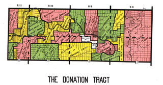
The Donation Tract was a land tract in southern Ohio that was established by the Congress in the late 18th century to buffer Ohio Company lands against local indigenous people. Congress gave 100-acre (0.40 km2) lots to men who settled on the land. This marked the first time that federal land was given without charge to specified settlers, predating the more famous Homestead Act of 1862 by seventy years.

<span class="mw-page-title-main">Congress Lands North of Old Seven Ranges</span>

The Congress Lands North of the Old Seven Ranges was a land tract in northeast Ohio that was established by the Congress early in the 19th century. It is located south of the Connecticut Western Reserve and Firelands, east of the Congress Lands South and East of the First Principal Meridian, north of the United States Military District and Seven Ranges, and west of Pennsylvania.

<span class="mw-page-title-main">Congress Lands West of Miami River</span>

The Congress Lands West of Miami River was a land tract in southwest Ohio that was established by the Congress late in the 18th century. It is located south of the Greenville Treaty Line, east of Indiana, and north of the Great Miami River. The original survey in 1798 contained a triangular shaped slice of land, now located in Indiana, that extended to the Greenville line as it ran from Fort Recovery to opposite the mouth of the Kentucky River.

<span class="mw-page-title-main">Congress Lands East of Scioto River</span>

The Congress Lands East of Scioto River was a land tract in southern Ohio that was established by the Congress late in the 18th century. It is located south of the United States Military District and Refugee Tract, west of the Old Seven Ranges, east of the Virginia Military District and north of the Ohio River, French Grant, and the Ohio Company of Associates.

<span class="mw-page-title-main">Salt Reservations</span> Collection of land tracts in the Midwest of the USA

The Salt Reservations were a collection of land tracts surrounding salt springs in Ohio and some other states that were donated to the states by the federal government early in the 19th century.

<span class="mw-page-title-main">Twelve Mile Square Reservation</span> Area of Ohio, United States

The Twelve Mile Square Reservation, also called the Twelve Mile Square Reserve, was a tract of land in Ohio ceded by Indians to the United States of America in the Treaty of Greenville in 1795. This particular area of land immediately surrounding Fort Miami was considered to be of strategic importance by the United States government representatives. It was subsequently surveyed in a manner different from surrounding land, and lots sold, or granted, to settlers.

<span class="mw-page-title-main">Purchase on the Muskingum</span>

The Purchase on the Muskingum also called Ohio Company's Second Purchase, was a tract of land in the Northwest Territory, later Ohio, that the Ohio Company of Associates purchased from the United States federal government in 1792.

<span class="mw-page-title-main">College Lands</span>

The College Lands were a tract of land in the Northwest Territory, later Ohio, that the Congress donated for the support of a university. Ohio University became the first college northwest of the Ohio River as a beneficiary of this tract.

Israel Ludlow was a government surveyor who helped found Cincinnati, Dayton and Hamilton in southwest Ohio.

References