Black River, New York

Last updated

Black River, New York
USA New York location map.svg
Red pog.svg
Black River
Usa edcp location map.svg
Red pog.svg
Black River
Coordinates: 44°0′42″N75°47′41″W / 44.01167°N 75.79472°W / 44.01167; -75.79472
Country United States
State New York
County Jefferson
Towns Le Ray, Rutland
Area
[1]
  Total1.89 sq mi (4.88 km2)
  Land1.78 sq mi (4.61 km2)
  Water0.10 sq mi (0.27 km2)
Elevation
571 ft (174 m)
Population
 (2020)
  Total1,232
  Density691.75/sq mi (267.03/km2)
Time zone UTC-5 (Eastern (EST))
  Summer (DST) UTC-4 (EDT)
ZIP code
13612
Area code 315
FIPS code 36-06794
GNIS feature ID0944178
Website www.blackriverny.org

Black River is a village in Jefferson County, New York, United States. The population was 1,348 at the 2010 census. [2] The village is on the border of the towns of Le Ray and Rutland, east of Watertown.

Contents

History

The area was first settled around 1806 by the erection of a mill on the south side of the Black River. The village was previously called "Lockport", and grew to include both sides of the river as well as two small river islands.

On February 20, 1890, a large fire destroyed the business section of the downtown. Buildings destroyed by the fire included the Poor Block (which included a three-story building with an opera house on the third floor); the D.J. Scott and Son Block; the Arthur House (a hotel); Parkinson's Store (the old 1881 post office); Whipple and Hadsell's Store; F.H. Dillenbeck's Tinshop and Hardware Store; A.W. McDowell's Store; George Graham's barber shop; the I.O.O.F. Hall and two residential dwellings. The Kennedy Stone house was badly burned, but was later restored. Having no fire department at the time, the residents of Black River immediately made plans to organize a fire department later that year. Black River Fire Company No. 1 was organized September 4, 1890, and incorporated on January 3, 1891. The department was re-incorporated as the Black River Fire Department on February 21, 1940. This department still provides fire protection for the village, and is one of the oldest continually operating fire departments in Jefferson County. [3]

The community incorporated as a village in 1891, taking land in the towns of Rutland and Le Ray.

The LeRay Mansion was listed on the National Register of Historic Places in 1974. [4]

Geography

The village of Black River is located in east-central Jefferson County at 44°0′42″N75°47′41″W / 44.01167°N 75.79472°W / 44.01167; -75.79472 (44.011567, -75.794773). [5] According to the United States Census Bureau, it has a total area of 1.85 square miles (4.78 km2), of which 1.79 square miles (4.64 km2) are land and 0.054 square miles (0.14 km2), or 2.88%, are water. [2]

The Black River flows through the center of the village and forms the border between the towns of Le Ray and Rutland.

New York State Route 3 (Rutland Street) passes through the south side of the village and intersects New York State Route 342 west of the village. NY-3 leads west 6 miles (10 km) (downriver) to the center of Watertown and east 12 miles (19 km) (upriver) to Carthage. NY 342 leads northwest 7 miles (11 km) to Interstate 81 north of Watertown.

Climate

Climate data for Black river, New York (Precipitation only 2011-2022)
MonthJanFebMarAprMayJunJulAugSepOctNovDecYear
Average precipitation inches (mm)3.52
(89)
3.29
(84)
2.49
(63)
3.86
(98)
3.95
(100)
4.14
(105)
3.16
(80)
4.00
(102)
3.42
(87)
5.33
(135)
4.01
(102)
4.18
(106)
45.35
(1,151)
Average snowfall inches (cm)35.7
(91)
29.7
(75)
8.2
(21)
0.2
(0.51)
0.1
(0.25)
0.0
(0.0)
0.0
(0.0)
0.0
(0.0)
0.0
(0.0)
0.0
(0.0)
4.6
(12)
17.6
(45)
96.1
(244.76)
Average precipitation days (≥ 0.01 Inches)151512151412111212161416164
Average snowy days (≥ 0.1 inches)89400000002528
Source: National Weather Service [6]

Demographics

Historical population
CensusPop.Note
1860 250
1870 181−27.6%
1880 1957.7%
1900 949
1910 916−3.5%
1920 9372.3%
1930 928−1.0%
1940 897−3.3%
1950 1,06218.4%
1960 1,23716.5%
1970 1,3075.7%
1980 1,3845.9%
1990 1,349−2.5%
2000 1,285−4.7%
2010 1,3484.9%
2020 1,232−8.6%
U.S. Decennial Census [7]

As of the census [8] of 2000, there were 1,285 people, 521 households, and 373 families residing in the village. The population density was 709.8 inhabitants per square mile (274.1/km2). There were 556 housing units at an average density of 307.1 per square mile (118.6/km2). The racial makeup of the village was 91.98% White, 2.65% African American, 0.47% Native American, 2.72% Asian, 0.54% from other races, and 1.63% from two or more races. Hispanic or Latino of any race were 1.32% of the population.

There were 521 households, out of which 32.2% had children under the age of 18 living with them, 56.4% were married couples living together, 11.7% had a female householder with no husband present, and 28.4% were non-families. 23.4% of all households were made up of individuals, and 10.2% had someone living alone who was 65 years of age or older. The average household size was 2.47 and the average family size was 2.89.

In the village, the population was spread out, with 25.9% under the age of 18, 6.8% from 18 to 24, 30.7% from 25 to 44, 22.8% from 45 to 64, and 13.8% who were 65 years of age or older. The median age was 37 years. For every 100 females, there were 91.8 males. For every 100 females age 18 and over, there were 87.8 males.

The median income for a household in the village was $45,761, and the median income for a family was $54,236. Males had a median income of $36,058 versus $26,458 for females. The per capita income for the village was $20,524. About 3.0% of families and 6.1% of the population were below the poverty line, including 5.4% of those under age 18 and 6.8% of those age 65 or over.

Related Research Articles

Calcium is a census-designated place (CDP) in Jefferson County, New York, United States. The population was 3,573 as of the 2020 census. The CDP is in the town of Le Ray and includes the hamlets of Calcium and Sanfords Four Corners.

Carthage is a village in the town of Wilna in Jefferson County, New York, United States. The population was 3,236 at the 2020 census. The village is named after the historic city of Carthage.

Champion is a town in Jefferson County, New York, United States. The population was 4,494 at the 2010 census. The town is named after General Henry Champion, early owner.

Chaumont is a village in Jefferson County, New York, United States. Its population was 624 at the 2010 census. The village is named for Jacques-Donatien Le Ray de Chaumont, son of Benjamin Franklin's landlord and friend at Passy in France. The village of Chaumont is in the town of Lyme and is northwest of Watertown.

Deferiet is a village in Jefferson County, New York, United States. The population was 294 at the 2010 census. The village is named after settler Jenika de Ferriet.

Depauville is a hamlet and census-designated place (CDP) in the southern region of the town of Clayton, within Jefferson County, New York, United States. The population was at 577 at the 2010 census.

<span class="mw-page-title-main">Dexter, New York</span> Village in New York, United States

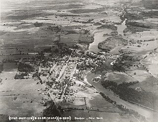
Dexter is a village in Jefferson County, New York, United States. The population was 1,052 at the 2010 census. The name is derived from Simon Newton Dexter, one of the village's stockholders.

Evans Mills is a village in Jefferson County, New York, United States. The population was 621 at the 2010 census. The village is within the town of Le Ray and is northeast of Watertown.

Glen Park is a village in Jefferson County, New York, United States. The population was 502 at the 2010 census. The village is on the border of the towns of Brownville and Pamelia and is immediately northwest of Watertown.

Great Bend is a hamlet and census-designated place (CDP) in Jefferson County, New York, United States. The population was 843 at the 2010 census.

Herrings is a hamlet and former village in Jefferson County, New York, United States. The population was 90 at the 2010 census, down from 129 in 2000. The hamlet is named after two brothers who owned a paper mill in the area.

Le Ray is a town in Jefferson County, New York, United States. The population was 25,574 at the 2020 census, up from 21,782 in 2010. The town is named for Jacques-Donatien Le Ray, known as a French "father of the American Revolution".

Rutland is a town in Jefferson County, New York, United States. The population was 3,038 at the 2020 census.

West Carthage is a village in Jefferson County, New York, United States. The population was 1,780 at the 2020 census.

Denmark is a town in Lewis County, New York, United States, named after the Kingdom of Denmark in northern Europe. The population was 2,860 at the 2010 census. The town is on the northwestern border of Lewis County and lies east of Watertown.

Antwerp is a village in Jefferson County, New York, United States. The population was 686 at the 2010 census. The village is in center of the town of Antwerp and is northeast of Watertown.

<span class="mw-page-title-main">Brownville (village), New York</span> Village in New York, United States

Brownville is a village in Jefferson County, New York, United States. The population was 1,119 at the 2010 census, up from 1,022 in 2000. The village is named after Jacob Brown, an early settler and developer.

Philadelphia is a village in Jefferson County, New York, United States. The population was 1,252 at the 2010 census, down from 1,519 in 2000.

Theresa is a village in the town of Theresa in Jefferson County, New York, United States. The population was 863 at the 2010 census. The village is northeast of Watertown.

Watertown is a town in Jefferson County, New York, United States. The population was 5,913 at the 2020 census. The town is located in the central part of the county and borders the city of Watertown to the south, east, and west. As the city has a population of 24,685, or four times the town's population, references to "Watertown, New York", usually apply to the city rather than the town.

References

  1. "ArcGIS REST Services Directory". United States Census Bureau. Retrieved September 20, 2022.
  2. 1 2 "Geographic Identifiers: 2010 Census Summary File 1 (G001): Black River village, New York". American Factfinder. U.S. Census Bureau. Archived from the original on February 13, 2020. Retrieved September 4, 2018.
  3. Black River Fire Department, Inc. Historical Archive
  4. "National Register Information System". National Register of Historic Places . National Park Service. July 9, 2010.
  5. "US Gazetteer files: 2010, 2000, and 1990". United States Census Bureau. February 12, 2011. Retrieved April 23, 2011.
  6. "NOW Data - NOAA Online Cliamte Data". National Oceanic and Atmosoheric Administration. Retrieved September 25, 2023.
  7. "Census of Population and Housing". Census.gov. Retrieved June 4, 2015.
  8. "U.S. Census website". United States Census Bureau . Retrieved January 31, 2008.