Hounsfield, New York

Last updated
Hounsfield, New York
USA New York location map.svg
Red pog.svg
Hounsfield
Usa edcp location map.svg
Red pog.svg
Hounsfield
Coordinates: 43°56′46″N76°4′45″W / 43.94611°N 76.07917°W / 43.94611; -76.07917 Coordinates: 43°56′46″N76°4′45″W / 43.94611°N 76.07917°W / 43.94611; -76.07917
Country United States
State New York
County Jefferson
Government
  Type Town Council
   Town Supervisor Timothy Scee (D)
   Town Council
Members' List
Area
[1]
  Total120.42 sq mi (311.88 km2)
  Land48.94 sq mi (126.74 km2)
  Water71.48 sq mi (185.13 km2)
Elevation
253 ft (77 m)
Population
 (2010)
  Total3,466
  Estimate 
(2016) [2]
3,445
  Density70.40/sq mi (27.18/km2)
Time zone UTC-5 (Eastern (EST))
  Summer (DST) UTC-4 (EDT)
ZIP code
13685
Area code(s) 315
FIPS code 36-045-35782
GNIS feature ID0979081
Website townofhounsfield-ny.org

Hounsfield is a town in Jefferson County, New York, United States. The population was 3,466 at the 2010 census. [3] The name of the town is from Ezra Hounsfield, [4] a land agent and land owner.

Contents

Hounsfield is in the western part of the county and is west of Watertown.

History

The first settler within the town arrived around 1800.

The land comprising the town was purchased by Augustus Sackett in 1801 from a foreclosure of two prior landowners. He took an active part in developing the town and increasing its population.

Hounsfield was formed from the town of Watertown in 1806. The town and its citizens were deeply involved in the War of 1812, primarily due to the two battles that took place at Sackets Harbor.

In 1814, the community of Sackets Harbor, by Black River Bay, set itself off from the town by becoming an incorporated village.

The Bedford Creek Bridge, Conklin Farm, District School No. 19, District School No. 20, East Hounsfield Christian Church, Dr. Samuel Guthrie House, Ressequie Farm, Shore Farm, Stephen Simmons House, Star Grange No. 9, Stevenson-Frink Farm, Storrs' Harbor Naval Shipyard Site, and Sulphur Springs Cemetery are listed on the National Register of Historic Places. [5]

Notable people

Geography

According to the United States Census Bureau, the town has a total area of 120.4 square miles (311.8 km2), of which 48.9 square miles (126.7 km2) are land and 71.5 square miles (185.2 km2), or 59.37%, are water. [3] The northeastern boundary is the Black River and the western boundary is Lake Ontario. Mill Creek enters Black River Bay near Sackets Harbor.

New York State Route 3 is a north-south highway in the western part of Hounsfield. Interstate 81 crosses the southeastern corner of the town.

Demographics

Historical population
CensusPop.
1820 3,429
1830 3,415−0.4%
1840 4,14621.4%
1850 4,136−0.2%
1860 3,339−19.3%
1870 2,636−21.1%
1880 2,7705.1%
1890 2,651−4.3%
1900 2,7724.6%
1910 2,217−20.0%
1920 2,2973.6%
1930 2,92627.4%
1940 3,1377.2%
1950 2,630−16.2%
1960 2,7223.5%
1970 2,7711.8%
1980 2,645−4.5%
1990 3,08916.8%
2000 3,3237.6%
2010 3,4664.3%
2016 (est.)3,445 [2] −0.6%
U.S. Decennial Census [6]

As of the census [7] of 2000, there were 3,323 people, 1,350 households, and 908 families residing in the town. The population density was 67.5 people per square mile (26.0/km2). There were 1,839 housing units at an average density of 37.3 per square mile (14.4/km2). The racial makeup of the town was 97.53% White, 0.57% African American, 0.39% Native American, 0.30% Asian, 0.18% from other races, and 1.02% from two or more races. Hispanic or Latino of any race were 1.14% of the population.

There were 1,350 households, out of which 31.0% had children under the age of 18 living with them, 55.2% were married couples living together, 7.9% had a female householder with no husband present, and 32.7% were non-families. 26.7% of all households were made up of individuals, and 9.1% had someone living alone who was 65 years of age or older. The average household size was 2.45 and the average family size was 2.98.

In the town, the population was spread out, with 23.7% under the age of 18, 8.8% from 18 to 24, 33.0% from 25 to 44, 22.6% from 45 to 64, and 11.9% who were 65 years of age or older. The median age was 36 years. For every 100 females, there were 106.9 males. For every 100 females age 18 and over, there were 107.4 males.

The median income for a household in the town was $42,011, and the median income for a family was $47,742. Males had a median income of $32,464 versus $26,406 for females. The per capita income for the town was $19,806. About 7.6% of families and 10.6% of the population were below the poverty line, including 14.8% of those under age 18 and 3.6% of those age 65 or over.

Communities and location in Hounsfield

Communities and inhabited places

Geographical features and other locations

Related Research Articles

Jefferson County, New York County in New York, United States

Jefferson County is a county on the northern border of the U.S. state of New York. As of the 2020 census, the population was 116,721. Its county seat is Watertown. The county is named after Thomas Jefferson, third President of the United States of America. It is adjacent to Lake Ontario, southeast from the Canada–US border of Ontario.

Sterling, New York Town in New York, United States

Sterling is a town in Cayuga County, New York, United States. The population was 3,040 at the 2010 census. Located on the shore of Lake Ontario, the town is named after William Alexander, Lord Stirling, an American general of the Revolutionary War. Sterling is the most northerly town in the county and lies northwest of Syracuse.
Alexandria, New York Town in New York, United States

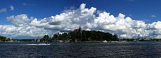
Alexandria is a town in the Thousand Islands region of the U.S. state of New York, within Jefferson County. The town's population was 4,061 at the 2010 United States Census. The town is named after Alexander LeRay, the son of an early developer. The village of Alexandria Bay is within the town.

Dexter is a village in Jefferson County, New York, United States. The population was 1,052 at the 2010 census. The name is derived from Simon Newton Dexter, one of the village's stockholders.

Henderson is a town in Jefferson County, New York, United States. The population was 1,360 at the 2010 census. The town is named after William Henderson, the original European-American land owner.

Lyme is a town in Jefferson County, New York, United States. The population was 2,185 at the 2010 census. The settlements of Chaumont and Three Mile Bay are located within the town. Lyme is in the western part of Jefferson County and is northwest of Watertown.

Orleans is a town in Jefferson County, New York, United States. The population was 2,789 at the 2010 census, up from 2,463 in 2000. The town is located in the northern part of the county and is north of Watertown. Orleans is named after the commune of Orléans in France.

Pamelia is a town in Jefferson County, New York, United States. The population was 3,160 at the 2010 census, up from 2,897 in 2000. The town was named for Pamelia Williams, wife of landowner and developer General Jacob J. Brown.

Sackets Harbor is a village in Jefferson County, New York, United States, on Lake Ontario. The population was 1,450 at the 2010 census. The village was named after land developer and owner Augustus Sackett, who founded it in the early 1800s.

Plattsburgh (town), New York Town in New York, United States

Plattsburgh is a town in Clinton County, New York, United States. The population was 11,886 at the 2020 census. The town is named after Zephaniah Platt, an early land owner, and it surrounds the separate and more populous city of the same name. The town is in the eastern part of the county, in the North Country region of the state of New York. The region's airport, Plattsburgh International Airport, is located in the southern part of the town.

Brownville is a town in Jefferson County, New York, United States. The population was 6,263 at the 2010 census, up from 5,839 in 2000. The town is named after Jacob Brown, an early settler and leader.

Cape Vincent is a town in Jefferson County, New York, United States. The population was 2,777 at the 2010 census.
Clayton, New York Town in New York, United States

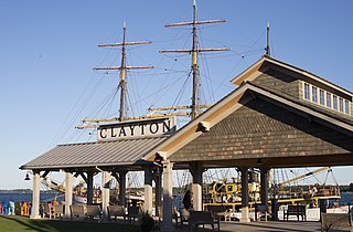
Clayton is a town in Jefferson County, New York, United States. The population was 5,153 at the 2010 census. The town is named after John M. Clayton, a federal political leader from Delaware.

Ellisburg is a town in Jefferson County, New York, United States. The population was 3,474 at the 2010 census. The town is in the southwestern corner of the county and is south of Watertown. Ellisburg is named after early European-American landowners. Among the villages in the town is Ellisburg.

Watertown is a town in Jefferson County, New York, United States. The population was 4,470 at the 2010 census. The town is located in the central part of the county and borders the city of Watertown to the south, east, and west. As the city has a population of 24,685, or six times the town's population, references to "Watertown, New York", usually apply to the city rather than the town.

Hammond is a town in St. Lawrence County, New York, United States. The population was 1,191 at the 2010 census. The name is derived from early land owner Abijah Hammond.
Morristown (town), New York

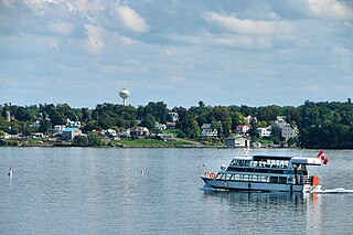
Morristown is a town in St. Lawrence County, New York, United States. The population was 1,974 at the 2010 census. The town is named after Gouverneur Morris, a signer of the United States Declaration of Independence and landowner in New York.

Little Galloo Island is located in eastern Lake Ontario near the entrance to Sackets Harbor in Jefferson County, New York, within the jurisdiction of the Town of Hounsfield.
Galloo Island Light Lighthouse

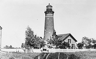
Galloo Island light is a historic lighthouse that is located the South Western side of the island of Galloo. It is found six miles off the mainland of Jefferson Country which is part of the state of New York. According to its location, it falls under the jurisdiction of the town of Hounsfield. The light tower and the majority of the island are privately owned. However, because of the law, the Coast Guard is permitted to cross into this private property because of the light in the tower that is used to guide ships. The lighthouse is a fixed white light that produces a beam that is visible at a maximum distance of 15 miles. It also consists of a steam whistle that it sounds when the weather turns foggy. The whistle blows for 10 seconds and then it is silent for 30 seconds. The island does not have a harbor and landings have to be made from smaller boats. Today it stands tall and abandoned, overlooking the waves.

Galloo Island

Galloo Island is located in eastern Lake Ontario near the entrance to Sackets Harbor in Jefferson County, New York, within the jurisdiction of the Town of Hounsfield.

References

  1. "2016 U.S. Gazetteer Files". United States Census Bureau. Retrieved Jul 5, 2017.
  2. 1 2 "Population and Housing Unit Estimates" . Retrieved June 9, 2017.
  3. 1 2 "Geographic Identifiers: 2010 Census Summary File 1 (G001): Hounsfield town, Jefferson County, New York". American Factfinder. U.S. Census Bureau. Archived from the original on February 13, 2020. Retrieved August 30, 2018.
  4. Gannett, Henry (1905). The Origin of Certain Place Names in the United States. Govt. Print. Off. pp.  161.
  5. "National Register Information System". National Register of Historic Places . National Park Service. July 9, 2010.
  6. "Census of Population and Housing". Census.gov. Retrieved June 4, 2015.
  7. "U.S. Census website". United States Census Bureau . Retrieved 2008-01-31.