Depauville, New York

Last updated
Depauville, New York
USA New York location map.svg
Red pog.svg
Depauville
Usa edcp location map.svg
Red pog.svg
Depauville
Coordinates: 44°8′35″N76°3′28″W / 44.14306°N 76.05778°W / 44.14306; -76.05778
Country United States
State New York
County Jefferson
Town Clayton
Area
[1]
  Total9.82 sq mi (25.44 km2)
  Land9.82 sq mi (25.44 km2)
  Water0.00 sq mi (0.00 km2)
Elevation
305 ft (93 m)
Population
 (2020)
  Total488
  Density49.68/sq mi (19.18/km2)
Time zone UTC-5 (Eastern (EST))
  Summer (DST) UTC-4 (EDT)
ZIP code
13632
Area code 315
FIPS code 36-20302
GNIS feature ID0948332

Depauville is a hamlet and census-designated place (CDP) in the southern region of the town of Clayton, within Jefferson County, New York, United States. The population was at 577 at the 2010 census. [2]

Contents

History

In 1784, the Oneida people ceded all territory to the state of New York except for a tract of land around 100 square miles (260 km2) known as Penet Square. The Oneida considered the tract as a gift to Pierre Penet. After Penet's death, rights of land ownership were blurred and squatters occupied the territory as early as 1785. [3] Catfish Falls was a settlement at the head of the Chaumont River, named after the 25-foot (7.6 m) waterfall within the settlement. [4] The squatters that inhabited this area were often called "Catfish People", marking their settlement from the clearing of trees establishing its boundaries. In 1816, merchant Francis Depau purchased several lots in Penet Square including Catfish Falls, later renaming the settlement "Depauville" after himself. [5]

Depauville during the early 1800s was a site of manufacturing; the settlement contained a gristmill and sawmill. Lumber was a profitable resource for the region. Depauville also produced limewater, nearly 1,000 barrels after two years of production, a first for the county. [5] Around 1868 the Depauville Steamboat Company was established and produced side-wheel steamboats. The M. W. Wright was constructed in 1968, a steam-powered vessel 70 feet (21 m) from bow to stern, with a width of 14 feet (4.3 m), and weighing in at nearly 43 tons. [3] The ship was large enough to raise concerns on its capability to navigate the shallow waters of the Chaumont River before reaching Lake Ontario.

Depauville's first Fire District was created in 1932 and during the Great Depression housed a camp of the Civilian Conservation Corps (CCC). The CCC established a headquarters consisting of ten camps at the Madison Barracks in Sackets Harbor.

Depauville saw damage from a microburst on July 15, 1995. In 1996, the Clayton Fire District formed, bringing the Depauville Fire Department [6] under the same umbrella with the Clayton Fire Department, although each retained its identity. Depauville in January 1998 witnessed one of the most destructive natural disasters that Jefferson County had ever endured, the Ice Storm of 1998, 36 hours of freezing rain that left damaged homes and properties, impassable roadways and many people powerless and hungry for weeks. [3]

Geography

Depauville is located in northern Jefferson County at 44°8′35″N76°3′28″W / 44.14306°N 76.05778°W / 44.14306; -76.05778 (44.143189, -76.057757), [7] in the southern part of the town of Clayton. According to the United States Census Bureau, the CDP has a total area of 9.8 square miles (25.4 km2), all land.

Depauville hamlet is located at the junction of New York State Route 12 and County Roads 11 (Sylvia Street), 12 (Overbluff Road), and 179 (Caroline Street). Route 12 leads north 7 miles (11 km) to the village of Clayton on the St. Lawrence River and southeast 14 miles (23 km) to Watertown, the county seat. The village is mostly on the south bank of the Chaumont River.

Recreation

Depauville provides community events held at each of two churches, the fire department banquet hall and public library. [8] Depauville also has a small town market and a bar, the Depauville Hotel. The Depauville Hotel is one of many stops for snowmobilers during the winter months as it is a crossroad of snowmobile trails that travel north to Clayton and eventually Gouverneur or west to Chaumont that accesses Lake Ontario. Depauville is a site for hunting and fishing as the salmon spawn and migration includes the Chaumont River from Lake Ontario. Access to the Thousand Islands region is a 10-minute drive northbound on State Route 12.

Demographics

Historical population
CensusPop.Note
2020 488
U.S. Decennial Census [9]

As of the census [10] of 2000, there were 512 people, 178 households, and 137 families residing in the CDP. The population density was 52.3 inhabitants per square mile (20.2/km2). There were 203 housing units at an average density of 20.7/sq mi (8.0/km2). The racial makeup of the CDP was 99.22% White, 0.39% from other races, and 0.39% from two or more races. Hispanic or Latino of any race were 0.59% of the population.

There were 178 households, out of which 44.9% had children under the age of 18 living with them, 60.1% were married couples living together, 12.4% had a female householder with no husband present, and 23.0% were non-families. 17.4% of all households were made up of individuals, and 7.3% had someone living alone who was 65 years of age or older. The average household size was 2.88 and the average family size was 3.27.

In the CDP, the population was spread out, with 32.2% under the age of 18, 7.0% from 18 to 24, 32.8% from 25 to 44, 18.9% from 45 to 64, and 9.0% who were 65 years of age or older. The median age was 32 years. For every 100 females, there were 102.4 males. For every 100 females age 18 and over, there were 92.8 males.

The median income for a household in the CDP was $37,411, and the median income for a family was $35,893. Males had a median income of $31,184 versus $21,042 for females. The per capita income for the CDP was $17,172. None of the families and 1.6% of the population were living below the poverty line, including no under eighteens and none of those over 64.

Related Research Articles

<span class="mw-page-title-main">Clay, Alabama</span> City in Alabama, United States

Clay is a city in northeastern Jefferson County, Alabama, United States. It is part of the Birmingham–Hoover–Cullman Combined Statistical Area in the north-central part of the state. Local government is run by a mayor and city council.

<span class="mw-page-title-main">Altoona, Florida</span> Census-designated place in Florida

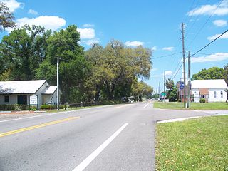
Altoona is an unincorporated community and census-designated place (CDP) in Lake County, Florida, United States. The population was 89 at the 2010 census. It is part of the Orlando–Kissimmee–Sanford Metropolitan Statistical Area.

<span class="mw-page-title-main">Cape St. Claire, Maryland</span> Census-designated place in Maryland, United States

Cape St. Claire, a suburb of Annapolis, is a covenanted, unincorporated community as well as a census-designated place (CDP) in Anne Arundel County, Maryland, United States. While the community of Cape St. Claire lies entirely within the CDP and accounts for approximately 80% of the homes and residents, the CDP also includes the smaller communities of Atlantis, Walnut Ridge, Green Holly, and St. Claire Court. The population of the CDP was 8,747 at the 2010 census.

<span class="mw-page-title-main">Algonquin, Maryland</span> Census-designated place in Maryland, United States

Algonquin is a census-designated place (CDP) in Dorchester County, Maryland, United States. The population was 1,241 at the 2010 census. The community was named for the Algonquin people, one of the Native American tribes in the East.

<span class="mw-page-title-main">Horine, Missouri</span> Census-designated place in Missouri, United States

Horine is an unincorporated community and census-designated place (CDP) in Jefferson County, Missouri, United States. The population was 821 at the 2010 census, down from 923 in 2000.

Adams Center is a hamlet and census-designated place (CDP) in the town of Adams in Jefferson County, New York, United States. The population was 1,492 during the 2020 decennial census.

Chaumont is a village in Jefferson County, New York, United States. Its population was 624 at the 2010 census. The village is named for Jacques-Donatien Le Ray de Chaumont, son of Benjamin Franklin's landlord and friend at Passy in France. The village of Chaumont is in the town of Lyme and is northwest of Watertown.

Great Bend is a hamlet and census-designated place (CDP) in Jefferson County, New York, United States. The population was 843 at the 2010 census.

La Fargeville is a hamlet and census-designated place (CDP) in the town of Orleans in Jefferson County, New York, United States. The population was 608 at the 2010 census. The hamlet is named after John Frederick La Farge, one of the early proprietors of the town. La Fargeville was once a village, but dissolved its municipal corporation in 1922.

Lyme is a town in Jefferson County, New York, United States. The population was 2,185 at the 2010 census. The settlements of Chaumont and Three Mile Bay are located within the town. Lyme is in the western part of Jefferson County and is northwest of Watertown.

<span class="mw-page-title-main">Natural Bridge, New York</span> Census-designated place in New York, United States

Natural Bridge is a hamlet and census-designated place (CDP) in Jefferson County, New York, United States. As of the 2010 census it had a population of 365.

<span class="mw-page-title-main">Galeville, New York</span> Census-designated place in New York, United States

Galeville is a hamlet in Onondaga County, New York, United States. The population was 4,617 at the 2010 census.

<span class="mw-page-title-main">North Madison, Ohio</span> Census-designated place in Ohio, United States

North Madison is a census-designated place (CDP) comprising the unincorporated communities of Redbird and Madison-on-the-Lake in Lake County, Ohio, United States. The population was 8,547 at the 2010 census. The CDP is located 1 mile (1.6 km) north of the unincorporated community of North Madison and U.S. Route 20. The area uses a mailing address of "Madison", with the ZIP Code 44057.

<span class="mw-page-title-main">East Berwick, Pennsylvania</span> Census-designated place in Pennsylvania, United States

East Berwick is a census-designated place (CDP) in Salem Township, Luzerne County, Pennsylvania, United States. The population was 2,007 at the 2010 census.

<span class="mw-page-title-main">Delano, Pennsylvania</span> CDP in Pennsylvania, United States

Delano is a census-designated place (CDP) in Schuylkill County, Pennsylvania, United States. The population was 377 at the 2000 census.

<span class="mw-page-title-main">Joanna, South Carolina</span> Census-designated place in South Carolina, United States

Joanna is an unincorporated community and census-designated place (CDP) in Laurens County, South Carolina, United States. The population was 1,539 at the 2010 census, down from 1,609 at the 2000 census. It is part of the Greenville–Mauldin–Easley Metropolitan Statistical Area.

<span class="mw-page-title-main">Lincolnia, Virginia</span> Census-designated place in Virginia, United States

Lincolnia is a census-designated place (CDP) in Fairfax County, Virginia, United States. The population was 22,828 at the 2010 census, an increase of over 44% from 2000.

<span class="mw-page-title-main">Brownville (village), New York</span> Village in New York, United States

Brownville is a village in Jefferson County, New York, United States. The population was 1,119 at the 2010 census, up from 1,022 in 2000. The village is named after Jacob Brown, an early settler and developer.

<span class="mw-page-title-main">Clayton, New York</span> Town in New York, United States

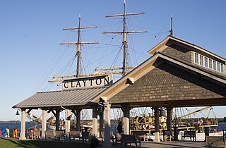
Clayton is a town in Jefferson County, New York, United States. The population was 5,153 at the 2010 census. The town is named after John M. Clayton, a federal political leader from Delaware.

<span class="mw-page-title-main">Minetto (CDP), New York</span> CDP in New York, United States

Minetto is a hamlet in Oswego County, New York, United States. The population was 1,069 at the 2010 census.

References

  1. "ArcGIS REST Services Directory". United States Census Bureau. Retrieved September 20, 2022.
  2. "Geographic Identifiers: 2010 Census Summary File 1 (G001): Depauville CDP, New York". American Factfinder. U.S. Census Bureau. Archived from the original on February 13, 2020. Retrieved September 19, 2018.
  3. 1 2 3 "A History of the Jefferson County Region - page 1". marcmny.tripod.com.
  4. "Northern New York Waterfalls ... Catfish Falls".
  5. 1 2 "History of Depauville".
  6. "Depauville Volunteer Fire Department". www.depauvillefd.org.
  7. "US Gazetteer files: 2010, 2000, and 1990". United States Census Bureau. 2011-02-12. Retrieved 2011-04-23.
  8. "Town of Clayton, NY". Archived from the original on 2012-03-06. Retrieved 2012-02-23.
  9. "Census of Population and Housing". Census.gov. Retrieved June 4, 2016.
  10. "U.S. Census website". United States Census Bureau . Retrieved 2008-01-31.