Mannsville, New York

Last updated

Mannsville, New York
USA New York location map.svg
Red pog.svg
Mannsville
Usa edcp location map.svg
Red pog.svg
Mannsville
Coordinates: 43°42′41″N76°3′51″W / 43.71139°N 76.06417°W / 43.71139; -76.06417
Country United States
State New York
County Jefferson
Town Ellisburg
Area
[1]
  Total0.93 sq mi (2.41 km2)
  Land0.90 sq mi (2.32 km2)
  Water0.03 sq mi (0.08 km2)
Elevation
620 ft (189 m)
Population
 (2020)
  Total297
  Density331.10/sq mi (127.81/km2)
Time zone UTC-5 (Eastern (EST))
  Summer (DST) UTC-4 (EDT)
ZIP Code
13661
Area code 315
FIPS code 36-45073
GNIS feature ID0956371

Mannsville is a village in the town of Ellisburg in Jefferson County, New York, United States. The population was 354 at the 2010 census, [2] down from 400 in 2000. The name is from Barzillian Mann, early developer.

Contents

Mannsville is in the southeastern part of Ellisburg and is south of Watertown.

History

The community was first settled around 1801. Mannsville incorporated as a village in 1879. In 1885, a fire burned several structures in the small village, but they were soon rebuilt.

In the 1830s missionaries served the area. The Mannsville Methodist-Episcopal Church was organized in 1847 with Rev. Fuller serving as the first pastor. [3] The building was erected in 1859. The parsonage, located three houses east, was built in 1880. In 1957 a large addition was built, and the sanctuary was remodeled in 1967. A new steeple was erected in 2002 with funds provided by Ethel S. Joyner, and work done by Graves Construction.

The first school building in the community was a little red schoolhouse built in 1826, at the intersection of Balch Place and current Route 11. [3] A second larger two-story building was built on Lorraine Street, but burned in 1878. The third school, built on the foundation of the Lorraine street building, burned in January 1883. A new building was dedicated in September 1883. There were 106 students in three departments. The schoolhouse again burned in 1907. A new two-story building was completed in 1908, and is currently known as the Mannsville Manor Elementary School. The cement blocks were made to resemble stone. O.D. Greene Jr. of Adams was the builder. Classes ran from first to eighth grades. The district centralized in 1930 with other districts in the towns of Ellisburg and Lorraine.

In the early 1930s, six village men held a meeting in the old Club House on Mill Street in Mannsville. [4] With a dollar each, the Mannsville Volunteer Fire Department was established. In 1949 they became incorporated and merged with Pierrepont Manor to become the Mannsville Manor Fire Department, or tongue in cheek as the "Cellar Savers".

In May 1960 seven active members of the Mannsville Manor Fire Department borrowed $200 from the department to start the first ambulance service in southern Jefferson County, which at that time served six townships. This was the beginning of Rescue 48. In May 1976, Rescue 48 was reorganized with 25 active members supplying 24-hour ambulance service. The Mannsville Manor Rescue Squad observed their 30th anniversary in 1990. On January 4, 1991, the Rescue Squad became one of the first volunteer paramedic ambulance services in Jefferson County.

The Pierrepont Manor Complex was listed on the National Register of Historic Places in 1977. [5]

Geography

Mannsville is located near the southern border of Jefferson County at 43°42′41″N76°3′51″W / 43.71139°N 76.06417°W / 43.71139; -76.06417 (43.711334, -76.064104), [6] in the southeastern part of the town of Ellisburg. According to the United States Census Bureau, the village has a total area of 0.93 square miles (2.4 km2), of which 0.89 square miles (2.3 km2) are land and 0.04 square miles (0.1 km2), or 3.50%, are water. Skinner Creek by the village attracted early settlers to use its water power.

Mannsville is at the intersection of U.S. Route 11 and County Road 90. Interstate 81 passes within one mile of the village to the west , with an interchange at CR 90. US-11 and I-81 lead north 21 miles (34 km) to Watertown, the county seat, and south 50 miles (80 km) to Syracuse.

Demographics

Historical population
CensusPop.Note
1880 473
1890 389−17.8%
1900 352−9.5%
1910 330−6.2%
1920 265−19.7%
1930 31318.1%
1940 34811.2%
1950 3788.6%
1960 44618.0%
1970 49410.8%
1980 431−12.8%
1990 4443.0%
2000 400−9.9%
2010 354−11.5%
2020 297−16.1%
U.S. Decennial Census [7]

As of the census [8] of 2000, there were 400 people, 143 households, and 106 families residing in the village. The population density was 434.6 inhabitants per square mile (167.8/km2). There were 168 housing units at an average density of 182.5 per square mile (70.5/km2). The racial makeup of the village was 99.25% White, 0.25% Native American, 0.25% Asian, and 0.25% from two or more races. Hispanic or Latino of any race were 0.50% of the population.

There were 143 households, out of which 42.7% had children under the age of 18 living with them, 54.5% were married couples living together, 15.4% had a female householder with no husband present, and 25.2% were non-families. 18.2% of all households were made up of individuals, and 9.1% had someone living alone who was 65 years of age or older. The average household size was 2.71 and the average family size was 3.07.

In the village, the population was spread out, with 28.8% under the age of 18, 7.3% from 18 to 24, 30.8% from 25 to 44, 18.0% from 45 to 64, and 15.3% who were 65 years of age or older. The median age was 36 years. For every 100 females, there were 89.6 males. For every 100 females age 18 and over, there were 85.1 males.

The median income for a household in the village was $47,574, and the median income for a family was $48,182. Males had a median income of $29,545 versus $20,625 for females. The per capita income for the village was $16,768. About 13.6% of families and 15.7% of the population were below the poverty line, including 24.0% of those under age 18 and 4.5% of those age 65 or over.

Related Research Articles

<span class="mw-page-title-main">Blue Ridge Manor, Kentucky</span> City in Kentucky, United States

Blue Ridge Manor is a home rule-class city in Jefferson County, Kentucky, United States. The city was formally incorporated by the state assembly in 1964. The population was 767 at the 2010 census, up from 623 at the 2000 census.

<span class="mw-page-title-main">Glenview Manor, Kentucky</span> City in Kentucky, United States

Glenview Manor is a home rule-class city in Jefferson County, Kentucky, United States. The population was 191 at the 2010 census.

<span class="mw-page-title-main">Manor Creek, Kentucky</span> City in Kentucky, United States

Manor Creek is a home rule-class city in Jefferson County, Kentucky, United States. The population was 140 at the 2010 census, down from 221 at the 2000 census.

<span class="mw-page-title-main">Strathmoor Manor, Kentucky</span> City in Kentucky, United States

Strathmoor Manor is a home rule-class city in Jefferson County, Kentucky, United States. The population was 337 at the 2010 census.

<span class="mw-page-title-main">Strathmoor Village, Kentucky</span> City in Kentucky, United States

Strathmoor Village is a home rule-class city in Jefferson County, Kentucky, United States. The population was 648 at the 2010 census.

<span class="mw-page-title-main">Caspian, Michigan</span> City in Michigan, United States

Caspian is a city in Iron County in the U.S. state of Michigan. The population was 906 at the time of the 2010 census and 805 in 2020. The city has an Italian heritage.

<span class="mw-page-title-main">Constantine, Michigan</span> Village in Michigan, United States

Constantine is a village in St. Joseph County in the U.S. state of Michigan. The population was 2,076 at the 2010 census. The village is located within Constantine Township. U.S. Highway 131 leads to Kalamazoo to the north and to the Indiana Toll Road six miles to the south. The St. Joseph River, navigable from source to outlet, passes through the village, emptying in Lake Michigan to the west.

Black River is a village in Jefferson County, New York, United States. The population was 1,348 at the 2010 census. The village is on the border of the towns of Le Ray and Rutland, east of Watertown.

Carthage is a village in the town of Wilna in Jefferson County, New York, United States. The population was 3,236 at the 2020 census. The village is named after the historic city of Carthage.

Lorraine is a town in Jefferson County, New York, United States. The population was 1,037 at the 2010 census, up from 930 in 2000. The town is named after Lorraine, a region in France.

<span class="mw-page-title-main">Orwell, New York</span> Town in New York, United States

Orwell is a town in Oswego County, New York, United States. The population was 1,167 at the 2010 census. The town was named after Orwell, Vermont.

<span class="mw-page-title-main">Pierrepont, New York</span> Town in New York, United States

Pierrepont is a town and hamlet in St. Lawrence County, New York, United States. As of the 2020 census, the town population was 2,523. It was named after Hezekiah Pierrepont, the early owner of much of the town's territory. The Town of Pierrepont is centrally located in the county and is southeast of Canton. A hamlet of the same name is in the town of Pierrepont. Pierrepont Manor, however, is located in Jefferson County.

<span class="mw-page-title-main">Rayland, Ohio</span> Village in Ohio, United States

Rayland is a village in southern Jefferson County, Ohio, United States, along the Ohio River. The population was 389 at the 2020 census. It is part of the Weirton–Steubenville metropolitan area.

<span class="mw-page-title-main">Mannsville, Oklahoma</span> Town in Oklahoma, United States

Mannsville is a town in Johnston County, Oklahoma, United States. The population was 863 at the 2010 census, up from 587 in 2000.

<span class="mw-page-title-main">Dickson City, Pennsylvania</span> Borough in Lackawanna County, Pennsylvania, United States

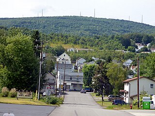
Dickson City is a borough in Lackawanna County, Pennsylvania, 4 miles (6 km) north of Scranton. Coal mining was an important industry in the past. The borough's population peaked at 12,395 in 1930 and was 6,051 at the 2020 census.

<span class="mw-page-title-main">Manheim Township, York County, Pennsylvania</span> Township in Pennsylvania, United States

Manheim Township is a township in York County, Pennsylvania, United States. As of the 2020 census, the township population was 3,457.

Ellisburg is a village in Jefferson County, New York, United States. The population was 244 at the 2010 census. The village is named after two brothers who were the original landowners. It is located near the middle of the town of Ellisburg and is southwest of Watertown.

Ellisburg is an incorporated town in Jefferson County, New York. The population was 3,352 at the time of the 2020 census. The town is in the southwestern corner of the county and is south of Watertown. Ellisburg is named after early European-American landowners. Among the villages in the town is Ellisburg.

<span class="mw-page-title-main">Lowville (village), New York</span> Village in New York, United States

Lowville is a village in Lewis County, New York, United States. As of the 2010 census it had a population of 3,470. The village is in the Black River Valley, between the foothills of the Adirondack Mountains and the Tug Hill Plateau, in an area often referred to as the North Country. It is located in the center of Lewis County, in the southeastern part of the similarly named town of Lowville.

<span class="mw-page-title-main">Waterloo, Wisconsin</span> City in Wisconsin, United States

Waterloo is a city in Jefferson County in the U.S. state of Wisconsin. As of the census of 2022, the population was 3,628. The name Waterloo was suggested by Mr. Wilt, a Frenchman living here, who was one of Napoleon's soldiers, at the battle of Waterloo. Waterloo is located in the Watertown-Fort Atkinson micropolitan area which is a sub-market of the larger Milwaukee-Racine-Waukesha CSA.

References

  1. "ArcGIS REST Services Directory". United States Census Bureau. Retrieved September 20, 2022.
  2. "Geographic Identifiers: 2010 Census Summary File 1 (G001): Mannsville village, New York". American Factfinder. U.S. Census Bureau. Archived from the original on February 13, 2020. Retrieved September 13, 2018.
  3. 1 2 Historical Society of Mannsville. Historical Driving Tour of Mannsville. Mannsville, NY: Town of Ellisburg Bicentennial Celebration, 2003. N. pag. Print. Retrieved October 19, 2010.
  4. Mannsville Manor Fire Dept. & Rescue Squad, INC. Mannsville, NY: n.p., n.d. Print. Retrieved October 19, 2010.
  5. "National Register Information System". National Register of Historic Places . National Park Service. July 9, 2010.
  6. "US Gazetteer files: 2010, 2000, and 1990". United States Census Bureau. February 12, 2011. Retrieved April 23, 2011.
  7. "Census of Population and Housing". Census.gov. Retrieved June 4, 2015.
  8. "U.S. Census website". United States Census Bureau . Retrieved January 31, 2008.