Brownville, New York

Last updated

Brownville, New York
USA New York location map.svg
Red pog.svg
Brownville
Usa edcp location map.svg
Red pog.svg
Brownville
Coordinates: 44°00′08″N75°58′59″W / 44.00222°N 75.98306°W / 44.00222; -75.98306
CountryUnited States
State New York
County Jefferson
Government
   Town Supervisor Leo K. Thompson (R)
   Town Council
Members
  • Kenneth G. Bates (R)
  • Ronald T. Tepfenhart (R)
  • Albert D. Roberts (R)
  • Richard W. Dodge (R)
Area
[1]
  Total65.85 sq mi (170.55 km2)
  Land58.92 sq mi (152.61 km2)
  Water6.93 sq mi (17.94 km2)
Population
 (2010)
  Total6,263
  Estimate 
(2016) [2]
6,214
  Density105.46/sq mi (40.72/km2)
Time zone UTC-5 (EST)
  Summer (DST) UTC-4 (EDT)
ZIP code
13615
Area code 315
FIPS code 36-045-10242
Website townofbrownville.com

Brownville is a town in Jefferson County, New York, United States. The population was 6,263 at the 2010 census, [3] up from 5,839 in 2000. The town is named after Jacob Brown, an early settler and leader.

Contents

Brownville is located in the western part of the county, northwest of Watertown. The town contains a village also named Brownville.

History

The Oneida people were the original inhabitants of the area.[ citation needed ]

The town was settled around 1799 near Brownville village. It was one of the first towns in the county. Its name is derived from the founder and first settler, Jacob Brown, who was a major-general in the United States Army and is considered to be a heroic figure in the War of 1812.

The town was formed in 1802 from the town of Leyden while still part of Herkimer County.

Many of the northern towns of the county were established, or partly established, from parts of Brownville, including Le Ray (1806), Lyme (1818), Pamelia (1819), Orleans (1821), and Alexandria (1821).

In 1828, the community of Brownville set itself off from the town by incorporating as a village.

In 1855, the community of Dexter set itself off from the town by incorporating as a village.

The William Archer House, Gen. Jacob Brown Mansion, Brownville Hotel, St. Paul's Church, Vogt House, and Arthur Walrath House are listed on the National Register of Historic Places. [4]

Notable people

Rollins A. Emerson (1873–1947), geneticist, was born in Pillar Point

Geography

According to the United States Census Bureau, the town has a total area of 66.4 square miles (172.1 km2), of which 59.1 square miles (153.1 km2) are land and 7.3 square miles (19.0 km2), or 11.02%, are water. [3]

The western border of the town is Lake Ontario and Guffin Bay, an arm of the lake, and the southern border is formed by the Black River, which flows into the lake at Black River Bay. The Perch River flows through the town from the northeastern corner to the southern border and Lake Ontario at Black River Bay.

New York State Route 12E is an east-west highway, which intersects New York State Route 180, a north-south highway, at Limerick. New York State Route 12 crosses the northeastern corner of the town.

Demographics

Historical population
CensusPop.Note
1820 3,990
1830 2,938−26.4%
1840 3,96835.1%
1850 4,2827.9%
1860 3,966−7.4%
1870 3,219−18.8%
1880 2,624−18.5%
1890 3,11018.5%
1900 3,69318.7%
1910 3,615−2.1%
1920 3,8566.7%
1930 3,489−9.5%
1940 3,6715.2%
1950 3,8063.7%
1960 3,9854.7%
1970 4,3218.4%
1980 5,11318.3%
1990 5,6049.6%
2000 5,8394.2%
2010 6,2637.3%
2016 (est.)6,214 [2] −0.8%
U.S. Decennial Census [5]

As of the census [6] of 2000, there were 5,843 people, 2,184 households, and 1,633 families residing in the town. The population density was 98.5 inhabitants per square mile (38.0/km2). There were 2,857 housing units at an average density of 48.2 per square mile (18.6/km2). The racial makeup of the town was 97.84% White, 0.27% Black or African American, 0.55% Native American, 0.27% Asian, 0.02% Pacific Islander, 0.27% from other races, and 0.77% from two or more races. Hispanic or Latino of any race were 0.58% of the population.

There were 2,184 households, out of which 37.3% had children under the age of 18 living with them, 60.3% were married couples living together, 10.5% had a female householder with no husband present, and 25.2% were non-families. 20.5% of all households were made up of individuals, and 9.1% had someone living alone who was 65 years of age or older. The average household size was 2.66 and the average family size was 3.07.

In the town, the population was spread out, with 27.3% under the age of 18, 6.8% from 18 to 24, 29.2% from 25 to 44, 23.8% from 45 to 64, and 12.8% who were 65 years of age or older. The median age was 38 years. For every 100 females, there were 93.1 males. For every 100 females age 18 and over, there were 91.9 males.

The median income for a household in the town was $38,277, and the median income for a family was $43,866. Males had a median income of $33,889 versus $21,904 for females. The per capita income for the town was $16,303. About 6.0% of families and 8.2% of the population were below the poverty line, including 5.5% of those under age 18 and 11.3% of those age 65 or over.

Communities and locations

Related Research Articles

<span class="mw-page-title-main">Sterling, New York</span> Town in New York, United States

Sterling is a town in Cayuga County, New York, United States. The population was 3,040 at the 2010 census. Located on the shore of Lake Ontario, the town is named after William Alexander, Lord Stirling, an American general of the Revolutionary War. Sterling is the most northerly town in the county and lies northwest of Syracuse.

<span class="mw-page-title-main">Alexandria, New York</span> Town in New York, United States

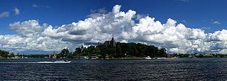
Alexandria is a town in the Thousand Islands region of the U.S. state of New York, within Jefferson County. The town's population was 4,061 at the 2010 United States Census. The town is named after Alexander LeRay, the son of an early developer. The village of Alexandria Bay is within the town.

Dexter is a village in Jefferson County, New York, United States. The population was 1,052 at the 2010 census. The name is derived from Simon Newton Dexter, one of the village's stockholders.

Glen Park is a village in Jefferson County, New York, United States. The population was 502 at the 2010 census. The village is on the border of the towns of Brownville and Pamelia and is immediately northwest of Watertown.

Hounsfield is a town in Jefferson County, New York, United States. The population was 3,466 at the 2010 census. The name of the town is from Ezra Hounsfield, a land agent and land owner.

Lyme is a town in Jefferson County, New York, United States. The population was 2,185 at the 2010 census. The settlements of Chaumont and Three Mile Bay are located within the town. Lyme is in the western part of Jefferson County and is northwest of Watertown.

Pamelia is a town in Jefferson County, New York, United States. The population was 3,160 at the 2010 census, up from 2,897 in 2000. The town was named for Pamelia Williams, wife of landowner and developer General Jacob J. Brown.

<span class="mw-page-title-main">Richland, New York</span> Town in New York, United States

Richland is a town in the northeastern part of Oswego County, New York, United States. The population was 5,718 at the 2010 census.

<span class="mw-page-title-main">Lisbon, New York</span> Town in New York, United States

Lisbon is a town in St. Lawrence County, New York, United States. The population was 4,102 at the 2010 census.

<span class="mw-page-title-main">New Berlin, New York</span> Town in New York, United States

New Berlin is a town in Chenango County, central New York, United States. The population was 2,682 at the 2010 census. The town contains the village of New Berlin. The town is at the eastern border of the county and is northeast of Norwich.

<span class="mw-page-title-main">Champlain, New York</span> Town in the United States

Champlain is a town in Clinton County, New York, United States. The population was 5,754 at the 2010 census. The town is located on the western shore of Lake Champlain, near the northern end of Lake Champlain and is on the U.S./Canadian border.

<span class="mw-page-title-main">Plattsburgh (town), New York</span> Town in New York, United States

Plattsburgh is a town in Clinton County, New York, United States. The population was 11,886 at the 2020 census. The town is named after Zephaniah Platt, an early land owner, and it surrounds the separate and more populous city of the same name. The town is in the eastern part of the county, in the North Country region of the state of New York. The region's airport, Plattsburgh International Airport, is located in the southern part of the town.

<span class="mw-page-title-main">Brownville (village), New York</span> Village in New York, United States

Brownville is a village in Jefferson County, New York, United States. The population was 1,119 at the 2010 census, up from 1,022 in 2000. The village is named after Jacob Brown, an early settler and developer.

Cape Vincent is a town in Jefferson County, New York, United States. The population was 2,765 at the 2020 census.

<span class="mw-page-title-main">Clayton, New York</span> Town in New York, United States

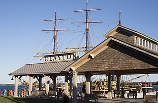
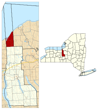
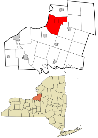
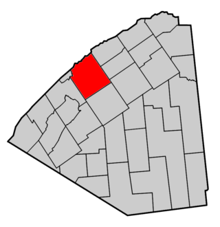
Clayton is a town in Jefferson County, New York, United States. The population was 5,153 at the 2010 census. The town is named after John M. Clayton, a federal political leader from Delaware.

Ellisburg is an incorporated town in Jefferson County, New York. The population was 3,474 at the time of the 2010 census. The town is in the southwestern corner of the county and is south of Watertown. Ellisburg is named after early European-American landowners. Among the villages in the town is Ellisburg.

<span class="mw-page-title-main">Morristown, New York</span> Town in New York, United States

Morristown is a town in St. Lawrence County, New York, United States. The population was 1,974 at the 2010 census. The town is named after Gouverneur Morris, a signer of the United States Declaration of Independence and landowner in New York.

Waddington is a town in St. Lawrence County, New York, United States. The population was 2,266 at the 2010 census. The town was named after its principal village.

<span class="mw-page-title-main">New York State Route 12E</span> New York state highway

New York State Route 12E (NY 12E) is a state highway located entirely within the northwestern part of Jefferson County in northern New York in the United States. The southern terminus is at NY 12F in the village of Brownville. Its northern terminus, both signed and official, is at NY 12 in the village of Clayton. While NY 12 follows a direct north–south routing between Watertown and Clayton, NY 12E diverges westward to follow the shoreline of Lake Ontario. The portion of NY 12E north of its junction with NY 180 is part of the Seaway Trail, a National Scenic Byway.

<span class="mw-page-title-main">New York State Route 180</span> State highway in Jefferson County, New York, US

New York State Route 180 (NY 180) is a north–south state highway in the northwestern part of Jefferson County in the U.S. state of New York. The southern terminus of the route is at NY 3 in the Hounsfield hamlet of Baggs Corner, located 7 miles (11 km) west of downtown Watertown. The northern terminus is at NY 12 in the Orleans hamlet of Fishers Landing. NY 180 is part of the Seaway Trail from its southern terminus at Baggs Corner to its junction with NY 12E at the Brownville hamlet of Limerick.

References

  1. "2016 U.S. Gazetteer Files". United States Census Bureau. Retrieved July 5, 2017.
  2. 1 2 "Population and Housing Unit Estimates" . Retrieved June 9, 2017.
  3. 1 2 "Geographic Identifiers: 2010 Census Summary File 1 (G001): Brownville town, Jefferson County, New York". American Factfinder. U.S. Census Bureau. Archived from the original on February 13, 2020. Retrieved August 28, 2018.
  4. "National Register Information System". National Register of Historic Places . National Park Service. July 9, 2010.
  5. "Census of Population and Housing". Census.gov. Retrieved June 4, 2015.
  6. "U.S. Census website". United States Census Bureau . Retrieved January 31, 2008.