
Bull Shoals Lake is an artificial lake or reservoir in the Ozark Mountains of northern Arkansas and southern Missouri. It has hundreds of miles of lake arms and coves, and common activities include boating, water sports, swimming, and fishing. Nineteen developed parks around the shoreline provide campgrounds, boat launches, swim areas, and marinas.

Table Rock Lake is an artificial lake or reservoir in the Ozarks of southwestern Missouri and northwestern Arkansas in the United States. Designed, built and operated by the U.S. Army Corps of Engineers, the lake is impounded by Table Rock Dam, which was constructed from 1954 to 1958 on the White River.

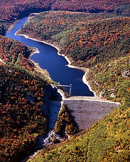
Lake Ouachita is a reservoir created by the damming of the Ouachita River by Blakely Mountain Dam.

The Lower Mississippi River is the portion of the Mississippi River downstream of Cairo, Illinois. From the confluence of the Ohio River and Upper Mississippi River at Cairo, the Lower flows just under 1000 miles (1600 km) to the Gulf of Mexico. It is the most heavily travelled component of the Mississippi River System.

The Cochiti Dam is an earthen fill dam located on the Rio Grande in Sandoval County, New Mexico, approximately 50 miles (80 km) north of Albuquerque, New Mexico, in the United States. By volume of material, it is the 23rd largest dam in the world at 62,849,000 yd3 of material, one of the ten largest such dams in the United States, and the eleventh largest such dam in the world. Cochiti Dam is one of the four United States Army Corps of Engineers projects for flood and sediment control on the Rio Grande system, operating in conjunction with Abiquiu Dam, Galisteo Dam and Jemez Canyon Dam.

Lucky Peak Dam is a rolled earth and gravel fill embankment dam in the western United States, located on the Boise River in Ada County, Idaho. It is directly downstream of Arrowrock Dam, a concrete arch dam completed in 1915. At the time of its construction in the early 1950s, Lucky Peak's primary purpose was flood control, with a secondary purpose of irrigation. The normal operating elevation of the full reservoir is 3,055 feet (931 m) above sea level, the empty reservoir's elevation is 2,824 feet (861 m).

Shenango River Lake is a reservoir in the Shenango River Valley of western Pennsylvania and northeastern Ohio. Authorized by the Flood Control Acts of 1938, the lake is one of 16 flood control projects in the Pittsburgh District designed to prevent flooding. It is a popular site among anglers and is lined by 330 campsites.

Kanopolis Lake is a reservoir in Ellsworth County in the Smoky Hills of central Kansas, about 31 miles southwest of Salina and a few miles southeast of the town of Kanopolis. The lake is formed by Kanopolis Dam. Completed in 1948 as a flood control and water conservation project of the United States Army Corps of Engineers, the dam impounds the Smoky Hill River.
Long Branch Dam is a dam in Macon County in northern Missouri, about eighty miles north of Columbia, Missouri.

Mud Mountain Dam is a dam in King County, Washington, a few miles southeast of Enumclaw. The dam impounds the White River and is used for flood control.

Bowman-Haley Dam is an embankment dam located in Bowman County, North Dakota, in the southwestern part of the state. The dam is just over 2 miles north of the South Dakota border.

Cold Brook Dam is an earthen dam located near Hot Springs, South Dakota in Fall River County in the southwestern part of the state, in the southern Black Hills.

Cottonwood Springs Dam is a dam in Fall River County, South Dakota in the southwestern part of the state, south of the Black Hills.
A. I. Selden Dam is a dam in Hale County, Alabama. The concrete gravity dam was constructed in 1958 by the United States Army Corps of Engineers with a height of 71 feet (22 m) and 684 feet (208 m) long at its crest. It impounds the Black Warrior River for navigation and flood control. Named for the U.S. Representative from Alabama, Armistead I. Selden, Jr., the dam is owned and operated by the Corps of Engineers.

Salamonie Dam is a dam in Wabash County, Indiana.

Cherry Creek Dam is a dam in Arapahoe County, Colorado southeast of Denver.
Ball Mountain Dam is a dam in Jamaica, Windham County, Vermont, in the southeastern part of the state.

Townshend Dam is a dam in Townshend, Windham County, Vermont.
East Barre Dam is a dam in East Barre, Washington County, Vermont.

Mahoning Creek Dam is a dam in Armstrong County, Pennsylvania.
