
Highbury & Islington is an interchange station in the London Borough of Islington, North London for London Underground, London Overground and National Rail services

Clapham Junction railway station is a major railway station and transport hub near St John's Hill in southwest Battersea in the London Borough of Wandsworth. It is 2 miles 57 chains from London Victoria and 3 miles 74 chains from London Waterloo; it is on both the South West Main Line and Brighton Main Line as well as numerous other routes and branch lines passing through or diverging from the main lines at this station. Despite its name, Clapham Junction is not located in Clapham, a district situated approximately 1 mile (1.6 km) to the southeast and is instead sited in Battersea.

The North London line (NLL) is a railway line which passes through the inner suburbs of west, north-west, north, and north-east London, England between Richmond in the south-west and Stratford in the east, avoiding central London. Its route is a rough semicircle.

Richmond, also known as Richmond (London), is a National Rail station in Richmond, Greater London on the Waterloo to Reading and North London Lines. South Western Railway services on the Waterloo to Reading Line are routed through Richmond, which is between North Sheen and St Margarets stations, 9 miles 57 chains (15.6 km) down the line from London Waterloo. For London Overground and London Underground services, the next station is Kew Gardens.

Whitechapel is an interchange station in Whitechapel, East London for London Underground, London Overground and Elizabeth line services. The station is located behind a street market of the same name and opposite Tower Hamlets Town Hall. It lies between Aldgate East and Stepney Green stations on the District and Hammersmith & City lines, between Shoreditch High Street and Shadwell stations on the East London Line. To the West of Whitechapel on the Elizabeth Line is Liverpool Street, to the East the line splits with one branch going to Stratford and one to Canary Wharf. It is in Travelcard Zone 2.
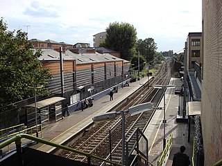
Gospel Oak railway station is in the London Borough of Camden in north-west London. It is situated the North London line, served by Mildmay line services between Clapham Junction/Richmond and Stratford, and is also the western passenger terminus of the Gospel Oak to Barking Line, served by Suffragette line services to/from Barking Riverside. Passengers using Oyster cards are required to tap on interchange Oyster card readers when changing between the two lines. The station is in Travelcard Zone 2, and is managed by London Overground which runs all passenger trains at the station.
The North London Railway (NLR) company had lines connecting the northern suburbs of London with the East and West India Docks further east. The main east to west route is now part of London Overground's North London Line. Other NLR lines fell into disuse but were later revived as part of the Docklands Light Railway, and London Overground's East London Line. The company was originally called the East & West India Docks & Birmingham Junction Railway (E&WID&BJR) from its start in 1850, until 1853. In 1909, it entered into an agreement with the London and North Western Railway which introduced common management, and the NLR was taken over completely by the LNWR in 1922. The LNWR itself became part of the LMS from the start of 1923. The railways were nationalised in 1948 and most LMS lines, including the North London route, then came under the control of the London Midland Region of British Railways.

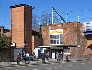
Brondesbury Park railway station is a National Rail station in Brondesbury Park in the London Borough of Brent on the North London line in Travelcard Zone 2 which is managed by London Overground. It is close to the Queen's Park area.

Camden Road railway station in the London Borough of Camden, north London, is operated by London Overground. It is on the North London line and in Travelcard Zone 2.

Hampstead Heath railway station is in the London Borough of Camden in north London on the North London Line, between Finchley Road & Frognal and Gospel Oak stations, and is in Travelcard Zone 2. Since 11 November 2007 it and the service there have been run by London Overground. It is located on South End Road close to South End Green and Pond Street in the old South End of Hampstead.

Dalston Kingsland railway station is a railway station on the North London Line in London, England. It is in the Dalston area of the London Borough of Hackney, on the western side of Kingsland High Street and opposite Ridley Road Market. The station and all trains serving it are operated by London Overground. It is in Travelcard Zone 2. Kingsland railway station was first opened on the site in 1850, but was replaced by Dalston Junction in 1865. The current station was opened by British Rail in 1983. Ticket barriers are in operation. The station straddles the boundary with the London Borough of Islington, with part of the platforms falling within Islington.

Hackney Central is a London Overground station on the North London line in Hackney Central, north-east London. It lies between Dalston Kingsland and Homerton and is in Travelcard Zone 2. The station and all trains serving it are operated by London Overground services which are managed by Transport for London.

Hackney Wick is a station on the North London Line in the area of Hackney Wick, East London. It is in Travelcard Zone 2. The station and all trains serving it are operated by London Overground. It opened on 12 May 1980 by British Rail as part of the Crosstown Linkline service between North Woolwich and Camden Road stations. Between Spring 2017 and May 2018 the station was rebuilt and modernised, including replacement of the footbridge by a subway. The new subway, in addition to linking the two platforms will, later in 2018, provide a cycle and pedestrian link between Hackney and Tower Hamlets.

Homerton is a station on the North London line in the district of Homerton, East London. The station and all trains serving it are operated by London Overground. It is in London fare zone 2. The current station opened on 13 May 1985 to coincide with the introduction of the Richmond to North Woolwich through electric passenger service. The station is close to Homerton University Hospital and Hackney Marshes.

Canonbury railway station serves the districts of Canonbury and Highbury within the London Borough of Islington in north London. It is on London Overground's North London line and East London line. The station and all trains serving it are operated by London Overground, and the station is in Travelcard Zone 2. This location of the station is close to the boundary with the London Borough of Hackney.

Kentish Town West railway station is a railway station on the North London line and is on Prince of Wales Road in the London Borough of Camden. It is in Travelcard Zone 2. The station and all trains serving it are operated by London Overground.
Finchley Road & Frognal railway station is on Finchley Road in the London Borough of Camden in north London. It is on the North London line, and the station and all trains serving it are operated by London Overground. It is in Travelcard Zone 2. The station is about five minutes walk from Finchley Road Underground station, and is marked as an official out-of-system interchange. The station was opened as Finchley Road St Johns Wood in 1860 on the Hampstead Junction Railway for the connection to the North London Railway.

Dalston Junction is an inter-modal rail and bus transport interchange in Dalston, London. It is located at the crossroads of Dalston Lane, Kingsland Road and Balls Pond Road. The station served by London Overground East London line and is in Zone 2. The station is located in a short section of cut and cover tunnel north of the Kingsland Viaduct.

London Overground is a suburban rail network serving London and its environs. Established in 2007 to take over Silverlink Metro routes, it now serves a large part of Greater London as well as Hertfordshire, with 113 stations on the six lines that make up the network.
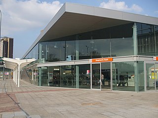
Shepherd's Bush station is a station located in the district of Shepherd's Bush in Greater London for London Overground and National Rail services.


