California Historical Landmarks in Solano County

Last updated

This list includes properties and districts listed on the California Historical Landmark listing in Solano County, California. Click the "Map of all coordinates" link to the right to view a Google map of all properties and districts with latitude and longitude coordinates in the table below.

Image [1] Landmark nameLocationCity or townSummary
Benicia Arsenal Oblique view of southwest front and southeast end; view to north, 90mm lens. - Benicia Arsenal, Powder Magazine No. 5, Junction of Interstate Highways 680 and 780, Benicia, HABS CAL,48-BENI,4-O-9.tif
Benicia Arsenal
176 Benicia Arsenal Adams and Jefferson Sts.
38°03′15″N122°08′08″W / 38.054036°N 122.135561°W / 38.054036; -122.135561 (Benicia Arsenal)
Benicia Also on the NRHP list as NPS-76000534
Benicia Barracks 89.3.99 Benicia Arsenal, California Mount Diablo in the Distance.jpg
Benicia Barracks
177 Benicia Barracks Francesca Terrace Park
38°03′23″N122°08′17″W / 38.056283°N 122.138067°W / 38.056283; -122.138067 (Benicia Barracks)
Benicia
Benicia Capitol Benicia state capitol exterior.JPG
Benicia Capitol
153 Benicia Capitol 1st and G Sts.
38°03′01″N122°09′28″W / 38.050278°N 122.157778°W / 38.050278; -122.157778 (Benicia Capitol)
Benicia
Benicia Lodge No. 5 BeniciaMasonicHall -- Side.JPG
Benicia Lodge No. 5
174 Benicia Lodge No. 5 110 W. J. St.
38°03′09″N122°09′27″W / 38.052383°N 122.157383°W / 38.052383; -122.157383 (Benicia Lodge No. 5)
Benicia
Benicia Seminary Benicia Seminary.jpg
Benicia Seminary
795 Benicia Seminary City park
38°03′14″N122°09′23″W / 38.053967°N 122.156417°W / 38.053967; -122.156417 (Benicia Seminary)
Benicia
First Presbyterian Church of Benicia Reverend Sylvester Woodbridge.jpg
First Presbyterian Church of Benicia
175 First Presbyterian Church of Benicia Benicia City Park
38°03′13″N122°09′26″W / 38.053533°N 122.157133°W / 38.053533; -122.157133 (First Presbyterian Church of Benicia)
Benicia Site is now Benicia City Park, on K Street.
First U.S. Naval Station in the Pacific Mare Island Shipyard at Night 2.jpg
First U.S. Naval Station in the Pacific
751 First U.S. Naval Station in the Pacific Mare Island Naval Shipyard
38°05′24″N122°15′48″W / 38.09°N 122.263333°W / 38.09; -122.263333 (First U.S. Naval Station in the Pacific)
Vallejo Also on the NRHP list as NPS-75002103
Small upload photo button.png
Upload Photo
880 Fischer-Hanlon House 135 W. G. St. Benicia Capitol State Historic Park
38°03′01″N122°09′32″W / 38.0502°N 122.158967°W / 38.0502; -122.158967 (Fischer-Hanlon House)
Benicia
Former California State Capitol California State Capitol Vallejo California.jpg
Former California State Capitol
574 Former California State Capitol Vallejo Station
38°06′00″N122°15′33″W / 38.100072°N 122.259117°W / 38.100072; -122.259117 (Former California State Capitol)
Vallejo Lost in August 20, 1859 fire
Matthew Turner Shipyard Park Matthew Turner (shipbuilder).jpg
Matthew Turner Shipyard Park
973 Matthew Turner Shipyard Park Matthew Turner Shipyard Park
38°03′44″N122°10′45″W / 38.0623°N 122.17925°W / 38.0623; -122.17925 (Matthew Turner Shipyard Park)
Benicia
Rockville Stone Chapel Rockville Stone Chapel.jpg
Rockville Stone Chapel
779 Rockville Stone Chapel Rockville Cemetery, Suisun Valley Rd.
38°14′50″N122°07′16″W / 38.24715°N 122.121217°W / 38.24715; -122.121217 (Rockville Stone Chapel)
Rockville
Saint Paul's Episcopal Church USA-Benicia-Saint Paul's Episcopal Church-4.jpg
Saint Paul's Episcopal Church
862 Saint Paul's Episcopal Church 120 E J St. at 1st St.
38°03′06″N122°09′24″W / 38.051743°N 122.156543°W / 38.051743; -122.156543 (Saint Paul's Episcopal Church)
Benicia
University of California Experimental Farm Portrait of John Wolfskill (CHS-1478).jpg
University of California Experimental Farm
804 University of California Experimental Farm Putah Creek Rd.
38°30′17″N121°58′50″W / 38.504733°N 121.980567°W / 38.504733; -121.980567 (University of California Experimental Farm)
Winters Also called Wolfskill Grant
Vaca-Pena Adobe Pena Adobe - Vacaville, CA.JPG
Vaca-Peña Adobe
534 Vaca-Peña Adobe Peña Adobe Park
38°20′15″N122°00′55″W / 38.337517°N 122.01525°W / 38.337517; -122.01525 (Vaca-Peña Adobe)
Vacaville Also on the NRHP list as NPS-72000261

Related Research Articles

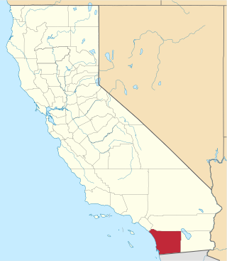
<span class="mw-page-title-main">National Register of Historic Places listings in San Diego County, California</span>

This is a list of the National Register of Historic Places listings in San Diego County, California.
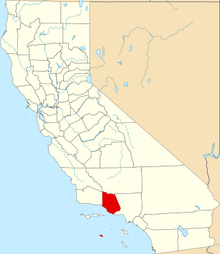
<span class="mw-page-title-main">National Register of Historic Places listings in Ventura County, California</span>

This is a list of the National Register of Historic Places listings in Ventura County, California.

<span class="mw-page-title-main">National Register of Historic Places listings in Humboldt County, California</span>

This is a list of the National Register of Historic Places listings in Humboldt County, California.

<span class="mw-page-title-main">National Register of Historic Places listings in Riverside County, California</span>

This is a list of the National Register of Historic Places listings in Riverside County, California.
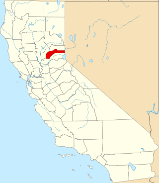
<span class="mw-page-title-main">National Register of Historic Places listings in Nevada County, California</span>

This is a list of the National Register of Historic Places listings in Nevada County, California.

<span class="mw-page-title-main">National Register of Historic Places listings in Shasta County, California</span>

This is a list of the National Register of Historic Places listings in Shasta County, California.
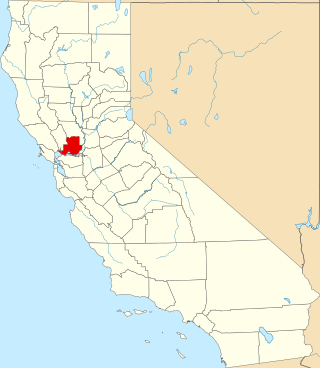
<span class="mw-page-title-main">National Register of Historic Places listings in Solano County, California</span>

This is a list of the National Register of Historic Places listings in Solano County, California.
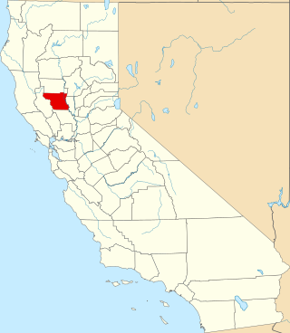
<span class="mw-page-title-main">National Register of Historic Places listings in Colusa County, California</span>

This is a list of the National Register of Historic Places listings in Colusa County, California.

<span class="mw-page-title-main">National Register of Historic Places listings in Mono County, California</span>

This is a list of the National Register of Historic Places listings in Mono County, California.

<span class="mw-page-title-main">National Register of Historic Places listings in Plumas County, California</span>

This is a list of the National Register of Historic Places listings in Plumas County, California.

<span class="mw-page-title-main">National Register of Historic Places listings in Alpine County, California</span>

This is a list of the National Register of Historic Places listings in Alpine County, California.

<span class="mw-page-title-main">National Register of Historic Places listings in Inyo County, California</span>

This is a list of the National Register of Historic Places listings in Inyo County, California.

<span class="mw-page-title-main">National Register of Historic Places listings in Calaveras County, California</span>

This is a list of the National Register of Historic Places listings in Calaveras County, California. This is intended to be a complete list of the properties and districts on the National Register of Historic Places in Calaveras County, California, United States. Latitude and longitude coordinates are provided for many National Register properties and districts; these locations may be seen together in an online map.

<span class="mw-page-title-main">National Register of Historic Places listings in Merced County, California</span>

This is a list of the National Register of Historic Places listings in Merced County, California.

<span class="mw-page-title-main">National Register of Historic Places listings in Madera County, California</span>

This is a list of the National Register of Historic Places listings in Madera County, California.

List table of the properties and districts — listed on the California Historical Landmarks — within Calaveras County, California.

Properties and districts listed as California Historical Landmarks within Kern County.

List table of the properties and districts — listed on the California Historical Landmarks in Los Angeles County, Southern California.

List table of the properties and districts listed on the California Historical Landmarks within Riverside County, southern California.

List table of the properties and districts — listed on the California Historical Landmarks — within San Bernardino County, Southern California.

References

  1. "California Historical Landmarks By County". Ohp.parks.ca.gov. Retrieved 2019-04-03.

See also