St. Albans City is the county seat of Franklin County, Vermont, in the United States. At the 2010 census, the city population was 6,918. St Albans City is surrounded by "St. Albans Town", which is incorporated separately from the city of St. Albans. The city and county are part of the Burlington metropolitan area, although the city is in Franklin County, north of the metro area's most populous county, Chittenden County.

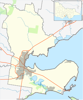
The City of Brimbank is a local government area located within the metropolitan area of Melbourne, Victoria, Australia. It comprises the western suburbs between 10 and 20 km west and northwest from the Melbourne city centre.

St Albans is a suburb 15 km (9 mi) north-west of Melbourne, Victoria, Australia, located within the City of Brimbank local government area. St Albans recorded a population of 37,309 at the 2016 Census.

The City of Hawkesbury is a local government area of New South Wales, Australia, part of which is at the fringe of the Sydney metropolitan area, about 50 kilometres (31 mi) north-west of the Sydney central business district. Hawkesbury City is named after the Hawkesbury River.
Keilor Downs is a suburb 17 km north-west of Melbourne, Victoria, Australia, located within the City of Brimbank local government area. Keilor Downs recorded a population of 9,995 at the 2016 Census.
St. Albans Park is a residential suburb of Geelong, Victoria, 6 km southeast from Geelong's city centre. It is bounded by Boundary Road (West), Coppards Road (East), Townsend Road (North) and the Barwon River (South). The suburbs that surround it are Whittington, Breakwater, Moolap and Marshall. The suburb extends around the St. Albans Homestead and stud, a historic house and accompanying stables. At the 2011 census, St. Albans Park had a population of 4,925.

The Division of Maribyrnong is an Australian electoral division in the state of Victoria. It is located in the inner north-western suburbs of Melbourne. It covers the suburbs of Aberfeldie, Airport West, Avondale Heights, Braybrook, Essendon, Kealba, Keilor East, Maribyrnong, Moonee Ponds, Niddrie, St Albans and Sunshine North. Due to redistributions, the division has been slowly moving west. It originally covered the suburbs of Footscray and North Melbourne. According to the 2011 census, Maribyrnong has the highest proportion of Catholics in any Commonwealth Electoral Division in Australia with 41.6% of the population.

Wisemans Ferry is a town in the state of New South Wales, Australia, located 75 kilometres north north-west of the Sydney central business district in the local government areas of Hornsby Shire, The Hills Shire, City of Hawkesbury and Central Coast Council. The town is a tourist spot with picnic and barbecue facilities. As well as a rich convict and colonial heritage in the area, the Dharug National Park and Yengo National Park are close by.

St Stephen is a civil parish in the St Albans City and District in Hertfordshire, England. It is located approximately 17 miles (27 km) north-northwest of central London, straddling the M25 motorway and immediately adjacent to the southern boundary of St Albans. St Stephen is a partly urbanised parish with multiple centres of activity and open land that forms part of the Metropolitan Green Belt. The local council is St Stephen Parish Council. The parish covers Bricket Wood, Chiswell Green, Frogmore, Colney Street, How Wood and Park Street. It is an ancient parish, and sections of it were transferred to St Albans progressively up to 1935. At the 2011 census it had a population of 13,865.
The Macdonald River is a perennial river located in the Hunter and Outer Metropolitan Sydney regions of New South Wales, Australia. It is a part of the Hawkesbury-Nepean catchment.

Hawkesbury is an electoral district of the Legislative Assembly in the Australian state of New South Wales. It is represented by Robyn Preston of the Liberal Party.

Muswellbrook Shire is a local government area in the Upper Hunter region of New South Wales, Australia. The Shire is situated adjacent to the New England Highway and the Hunter railway line.

Lower Macdonald is a hamlet village of Sydney, in the state of New South Wales, Australia. It is in the City of Hawkesbury north-west of Wisemans Ferry on the Macdonald River near its confluence with the Hawkesbury River.
Central Macdonald is a hamlet village of Sydney, in the state of New South Wales, Australia. It is located in the City of Hawkesbury just south of St Albans. Macdonald Valley Public School is situated in the village. It was previously known as the village of Benton.
Upper Macdonald is a small village 108 km north of Sydney, in the state of New South Wales, Australia. It is located in the City of Hawkesbury on the Macdonald River north of St Albans. The village used to be known as Howick.
Perrys Crossing is a locality of Sydney, in the state of New South Wales, Australia. It is located in the City of Hawkesbury north of St Albans. It lies across Mogo Creek, a tributary of the Macdonald River which flows into the Hawkesbury River.

Woolbrook is a village in the New England region of New South Wales, Australia. The nearest town, Walcha is 29 km to the east of Woolbrook. At the 2011 census, Woolbrook had a population of 248.
The Mogo Creek, a perennial stream of the Hawkesbury-Nepean catchment, is located in the Blue Mountains region of New South Wales, Australia.
Charles Leslie Macdonald, generally known as Leslie or C. Leslie Macdonald, was a racehorse owner and breeder, noted for two Melbourne Cup winners, Revenue in 1901 and Night Watch in 1918.


