
Slope County is a county in the U.S. state of North Dakota. As of the 2020 census, the population was 706, making it the least populous county in North Dakota and the 20th-least populous county in the United States. The county seat is Amidon.

Hubbard County is a county in the northwestern part of the U.S. state of Minnesota. As of the 2020 census, the population was 21,344. Its county seat is Park Rapids.

Gunnison County is a county located in the U.S. state of Colorado. As of the 2020 census, the population was 16,918. The county seat is Gunnison. The county was named for John W. Gunnison, a United States Army officer and captain in the Army Topographical Engineers, who surveyed for the transcontinental railroad in 1853.

Amidon is a city in, and the county seat of Slope County, North Dakota, United States.
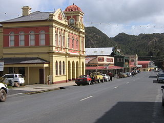
Queenstown is a town in the West Coast region of the island of Tasmania, Australia. It is in a valley on the western slopes of Mount Owen on the West Coast Range.

Liverpool Plains Shire is a local government area located in the North West Slopes region of New South Wales, Australia. The Shire was formed on 17 March 2004 by the amalgamation of Quirindi Shire with parts of Parry, Murrurundi and Gunnedah shires.

Moree Plains Shire is a local government area in the North West Slopes region of New South Wales, Australia. The northern boundary of the Shire is located adjacent to the border between New South Wales and Queensland. The Shire is located adjacent to the Newell and Gwydir Highways and the North West railway line.

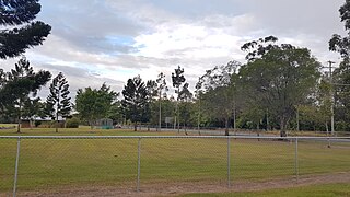
Tanah Merah is a residential suburb in the City of Logan, Queensland, Australia. In the 2016 census, Tanah Merah had a population of 4,752 people. It was originally named by the Queensland Place Names Board in 1971.

Narrabri Shire is a local government area in the North West Slopes region of New South Wales, Australia. The Shire is located adjacent to the Namoi River and the Newell and Kamilaroi Highways.

Inverell Shire is a local government area in the North West Slopes region of New South Wales, Australia adjacent to the Macintyre River and the Gwydir Highway.

Gunnedah Shire is a local government area in the North West Slopes region of New South Wales, Australia. The Shire is located adjacent to the Liverpool Plains in the Namoi River valley and is traversed by the Oxley Highway and the Kamilaroi Highway.
Glenroy is a suburb of the city of Albury, New South Wales, located northwest of the Albury Central Business District and west of Lavington. At the 2006 census, Glenroy had a population of 2659, although the area covered in the Census is considerably different from the actual area of the suburb.

Ardglen is a village on the Main North railway line and close to the New England Highway on the North West Slopes region of New South Wales, Australia.
Highvale is a rural residential locality in the City of Moreton Bay, Queensland, Australia. In the 2016 census, Highvale had a population of 1,766 people.
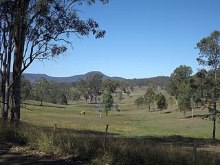
Biddaddaba is a rural locality in the Scenic Rim Region, Queensland, Australia. In the 2021 census, Biddaddaba had a population of 171 people.

Boyland is a rural locality in the Scenic Rim Region, Queensland, Australia. In the 2016 census Boyland had a population of 823 people.

Birnam is a rural locality in the Scenic Rim Region, Queensland, Australia. In the 2016 census, Birnam had a population of 106 people.

Frazerview is a rural locality in the Scenic Rim Region, Queensland, Australia. In the 2016 census, Frazerview had a population of 34 people.
Ferny Glen is a rural locality in the Scenic Rim Region, Queensland, Australia. In the 2016 census Ferny Glen had a population of 84 people.

Frenches Creek is a rural locality in the Scenic Rim Region, Queensland, Australia. In the 2016 census, Frenches Creek had a population of 85 people.
