Related Research Articles
The Division of Werriwa is an Australian electoral division in the state of New South Wales. The name Werriwa derives from a local Aboriginal name for Lake George, which was located in the division when it was established in 1900. The division was one of the original 65 divisions first contested at the first federal election.

The Colo River, a perennial stream that is part of the Hawkesbury-Nepean catchment, is located in the Central Tablelands of New South Wales, Australia.
The Division of Fowler is an Australian electoral division in the state of New South Wales.
The Wollemi Creek, a partly perennial stream of the Hawkesbury-Nepean catchment, is located in the Central Tablelands and Blue Mountains regions of New South Wales, Australia.
The Division of Hughes is an Australian electoral division in the state of New South Wales.

Bonnyrigg is a suburb of Sydney, in the state of New South Wales, Australia 36 kilometres west of the Sydney central business district, in the local government area of the City of Fairfield. It is part of the Greater Western Sydney region.
Bonnyrigg Heights is a suburb of Sydney, in New South Wales, Australia. Its name originates from Bonnyrigg, Midlothian, Scotland. Bonnyrigg Heights is located on the traditional indigenous lands of the Dharug Nation.
Canley Heights is a suburb of Sydney, in the state of New South Wales, Australia 31 kilometres west of the Sydney central business district, in the local government area of the City of Fairfield and is part of the South-western Sydney region.

Chipping Norton is a suburb of Sydney, in the state of New South Wales, Australia. Chipping Norton is 27 kilometres south-west of the Sydney central business district, in the local government area of the City of Liverpool and is part of the South Western Sydney region.
Emu Heights is a suburb of Sydney, in the state of New South Wales, Australia. Emu Heights is located 58 kilometres west of the Sydney central business district, in the local government area of the City of Penrith.

Wolgan Valley is a small valley located along the Wolgan River in the Lithgow Region of New South Wales, Australia. The valley is located approximately 32 kilometres (20 mi) north of Lithgow and 150 kilometres north-west of Sydney. Accessible by the Wolgan Valley Discovery Trail from the Castlereagh Highway, the road travels through the valley leading onto the historical village of Newnes and its extensive industrial ruins.

Bell is a small rural and residential village in the Blue Mountains region of New South Wales, Australia. It is the north-westernmost village in the City of Blue Mountains, located approximately 125 kilometres (78 mi) west of Sydney central business district by road or 137 kilometres (85 mi) by rail, approximately 20 kilometres (12 mi) east of Lithgow and 10 kilometres (6.2 mi) north of Mount Victoria. It is a locality on the junction of the Bells Line of Road, Chifley Road and the Darling Causeway, with an elevation of approximately 1,100 metres (3,600 ft) AHD .
Mellong is a locality in the state of New South Wales, Australia. Mellong is located about 110 km NNW of Sydney. It is a scattered village located in the City of Hawkesbury south of Putty and north of Colo Heights.
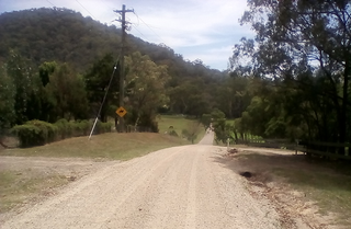
Upper Colo is a locality of Sydney, in the state of New South Wales, Australia. It is located in the City of Hawkesbury west of Colo and south of Colo Heights, on the Colo River, a tributary of the Hawkesbury River. It was previously known as Colo Upper.

The Sackville Ferry is a cable ferry across the Hawkesbury River in New South Wales, Australia. The vehicular ferry connects the communities of Sackville, on the north/west bank of the river, and Sackville North, on the south/east bank. Because of the tortuous course of the river, the ferry actually runs north-west from Sackville to Sackville North.

The Bargo River, a watercourse of the Hawkesbury-Nepean catchment, is located in the Southern Highlands and Macarthur districts of New South Wales, Australia.
The Capertee River, a perennial stream that is part of the Hawkesbury-Nepean catchment, is located in the Central Tablelands region of New South Wales, Australia.

The Wollangambe River, an Australian perennial river that is part of the Hawkesbury–Nepean catchment within the Sydney Basin, is located in the Greater Blue Mountains Area of New South Wales.
The Division of McMahon is an Australian electoral division in the state of New South Wales.
Pacific Heights is a semi-rural locality in the Livingstone Shire, Queensland, Australia. In the 2016 census, Pacific Heights had a population of 926 people.
References
- ↑ Australian Bureau of Statistics (27 June 2017). "Colo Heights (State Suburb)". 2016 Census QuickStats. Retrieved 29 March 2020.
 Material was copied from this source, which is available under a Creative Commons Attribution 4.0 International License.
33°22′08″S150°43′19″E / 33.369°S 150.722°E
| | This article related to the geography of Sydney is a stub. You can help Wikipedia by expanding it. |