North Richmond, New South Wales

Last updated

North Richmond
New South Wales
Australia New South Wales location map blank.svg
Red pog.svg
North Richmond
North Richmond, New South Wales
Coordinates 33°35′21″S150°42′40″E / 33.58917°S 150.71111°E / -33.58917; 150.71111
Population5,467 (UCL 2021) [1]
Postcode(s) 2754
Elevation27 m (89 ft)
Location
LGA(s) Hawkesbury
State electorate(s) Hawkesbury
Federal division(s) Macquarie
Localities around North Richmond:
Kurrajong Kurmond and Tennyson Freemans Reach and Glossodia
Grose Vale North Richmond Richmond Lowlands
Grose Wold Agnes Banks Richmond

North Richmond is a town and also considered as suburb of Richmond, in the state of New South Wales, Australia. [2] North Richmond is located 67 kilometres north-west of the Sydney central business district in the local government area of the City of Hawkesbury. It is separated from Richmond to the south-east by the Hawkesbury River. North Richmond is not part of Sydney metropolitan area as its border is Hawkesbury River, however North Richmond is considered as outskirts of Sydney region. Due to Redbank, a new land estate area in North Richmond, population increased gradually from 2020.

Contents

History

The traditional land owners of the town and surrounding district are the Darug people. In the early years of European Settlement, the area was known as Enfield. The name was changed at a later date during the 19th century to avoid confusion with Enfield in Sydney's west. While located to the west of the town of Richmond, it is thought to have been named North Richmond because it was north of Richmond Hill. This hill was named by Governor Philip when travelling up the Hawkesbury River in 1789.

In 1833 the "Woolpack Inn" was opened on higher ground near the river crossing, by John Town, a prominent local landowner. In 1874 the name changed to the "Travellers' Rest". In 1933 a more modern hotel was built next to the old inn and in 1940 was renamed the "North Richmond Hotel".

North Richmond bridge undergoing repairs, Sydney, ca. 1871 North Richmond bridge undergoing repairs, Sydney, ca. 1871.jpg
North Richmond bridge undergoing repairs, Sydney, ca. 1871

In the 1860s a wooden bridge was built across the Hawkesbury River to provide an easier crossing than the ferry or punt which had been used. In 1905 it was replaced by a higher-level bridge which was the largest reinforced concrete bridge to be constructed. It remained so for 20 years. In 1926 a railway branch line between Richmond and Kurrajong was opened. The railway bridge was built right next to the concrete bridge. The line curved to the right at the western end of the bridge before curving back around to cross Bells Line of Road at an angle near the intersection with Grose Vale Road. North Richmond had a railway station. When the line closed in 1952, the railway bridge became part of the roadway.

Beside a hotel and school, North Richmond also had a police station and lockup and a Wesleyan (Methodist) Chapel.

Population

According to the 2016 census of Population, there were 4,977 people in North Richmond.

Landmarks

North Richmond has three main roads. These are Grose Vale Road, Bells Line of Road and Terrace Road. North Richmond has a shopping mall consisting of a Coles supermarket and various shops including Domino's Pizza and Subway. There is the local primary school called Richmond North Public School and the high school, Colo High School. West of the town is the mountains and east is the Hawkesbury River. A Panthers Club is located in North Richmond. There are three main parks in North Richmond, John Wellington Oval, Turnbull Oval and Inalls Lane. Cricket is played at John Wellington Oval and Turnbull Oval. Soccer is played at Turnbull Oval and Inalls Lane. The Colo Cougars Soccer Club are based at Inalls Lane.

Heritage listings

North Richmond has the following heritage listings:

Schools

Richmond North Public School on Grose Vale Road was established in 1871. It replaced the Church of England Denominational School which had operated at Enfield (as North Richmond was then known) for many years. Mr George Sanders, formally in charge of the Denominational School, was appointed the first teacher. The 1871 building was demolished to make way for new school buildings in the mid-1960s. Colo High School was established in 1978 in demountable buildings at North Richmond. The current permanent site was occupied in 1980. The blue and white colours were chosen to match colours selected by the Uniform Committee. Mr Sam Weller, the school's first Deputy Principal, suggested using the school building plan as a basis for the logo. Mr David Stone, founding Mathematics teacher, drew up the design which was accepted as the school badge. The shape also represents the Tree Of Knowledge, and its three sections, Students, Staff and the Community.

Related Research Articles

<span class="mw-page-title-main">Richmond, NSW, Australia</span> Town in New South Wales, Australia


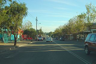
Richmond is a historic town in north-west of Sydney, New South Wales, Australia. Richmond is in local government area of City of Hawkesbury and comes under Sydney Metropolitan area. It is located 20 metres above sea level on the alluvial Hawkesbury River flats, at the foot of the Blue Mountains. It is about 65 km by road from Sydney, 22 km from Penrith, 26 km from Blacktown, 40 km from Parramatta, 78 km from Lithgow and 5 km from Windsor. Richmond Town is now part of Syndey urban area have all amenities including Shopping Malls, Service NSW, Schools, TAFE, University, Post Office, Restaurants, Railway Station, Cafe, Hotel and Supermarkets.

<span class="mw-page-title-main">Pymble, New South Wales</span> Suburb of Sydney, New South Wales, Australia

Pymble is a suburb on the Upper North Shore of Sydney in the state of New South Wales, Australia. Pymble is 15 kilometres (9 mi) north of the Sydney central business district in the local government area of Ku-ring-gai Council.

<span class="mw-page-title-main">Hawkesbury River</span> River in New South Wales, Australia

The Hawkesbury River, or Hawkesbury-Nepean River, is a river located northwest of Sydney, New South Wales, Australia. The Hawkesbury River and its associated main tributary, the Nepean River, almost encircle the metropolitan region of Sydney. Between Wisemans Ferry and the Pacific Ocean marks the boundary of Greater Metropolitan Sydney in the south and the Central Coast region to the north.

<span class="mw-page-title-main">Windsor, New South Wales</span> Town in New South Wales, Australia

Windsor is a historic town in north-west of Sydney, New South Wales, Australia. It is the council seat of the Hawkesbury local government area. The town sits on the Hawkesbury River, enveloped by farmland and Australian bush. Many of the oldest surviving European buildings in Australia are located at Windsor. It is 56 km (35 mi) north-west of the Sydney CBD, on the fringes of urban sprawl.

<span class="mw-page-title-main">St Albans, New South Wales</span> Suburb of City of Hawkesbury, New South Wales, Australia

St Albans is a small and historic village on the Macdonald River, New South Wales, Australia, about 94 kilometres (65 mi) north west of Sydney. At the 2011 census, St Albans and the surrounding area had a population of 305 people.

<span class="mw-page-title-main">Nepean River</span> River in New South Wales, Australia

Nepean River, is a major perennial river, located in the south-west and west of Sydney, New South Wales, Australia. The Nepean River and its associated mouth, the Hawkesbury River, almost encircles the metropolitan region of Sydney.

<span class="mw-page-title-main">Brooklyn, New South Wales</span> Outer Suburb of Sydney, New South Wales, Australia

Brooklyn is a suburb and the northern most town on the Pacific Highway in Sydney, New South Wales, Australia. Brooklyn is located on the northern outskirts of Sydney and is located in the local government area of the Hornsby Shire with a population of 722 as of the 2016 census. Brooklyn is surrounded by the Muogamarra Nature Reserve and occupies a strip of waterfront along the southern bank of the Hawkesbury River.

<span class="mw-page-title-main">City of Hawkesbury</span> Local government area in New South Wales, Australia

The City of Hawkesbury is a local government area of New South Wales, Australia, located on the northern and north-western fringe of the Greater Sydney area, about 50 kilometres (31 mi) north-west of the Sydney central business district. Hawkesbury City is named after the Hawkesbury River. Major towns in City of Hawkesbury are Windsor and Richmond.

<span class="mw-page-title-main">Main North railway line, New South Wales</span> Railway line in New South Wales, Australia

The Main North Line is a major railway in New South Wales, Australia. It runs through Strathfield to Armidale. The line is the main line between Sydney and Armidale. As of 1988, the line closed progressively north of Armidale with services gradually withdrawn till 2004, with the main route between Sydney and Brisbane now the North Coast line.

<span class="mw-page-title-main">Hawkesbury River railway station</span> Australian railway station

Hawkesbury River railway station is a heritage-listed railway station located on the Main Northern and Central Coast–Newcastle lines in Brooklyn in the Hornsby Shire local government area of Sydney, New South Wales, Australia. The station serves the town of Brooklyn and is located on the southern bank of the Hawkesbury River. It was designed and build by the Department of Railways New South Wales. It is also known as Hawkesbury River Railway Station group and Brooklyn Station. The property was added to the New South Wales State Heritage Register on 2 April 1999.

<span class="mw-page-title-main">Riverstone, New South Wales</span> Suburb of Sydney, New South Wales, Australia

Riverstone is a suburb of Sydney in the state of New South Wales, Australia. Riverstone is located 48 kilometres (30 mi) north-west of the Sydney central business district, in the Blacktown local government area and part of the Greater Western Sydney region. Originally settled in 1803 as part of a government stock farm, Riverstone is one of the oldest towns in Australia.

<span class="mw-page-title-main">Kurrajong, New South Wales</span> Town in New South Wales, Australia

Kurrajong is a small town in New South Wales, Australia. Kurrajong is located 75 kilometres (47 mi) north-west of Sydney, in the local government area of the City of Hawkesbury.

<span class="mw-page-title-main">Berambing, New South Wales</span> Town in New South Wales, Australia

Berambing is a rural locality in the Blue Mountains of New South Wales, Australia. The settlement is clustered around the Bells Line of Road, between Windsor and Lithgow, 10 kilometres (6.2 mi) west of Bilpin. It is situated across both the City of Hawkesbury and City of Blue Mountains local government areas. The settlement had a population of 106 people at the 2016 census.

Kurmond is a village 70.5 km west of Sydney, in the state of New South Wales, Australia. It is located in the City of Hawkesbury between Kurrajong and North Richmond on Bells Line of Road.

<span class="mw-page-title-main">Grose Vale, New South Wales</span> Suburb of City of Hawkesbury, New South Wales, Australia

Grose Vale is a suburb of Sydney, in the state of New South Wales, Australia. It is located in the City of Hawkesbury. It was previously known as South Kurrajong. Many historic properties are located in Grose Vale including "Lemon Forest" originally owned by the Lamrock family as well as a number of homes owned by the Dunston and Ezzy families.

<span class="mw-page-title-main">Northern Sydney</span> Region of Sydney in New South Wales, Australia

Northern Sydney is a large metropolitan area in Greater Sydney, New South Wales, Australia on the north shore of Sydney Harbour and Parramatta River. The region embraces suburbs in Sydney's north-east, north and inner north west. Northern Sydney is divided into distinctive regions such as the North Shore, Northern Beaches and Forest District.

<span class="mw-page-title-main">Richmond–Kurrajong railway line</span>

The Kurrajong railway line was a railway line in the distant rural western suburbs of Sydney, Australia. It was an extension of the branch off the Main Western line from Blacktown to Richmond and was operated by the New South Wales Government Railways.

<span class="mw-page-title-main">Australiana Pioneer Village</span> Historic site in New South Wales, Australia

Australiana Pioneer Village is a heritage-listed open-air museum at Rose Street, Wilberforce, City of Hawkesbury, New South Wales, Australia. It was built from 1969 to 1970. The property is owned by Hawkesbury City Council. It was added to the New South Wales State Heritage Register on 20 February 2004.

Yobarnie Keyline Farm is a heritage-listed former experimental farm and now pastoral property at 108 Grose Vale Road, North Richmond, City of Hawkesbury, New South Wales, Australia. It was designed by P.A. Yeomans and built by him from 1943 to 1964. It is also known as Redbank North Richmond and Belmont Park. The property is owned by Redbank Communities Pty Ltd. It was added to the New South Wales State Heritage Register on 8 March 2013.

References

  1. Australian Bureau of Statistics (28 June 2022). "North Richmond (urban centre and locality)". Australian Census 2021.  OOjs UI icon edit-ltr-progressive.svg
  2. "North Richmond". NSW Place and Road Naming Proposals System. Retrieved 1 October 2020.
  3. "Yobarnie Keyline Farm". New South Wales State Heritage Register . Department of Planning & Environment. H01826. Retrieved 21 January 2020. CC BY icon.svg Text is licensed by State of New South Wales (Department of Planning and Environment) under CC-BY 4.0 licence .