Related Research Articles

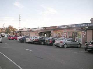
Richmond is a town in New South Wales, in the local government area of the City of Hawkesbury. It is located 19 metres above sea level on the alluvial Hawkesbury River flats, at the foot of the Blue Mountains on the Cumberland Plain. It is about 65 km by road from Sydney and about 78 km by road from Lithgow.

Westmead is a suburb in Sydney, in the state of New South Wales, Australia. Westmead is located 26 kilometres west of the Sydney central business district in the local government area of Cumberland Council and is part of the Greater Western Sydney region.

Bidwill is a suburb of Sydney, in the state of New South Wales, Australia. Bidwill is located 48 kilometres west of the Sydney central business district, in the local government area of the City of Blacktown and is part of the Greater Western Sydney region.

Glendenning is a suburb of Sydney, in the state of New South Wales, Australia. Glendenning is located 44 kilometres west of the Sydney central business district, in the local government area of the City of Blacktown and is part of the Greater Western Sydney region.
Glenwood is a suburb of Sydney, in the state of New South Wales, Australia. Glenwood is located 33 kilometres north-west of the Sydney central business district in the local government area of the City of Blacktown. Glenwood is part of the Hills District within the Greater Western Sydney region.

Plumpton is located 45 kilometres west of the Sydney central business district, in the local government area of the City of Blacktown and is part of the Greater Western Sydney region.

Woodcroft is a suburb of Sydney, in the state of New South Wales, Australia. Woodcroft is located 37 kilometres west of the Sydney central business district, in the local government area of the City of Blacktown and is part of the Greater Western Sydney region. The Woodcroft lake is near to the Bricketwood Drive and it is very popular among people to visit every morning and evening. Moreover, this place having many kids play spaces.

Wetherill Park is a suburb in Greater Western Sydney, in the state of New South Wales, Australia. Wetherill Park is located 34 kilometres west of the Sydney central business district, in the local government area of the City of Fairfield.
St Johns Park is a suburb of Sydney, in the state of New South Wales, Australia 35 kilometres west of the Sydney central business district, in the local government areas of the City of Fairfield. It is part of the Greater Western Sydney region.
Rossmore is a suburb of Sydney, in the state of New South Wales, Australia.
Leonay is a suburb of Sydney, in the state of New South Wales, Australia 58 kilometres west of the Sydney central business district, in the local government area of the City of Penrith. It is part of the Greater Western Sydney region.

Luddenham is a suburb of Sydney, in the state of New South Wales, Australia 42 kilometres west of the Sydney central business district, in the local government areas of the City of Penrith and City of Liverpool. It is part of the Greater Western Sydney region.
Lurnea is a suburb of Sydney, in the state of New South Wales, Australia. It is 35 kilometres south-west of the Sydney central business district, in the local government area of the City of Liverpool.

Cattai is an historic suburb of Sydney, in the state of New South Wales, Australia. It is located 44 kilometres north-west of the Sydney central business district and 30 kilometres north-west of Parramatta. It is in the local government areas of The Hills Shire and City of Hawkesbury. Cattai's state electoral district is Hawkesbury, and its federal electoral divisions are Berowra and Macquarie.
Edmondson Park is a suburb of Sydney, in the state of New South Wales, Australia. Edmondson Park is located 32 kilometres south-west of the Sydney central business district, in the local government area of the City of Liverpool. Some Southern areas near Bardia is part of City of Campbelltown LGA.
Greenfield Park is a suburb of Sydney, in the state of New South Wales, Australia. Greenfield Park is located 36 kilometres west of the Sydney central business district in the local government area of the City of Fairfield. The suburb has one of the most highest proportion of Assyrian people in the Sydney area and Australia per se.

Hammondville is a suburb, in south-western Sydney, in the state of New South Wales, Australia. Hammondville is located 31 kilometres south-west of the Sydney central business district in the local government area of the City of Liverpool.

Heckenberg is a suburb in south-western Sydney, in the state of New South Wales, Australia 36 kilometres south-west of the Sydney central business district, in the local government area of the City of Liverpool.

Leppington is a suburb of Sydney, in the state of New South Wales, Australia. Leppington is located 38 kilometres south-west of the Sydney central business district, in the local government areas of the City of Liverpool and Camden Council.

The Ponds is a suburb of Sydney, in the state of New South Wales, Australia. The Ponds is located approximately 40 kilometres (25 mi) west-northwest (WNW) of the Sydney central business district in the Blacktown local government area. At the 2016 census, The Ponds had an estimated resident population of 11,731.
References
- 1 2 Australian Bureau of Statistics (27 June 2017). "Hobartville (State Suburb)". 2016 Census QuickStats. Retrieved 13 June 2019.
Coordinates: 33°36′16″S150°44′35″E / 33.60458°S 150.74298°E
| | This article related to the geography of Sydney is a stub. You can help Wikipedia by expanding it. |