
Camperdown is an inner western suburb of Sydney, in the state of New South Wales, Australia. Camperdown is located 4 kilometres south-west of the Sydney central business district and is part of the Inner West region. Camperdown lies across the local government areas of the City of Sydney and Inner West Council.

Edensor Park is a suburb of Sydney, New South Wales, Australia. Edensor Park is located 38 kilometres west of the Sydney central business district in the local government area of the City of Fairfield. It is mainly a residential area, Edensor Park is part of the Greater Western Sydney region.

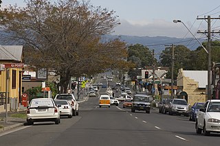
Richmond is a town in New South Wales, in the local government area of the City of Hawkesbury. It is located 19 metres above sea level on the alluvial Hawkesbury River flats, at the foot of the Blue Mountains on the Cumberland Plain. It is about 65 km by road from Sydney and about 78 km by road from Lithgow.

Menai is a suburb in southern Sydney, in the state of New South Wales, Australia 29 kilometres south of the Sydney central business district in the local government area of the Sutherland Shire.

Winmalee is a town in New South Wales, Australia. Winmalee is located 77 kilometres west of Sydney, in the local government area of the City of Blue Mountains. At the 2011 census, Winmalee had a population of 6,593.
Albion Park is a suburb situated in the Macquarie Valley in the City of Shellharbour, which is in turn one of the three local government areas that comprise the Wollongong Metropolitan Area, New South Wales, Australia. Although it is surrounded by a 'green belt' of farms, Albion Park had a population of 13,316 at the 2016 census.

Toongabbie is a suburb of Sydney, in the state of New South Wales, Australia. One of the oldest suburbs in Sydney, Toongabbie is located approximately 30 kilometres west of the Sydney central business district and is part of the Greater Western Sydney region. Toongabbie is split between the local government areas of the City of Parramatta, the City of Blacktown and Cumberland Council. The suburb is often locally referred to as "Toonie", "Toonga Bay" and "Bayside".

Bass Hill, a suburb of local government area City of Canterbury-Bankstown, is located 23 kilometres south-west of the Sydney central business district, in the state of New South Wales, Australia, and is a part of the South-western Sydney region.

Allawah is a suburb in southern Sydney, in the state of New South Wales, Australia. Allawah is 16 kilometres south of the Sydney central business district and is part of the St George area. Allawah lies in the local government area of the Georges River Council. The postcode is 2218, which is shared by the neighbouring suburb of Carlton.

Winston Hills is a suburb of Sydney, in the state of New South Wales, Australia. Winston Hills is located 28 kilometres west of the Sydney central business district in the local government areas of the City of Parramatta and The Hills Shire. Winston Hills is part of the Hills District region of Greater Western Sydney.

Lalor Park is a suburb of Sydney, in the state of New South Wales, Australia. Lalor Park is located 35 kilometres west of the Sydney central business district in the local government area of the City of Blacktown. Lalor Park is part of the Greater Western Sydney region. Lalor Park is commonly abbreviated as 'L.P'.

Sylvania Waters is a suburb in southern Sydney located in the state of New South Wales, Australia, 21 kilometres south of the Sydney central business district in the local government area of Sutherland Shire.
Roselands is a suburb to the south-west of the Sydney CBD, in the state of New South Wales, Australia. Roselands is located 16 kilometres south-west of the Sydney central business district in the City of Canterbury-Bankstown. It is one of the easternmost suburbs in the Western Sydney area.

Rosebery is a suburb of Sydney, in the state of New South Wales, Australia. It is 6 kilometres south of the Sydney central business district and is part of the local government areas of the City of Sydney and the Bayside Council.
North Richmond is a semi-rural suburb of Richmond, in the state of New South Wales, Australia. North Richmond is located 67 kilometres north-west of the Sydney central business district in the local government area of the City of Hawkesbury. It is separated from Richmond to the south-east by the Hawkesbury River.
Mount Kuring-gai is an outer suburb of Northern Sydney, in the state of New South Wales, Australia. Mount Kuring-gai is located 31 kilometres north-west of the Sydney central business district, in the local government area of Hornsby Shire.

Kellyville is a suburb of Sydney, in the state of New South Wales, Australia 36 kilometres north-west of the Sydney central business district in the local government area of The Hills Shire. It is part of the Hills District region.
Londonderry is a suburb of Greater Western Sydney, in the state of New South Wales, Australia. It is 60 kilometres north-west of the Sydney central business district, in the local government area of the City of Penrith.

Condell Park, a suburb of local government area City of Canterbury-Bankstown, is 21 kilometres south-west of the Sydney central business district, in the state of New South Wales, Australia, and is a part of the south-western Sydney region. The postcode of Condell Park is 2200, which is shared with Bankstown and Bankstown Aerodrome.
Glossodia is a semi-rural suburb of Sydney, in the state of New South Wales, Australia. Glossodia is located 68 kilometres north-west of the Sydney central business district in the local government area of the City of Hawkesbury.
