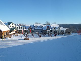
Asessippi Provincial Park is a provincial park in the Rural Municipality of Riding Mountain West, Manitoba, Canada.

Hecla-Grindstone Provincial Park is a provincial park in Manitoba, Canada, which includes Hecla Island, Grindstone, Black Island and a number of other small islands in Lake Winnipeg, one of the largest freshwater lakes in the world. The park lies adjacent to the northeast side of the Municipality of Bifrost – Riverton in Manitoba.
Birds Hill Provincial Park is a provincial park in Manitoba, Canada located in the Boreal Plains ecozone. The park protects areas representative of Aspen/Oak parkland, as well as provides opportunities for recreation. It is located 24 kilometers north of Winnipeg on Highway 59, and covers approximately 8,300 acres or 35.1 km2.

Whiteshell Provincial Park is a provincial park in southeast Manitoba, approximately 120 kilometres (75 mi) east of the city of Winnipeg. The park is considered to be a Class II protected area under the IUCN protected area management categories. It is 275,210 hectares in size.

Nopiming Provincial Park is a natural provincial park in Manitoba, Canada, located on the southeast side of the province, along the boundary with Ontario.
Atikaki Provincial Park is a wilderness park in Manitoba, Canada, located east of Lake Winnipeg along the Ontario boundary in the Canadian Shield. The area of Atikaki Provincial Park is 3,981 square kilometres (1,537 sq mi). Atikaki Provincial Park is north of Nopiming Provincial Park and borders the Woodland Caribou Provincial Park in Ontario.
The Manigotagan River is a whitewater river located in southeastern Manitoba, Canada. The river flows into the eastern side of Lake Winnipeg and it is a rare remote river of southern Canada. Situated at the river's mouth, on the shore of Lake Winnipeg, is the community of Manigotagan.

Bissett is a community situated on Rice Lake in the southeastern region of Manitoba, Canada, classified as a northern community and designated place. Located two and a half hours northeast of Winnipeg on Provincial Road 304, Bissett is an entry point to Nopiming Provincial Park.
Caribou River Provincial Wilderness Park is a provincial park in extreme north-central Manitoba, Canada. It is the northernmost provincial park in Manitoba, and borders the southern Nunavut border.

Beaudry Provincial Park is an approximately 953.4-hectare (2,356-acre) park located along the Assiniboine River west of the town of Headingley, Manitoba.

Pinawa Dam Provincial Park is a provincial park located north of Pinawa, Manitoba, on Hwy 520, overlooking the Pinawa Channel.
Birch Island Provincial Park is a remote provincial park located on Lake Winnipegosis in Manitoba, Canada. The park is bordered on its western boundary by the Swan-Pelican Provincial Forest and on its eastern side by Chitek Lake Anishinaabe Provincial Park.
Elk Island Provincial Park is a provincial park in Manitoba, Canada. The park is 10.7 square kilometres (4.1 sq mi) in size, and is considered to be a Class III protected area under the IUCN protected area management categories.
River Road Provincial Park is a provincial park in the Canadian province of Manitoba, designated by the Government of Manitoba in 1997. The park is .05 square kilometres (0.019 sq mi) in size, and is considered to be a Class V protected area under the IUCN protected area management categories.
Rivers Provincial Park is a provincial park in the Canadian province of Manitoba, designated by the Government of Manitoba in 1961. The park is .86 square kilometres (0.33 sq mi) in size and is considered to be a Class III protected area under the IUCN protected area management categories.
Sand Lakes Provincial Park is a provincial park in the Canadian province of Manitoba, designated by the Government of Manitoba in 1995. The park is 8,310 square kilometres (3,210 sq mi) in size and is considered a Class Ib protected area under the IUCN protected area management categories.
Fisher Bay Provincial Park is located along the western shore of Lake Winnipeg near the mouth of the Fisher River. It was designated as a provincial park by the Government of Manitoba in 2011. The park is 84,150 square kilometres (32,490 sq mi) in size. The park is considered to be a Class II protected area under the International Union for Conservation of Nature protected area management categories.
Colvin Lake Provincial Park is a provincial park in Manitoba, Canada, designated by the Government of Manitoba in 2010. The park is 1,630 km2 (630 sq mi) in size. It is considered a Class Ib protected area under the International Union for Conservation of Nature (IUCN) protected-area management categories.
Sturgeon Bay Provincial Park is a provincial park on the western shore of Lake Winnipeg in Manitoba, Canada. The park is considered to be a Class Ib protected area under the IUCN protected area management categories. It is 144.9 km2 (55.9 sq mi) in size.
