Riding Mountain Biosphere Reserve

Last updated
Riding Mountain Biosphere Reserve
The Riding Mountain Biosphere Reserve official logo.gif
Official Logo of the Riding Mountain Biosphere Reserve.
Canada Manitoba relief location map.jpg
Red pog.svg
Location of the Riding Mountain Biosphere Reserve main office in Manitoba, Canada.
Canada relief map 2.svg
Red pog.svg
Riding Mountain Biosphere Reserve (Canada)
Location Manitoba, Canada
Nearest city Dauphin
Coordinates 50°30′0.935″N99°54′44.686″W / 50.50025972°N 99.91241278°W / 50.50025972; -99.91241278 Coordinates: 50°30′0.935″N99°54′44.686″W / 50.50025972°N 99.91241278°W / 50.50025972; -99.91241278
Area15,000 km2 (5,800 sq mi)
Designated1986
Governing body UNESCO
Website http://www.rmbr.ca

Riding Mountain Biosphere Reserve (RMBR) is a UNESCO World Biosphere Reserve designated by the United Nations Educational, Scientific and Cultural Organization (UNESCO) in 1986 as part of its Man and the Biosphere Programme. The RMBR, which encompasses Riding Mountain National Park and twelve surrounding municipalities in the province of Manitoba, is one of 16 Biosphere Reserves in Canada. [1] Ecologically sensitive ecosystems include the grasslands, deciduous forest and boreal forest. [2] Although grasslands occupy only 7,400 of the total 1,331,800 hectares, they are considered of national importance since they exist as discrete units and the rare climax rough fescue community represents the eastern extent of its range. [3] The Biosphere Reserve extends the protection of these ecosystems outside of park boundaries. Municipalities in the Riding Mountain Biosphere Reserve include Clanwilliam – Erickson, Dauphin, Gilbert Plains, Grandview, Harrison Park, Lakeshore, McCreary, Rosedale, St. Rose, Riding Mountain West, Rossburn, and Yellowhead. [4] First Nations in the Biosphere Reserve include Rolling River First Nation, Keeseekoowenin First Nation, Waywayseecappo First Nation, and Tootinaowaziibeeng First Nation. Asessippi Provincial Park and Duck Mountain Provincial Forest also border the Biosphere Reserve. [5]

Contents

History

Created in 1986, the Riding Mountain Biosphere Reserve is a non-profit volunteer organization, managed by representatives from the surrounding area. The organization's stated mission is "to foster and encourage, through research, information exchange, education and communication, a sustainable regional economy with high biodiversity and landscape values, with Riding Mountain National Park as a key component." [6] Prior to its creation in 1986, The Riding Mountain Liaison Committee (RMNLC) was entrusted to oversee the integration of this area and surrounding communities, eleven of which participated in a consultation process. [7]

Upon establishment, the Biosphere Reserve included 18 municipalities, several of which were merged in 2015 as a result of the Manitoba Municipal Amalgamation Act enacted in 2013 by the Manitoba provincial government. A Biosphere Reserve Management Committee (BRMC) was created to oversee the area. Biosphere Reserve land situated outside of Riding Mountain National Park is both privately and publicly owned and managed.

Local initiatives hosted by the Biosphere Reserve include a spring market, a native species garden, educational programming and geocaching programs. [8] [9] Public workshops held by the Biosphere Reserve covered topics such as climate change, beaver problems, sustainable agriculture, and the potential of poplar. In 1996 when Louisiana Pacific received hardwood cutting rights, the Biosphere Reserve researched "the impact of timber harvesting on cavity nesting birds and other species found in the corridor between the Ducks and Riding Mountain.". [10] [11]

Other activities undertaken by the Biosphere Reserve include the rehabilitation of fish spawning areas on the Milk River. In December 1998 an elk in Riding Mountain National Park tested positive for bovine tuberculosis. [12] Because beavers, elk and moose freely moved within the boundary of the park and surrounding region, there was a risk of the disease spreading. [9] Some of the areas susceptible included agricultural farmland bordering the park. [7] In 2012 a Water Stewardship Project was launched in association with the Centre for Sustainable Watershed. [7] More recently funding issues have created a challenged for continued programming. [7]

Geography

Deep Lake in Riding Mountain National Park Deep Lake - Riding Mountain National Park.JPG
Deep Lake in Riding Mountain National Park

Riding Mountain Biosphere Reserve covers 15,000 square kilometres of land in South-western Manitoba, with the core area, Riding Mountain National Park (RNMP), covering nearly 3,000 square kilometres. It is some 300 km northwest of Winnipeg, Manitoba. [3] The Park, established in 1933 and governed by Parks Canada, predates RMBR by fifty-three years. It has a town site, Wasagaming, several trails, and a wild bison enclosure at Lake Audy.

Significant geographic landmarks in Riding Mountain Biosphere Reserve include the Shell River Valley in the west, Manitoba Escarpment in the East, and Valley River and Wilson River in the North. [2] [13] The local climate is cool and moist due to a higher elevation than the surrounding area. [7] Due to these unique conditions, several different ecosystems are present in the vicinity of the Biosphere Reserve, including the deciduous forest, boreal forest, and grassland. [2] Many small lakes and marshes dot the landscape in the transition zone. [7]

A total of 29, 758 individuals reside in the transition zone of the Biosphere Reserve as of the 2011 census, with an average population of 2.8 persons per square kilometre. When the area under the jurisdiction of Riding Mountain National Park is taken into account, the population density is 2.2 persons per square kilometre. [7]

Ecological Characteristics

Forests cover most of the area, dominated by aspen (Populus tremuloides). Although grasslands occupy only 7,400 of the total 1,331,800 hectares, they are considered of national importance since they exist as discrete units and the rare climax rough fescue community represents the eastern extent of its range. Grasslands once occurred throughout southern Manitoba, but have been transformed since European settlement in the late nineteenth century. The biosphere reserve also includes agricultural areas that used to be forests or grasslands. The forest ecosystem maintains many larger mammals, such as black bear (Ursus americanus), American bison (Bison bison), gray wolf (Canis lupus) and coyote (Canis latrans). [3]

Socio-Economic Characteristics

Descendants of the Ojibwa First Nations live in four relatively small Indian Reserves within the transition zone. The rest of the area is settled mainly by people of Ukrainian, English, French or Scandinavian descent. [3]

The region supports a rural agricultural economy supplemented by tourism associated principally with the national park. The national park also maintains a well-developed interpretive centre with a wide variety of public information materials. [3]

In terms of the human population, a small number of permanent residents live within the core area in the form of resident park wardens and their families at warden stations along the periphery of the National Park. However, since 2000 most of these stations have been closed. A large, seasonal population of cabin owners occupies a site in Wasagaming town in Riding Mountain National Park during the summer months, with up to 15,000 people occupying the site during peak periods. [3]

Events

Held one weekend each summer in Sandy Lake, Manitoba, in the Rural Municipality of Harrison Park, this family festival includes bed races, a pancake breakfast, fireworks display, and an interdenominational hymn. [14]

The Clear Lake Chamber Music Festival is a classical live music festival in Manitoba. The first Festival, held in 2006, featured pianist Alexander Tselyakov, cellist Yuri Hooker, violinists Daniel Scholz, and Philippe and Mark Djokic. [15]

This Canadian prairie music festival, held in Kelwood, Manitoba, features local musicians and was first held in 2006. It has featured musicians such as Fred Penner, Sierra Noble, Old Bones Buffalo, Burnt Project, Don Amero, Al Simmons, Carly Dow Band, and Scott Nolan Band. [16]

DUKE Fest is a music festival held annually in Rossburn, Manitoba since 2014. It has featured musicians such as Ryan Keown Band, Jake Boreskewich, Sonny and the Hurricanes, In Too Deep, and Tom Dowden. [17]

This winter festival, held annually in McCreary, Manitoba since 2013, is based out of McCreary Community Centre and McCreary Golf and Country Cub as of 2016. Events held in the municipality include a Maple Syrup trivia night, performances by local musicians, horse-drawn wagon rides, and sampling of maple taffy. [18]

Held for over 30 years each Canada Day long weekend, Dauphin's Countryfest is Canada's longest running country music festival with over 15,000 attendees on-site and up to 45,000 visitors over the 4 day event. The festival has featured world famous acts including the Zach Brown Band, Terri Clark, and Toby Keith.

Recreation

See also

Sources

Definition of Free Cultural Works logo notext.svg  This article incorporates text from a free content work. ( license statement/permission ). Text taken from UNESCO - MAB Biosphere Reserves Directory , UNESCO, UNESCO. To learn how to add open license text to Wikipedia articles, please see this how-to page. For information on reusing text from Wikipedia, please see the terms of use.

Related Research Articles

<span class="mw-page-title-main">Rocky Mountain National Park</span> National park in Colorado, United States

Rocky Mountain National Park is an American national park located approximately 55 mi (89 km) northwest of Denver in north-central Colorado, within the Front Range of the Rocky Mountains. The park is situated between the towns of Estes Park to the east and Grand Lake to the west. The eastern and western slopes of the Continental Divide run directly through the center of the park with the headwaters of the Colorado River located in the park's northwestern region. The main features of the park include mountains, alpine lakes and a wide variety of wildlife within various climates and environments, from wooded forests to mountain tundra.

<span class="mw-page-title-main">Tourism in Canada</span> Overview of tourism in Canada

Canada has a large domestic and foreign tourism industry. The second largest country in the world, Canada's incredible geographical variety is a significant tourist attractor. Much of the country's tourism is centred in the following regions: Toronto, Montreal, Quebec City, Vancouver/Whistler, Niagara Falls, Vancouver Island, Canadian Rockies, British Columbia's Okanagan Valley, Churchill, Manitoba and the National Capital Region of Ottawa-Gatineau. The large cities are known for their culture, diversity, as well as the many national parks and historic sites.

<span class="mw-page-title-main">Waterton Lakes National Park</span> National park in Alberta, Canada

Waterton Lakes National Park is a national park located in the southwest corner of Alberta, Canada. It borders Glacier National Park in Montana, United States. Waterton was the fourth Canadian national park, formed in 1895 and named after Waterton Lake, in turn after the Victorian naturalist and conservationist Charles Waterton. Its range is between the Rocky Mountains and prairies. This park contains 505 km2 (195 sq mi) of rugged mountains and wilderness.
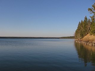
<span class="mw-page-title-main">Riding Mountain National Park</span> National park in Manitoba, Canada

Riding Mountain National Park is a national park in Manitoba, Canada. The park is located within Treaty 2 Territory and sits atop the Manitoba Escarpment. Consisting of a protected area 2,969 km2 (1,146 sq mi), the forested parkland stands in sharp contrast to the surrounding prairie farmland. It was designated a national park because it protects three different ecosystems that converge in the area; grasslands, upland boreal and eastern deciduous forests. It is most easily reached by Highway 10 which passes through the park. The south entrance is at the townsite of Wasagaming, which is the only commercial centre within the park boundaries.

McCreary is an unincorporated urban community in the Municipality of McCreary, Manitoba, Canada.
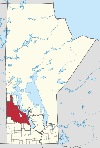
<span class="mw-page-title-main">Parkland Region</span>

Parkland is an informal geographic region of the Canadian province of Manitoba, located between Lakes Manitoba and Winnipegosis on the east and the Manitoba–Saskatchewan border on the west.

<span class="mw-page-title-main">Neepawa</span> Town in Manitoba, Canada

Neepawa is a town in Manitoba, Canada located on the Yellowhead Highway at the intersection with Highway 5. As of 2021 its population was 5,685. Neepawa was incorporated as a town in 1883. It is bordered by the Municipality of North Cypress – Langford and Rural Municipality of Rosedale. Neepawa is the self-proclaimed Lily capital of the world in part because of its Lily Festival.
<span class="mw-page-title-main">Tatra National Park, Poland</span> National park in Poland

Tatra National Park is a national park located in the Tatra Mountains in Tatra County, in the Lesser Poland Voivodeship—Małopolska region, in central-southern Poland. The park has its headquarters in the town of Zakopane.

Provincial Trunk Highway 5 is a provincial primary highway located in the Canadian province of Manitoba.

Duck Mountain Provincial Park is a provincial park, located in the Canadian province of Saskatchewan 14 km east of the town of Kamsack and stretches about 12 kilometres eastward to the Saskatchewan / Manitoba boundary. The park covers approximately 150 square kilometres. Road access to the park is via Highway 57, which connects Saskatchewan Highway 5 to Manitoba Highway 83.

<span class="mw-page-title-main">Division No. 17, Manitoba</span> Census division in Manitoba, Canada

Census Division No. 17 (Dauphin) is a census division located within the Parklands Region of the province of Manitoba, Canada. Unlike in some other provinces, census divisions do not reflect the organization of local government in Manitoba. These areas exist solely for the purposes of statistical analysis and presentation; they have no government of their own.

<span class="mw-page-title-main">Wildlife of Canada</span> Overview of the wildlife of Canada

The wildlife of Canada or biodiversity of Canada consist of over 80,000 classified species, with an equal number thought yet to be recognized. Known fauna and flora have been identified from five different kingdoms: protozoa ; chromist ; fungis ; plants ; and animals. Insects account for nearly 70 percent of recorded animal species in Canada.

Robert Sopuck is a Canadian politician who served as a Member of Parliament in the House of Commons of Canada from 2010 to 2019. First elected in a by-election on November 29, 2010, Sopuck represented the riding of Dauphin—Swan River—Marquette from 2010 to 2015 and the riding of Dauphin—Swan River—Neepawa from 2015 to 2019. He is a member of the Conservative Party of Canada.

<span class="mw-page-title-main">Beaver Hills (Alberta)</span> Upland region in Central Alberta, Canada

The Beaver Hills, also known as the Beaver Hills Moraine and the Cooking Lake Moraine, are a rolling upland region in Central Alberta, just to the east of Edmonton, the provincial capital. It consists of 1,572 square kilometres (607 sq mi) of "knob and kettle" terrain, containing many glacial moraines and depressions filled with small lakes. The landform lies partly within five different counties, Strathcona, Leduc, Beaver, Lamont and Camrose. The area is relatively undeveloped compared to the surrounding region, and is protected in part by Elk Island National Park, the Cooking Lake–Blackfoot Provincial Recreation Area, the Ministik Bird Sanctuary, Miquelon Lake Provincial Park and a number of smaller provincial natural areas. Since 2016 Beaver Hills has been a UNESCO-designated biosphere reserve.

The Prairie Mountain Health is the governing body responsible for healthcare delivery and regulation for the eponymous health region in southwest Manitoba.

<span class="mw-page-title-main">Waterton Biosphere Reserve</span> UNESCO Biosphere Reserve in Alberta, Canada

Waterton Biosphere Reserve is a UNESCO Biosphere Reserve encompassing Waterton Lakes National Park in the extreme south-west of the Province of Alberta, Canada. The reserve includes a section of the east slopes of the Rocky Mountains extending from the Continental Divide to the edge of the Canadian Great Plains to the east. The Glacier Biosphere Reserve and National Park in Montana, USA is located to the south of the area. The reserve is administered by Waterton Lakes National Park and the Waterton Biosphere Association.

The D Division is the division of the Royal Canadian Mounted Police responsible for federal policing in Manitoba and, at times, northwestern Ontario. Headquartered in Winnipeg, the division is commanded by Assistant Commissioner Jane MacLatchy and consists of 1089 police officers and 438 support staff.
<span class="mw-page-title-main">Clayoquot Sound Biosphere Reserve</span> UNESCO Biosphere Reserve in British Columbia, Canada

Clayoquot Sound Biosphere Reserve is a UNESCO Biosphere Reserve situated in Clayoquot Sound on the west coast of Vancouver Island in British Columbia, Canada. A diverse range of ecosystems exist within the biosphere reserve boundaries, including temperate coastal rainforest, ocean and rocky coastal shores.

References

  1. "Welcome to the Biosphere". Riding Mountain Biosphere Reserve. Retrieved 28 August 2015.
  2. 1 2 3 Riding Mountain Ecosystem Community Atlas. Canadian Parks and Wilderness Society. 2004. pp. 1–2. Retrieved 29 August 2015.
  3. 1 2 3 4 5 6 "Riding Mountain | United Nations Educational, Scientific and Cultural Organization". www.unesco.org. Retrieved 2016-06-14.
  4. "Partners and Related Organizations". Riding Mountain Biosphere Reserve. Retrieved 31 August 2015.
  5. "Maps and Resources". Riding Mountain Biosphere Reserve. Retrieved 31 August 2015.
  6. "About Riding Mountain Biosphere Reserve". Riding Mountain Biosphere Reserve. Retrieved 29 August 2015.
  7. 1 2 3 4 5 6 7 Stadel, Christoph (July 2015). "A Mountain in the Prairies – the Riding Mountain Biosphere Reserve, Manitoba, Canada" (PDF). Eco.mont: Journal on Protected Mountain Areas Research. 7 (2): 83–88. doi:10.1553/eco.mont-7-2s83. ISSN   2073-1558 . Retrieved March 12, 2016.
  8. "'At the Farm Gate' program links buy-local consumers, producers". Brandon Sun. 10 June 2010. Retrieved 29 August 2015.
  9. 1 2 "Riding Mountain hosts students for three-day trip". Brandon Sun. 9 June 2010. Retrieved 29 August 2015.
  10. Stilwell, Bill (November 16, 1999). "Riding Mountain biosphere Reserve". Russell Banner.
  11. Stilwell, Bill (November 16, 1999). "Riding Mountain biosphere reserve". Russell Banner.
  12. Name, Author's. "Wildlife Branch | Sustainable Development | Province of Manitoba". www.gov.mb.ca. Retrieved 2016-06-13.{{cite web}}: |first= has generic name (help)
  13. "Manitoba Ecosystem Community Atlas". Canadian Parks and Wilderness Society. 2004. Retrieved 29 August 2015.
  14. Irwin, Candy (July 29, 2011). "Sandy Lake is Worth the Trip". South Mountain Press.
  15. Villeneuve, Joanne (July 29, 2006). "There's a Lot of Depth to what he Does". Brandon Sun.
  16. "Sierra Noble Will Headline at Kelwood Fest in August". Brandon Sun. May 4, 2015.
  17. "Meet the 2015 Bands". Rossburn DUKE Fest. Retrieved 31 August 2015.
  18. "Something Sweet Coming to McCreary for Fourth Annual Maple Syrup Festival". The Neepawa Banner. February 26, 2016. Retrieved March 12, 2016.
  19. "Onanole Trail Officially Opens". The Municipality of Harrison Park. Retrieved 31 August 2015.
  20. 1 2 Drinkwater, John (August 13, 2015). "New trail connect park to Trans-Canada Trail". Neepawa Banner. Retrieved August 31, 2015.
  21. Huck, Dawn. "Official Opening of the Elk Link Trail". Trails Manitoba. Retrieved 31 August 2015.
  22. "Member Curling Clubs and Associations in Manitoba". CurlManitoba. Retrieved 31 August 2015.
  23. "Golf Manitoba - Member Directory". Golf Manitoba. Retrieved 31 August 2015.