
Lake Winnipeg is a very large, relatively shallow 24,514-square-kilometre (9,465 sq mi) lake in North America, in the province of Manitoba, Canada. Its southern end is about 55 kilometres (34 mi) north of the city of Winnipeg. Lake Winnipeg is Canada's sixth-largest freshwater lake and the third-largest freshwater lake contained entirely within Canada, but it is relatively shallow excluding a narrow 36 m (118 ft) deep channel between the northern and southern basins. It is the eleventh-largest freshwater lake on Earth. The lake's east side has pristine boreal forests and rivers that were in 2018 inscribed as Pimachiowin Aki, a UNESCO World Heritage Site. The lake is 416 km (258 mi) from north to south, with remote sandy beaches, large limestone cliffs, and many bat caves in some areas. Manitoba Hydro uses the lake as one of the largest reservoirs in the world. There are many islands, most of them undeveloped.

The Saskatchewan River is a major river in Canada. It stretches about 550 kilometres (340 mi) from where it is formed by the joining together of the North Saskatchewan River and South Saskatchewan River just east of Prince Albert, Saskatchewan, to Lake Winnipeg. It flows roughly eastward across Saskatchewan and Manitoba to empty into Lake Winnipeg. Through its tributaries the North Saskatchewan and South Saskatchewan, its watershed encompasses much of the prairie regions of Canada, stretching westward to the Rocky Mountains in Alberta and north-western Montana in the United States.

An alvar is a biological environment based on a limestone plain with thin or no soil and, as a result, sparse grassland vegetation. Often flooded in the spring, and affected by drought in midsummer, alvars support a distinctive group of prairie-like plants. Most alvars occur either in northern Europe or around the Great Lakes in North America. This stressed habitat supports a community of rare plants and animals, including species more commonly found on prairie grasslands. Lichen and mosses are common species. Trees and bushes are absent or severely stunted.

Eastern Manitoba, or the Eastman Region, is an informal geographic region of the Canadian province of Manitoba. It is bounded on the north by the Winnipeg River and Lake Winnipeg, on the east by the Manitoba-Ontario border, on the south by the Canada–US border, and on the west by the Red River. With a population of 128,855 as of the 2021 Canadian census, the Eastman Region is the second most populous region outside of the Winnipeg Metropolitan Region.
Norway House is a population centre of over 5,000 people, some 30 km (19 mi) north of Lake Winnipeg, on the bank of the eastern channel of Nelson River, in the province of Manitoba, Canada. The population centre shares the name Norway House with the northern community of Norway House and Norway House 17, a First Nation reserve of the Norway House Cree Nation. Thus, Norway House has both a Chief and a Mayor.

Grand Rapids is a town in Manitoba, Canada, on the northwestern shore of Lake Winnipeg where the Saskatchewan River enters the lake. As the name implies, the river had a significant drop at this point. In modern days, a large hydroelectric plant has been built there. Cedar Lake, a short distance upriver, provides a natural water source for the plant. Provincial Trunk Highway 6, the region's primary roadway, crosses the Saskatchewan River at the Grand Rapids Bridge.

Whiteshell Provincial Park is a provincial park in southeast Manitoba, approximately 120 kilometres (75 mi) east of the city of Winnipeg. The park is considered to be a Class II protected area under the IUCN protected area management categories. It is 275,210 hectares in size.

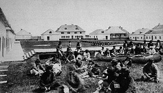
Misipawistik Cree Nation is a Cree community in northern Manitoba. Misipawistik in the local Cree language means 'Rushing Rapids', which was once a historical Canadian landmark before the construction of the Manitoba Hydro-electric Dam in the late 1950s.

The Nelson River Hydroelectric Project refers to the construction of a series of dams and hydroelectric power plants on the Nelson River in Northern Manitoba, Canada. The project began to take shape in the late 1950s, with the planning and construction of the Kelsey dam and hydroelectric power station, and later was expanded to include the diversion of the upper Churchill River into the Nelson River and the transformation of Lake Winnipeg, the world's 11th largest freshwater lake, into a hydroelectric reservoir. The project is owned and operated by Manitoba Hydro, the electrical utility in the province.
George Island Light is a lighthouse located on George Island that lies in the middle of the North Basin of Lake Winnipeg in the Canadian province of Manitoba. It is located approximately 400 km (250 mi) north from Winnipeg, and approximately halfway between the shore communities of Grand Rapids and Poplar River.
George Island is a small island located within the north basin of Lake Winnipeg in the Canadian province of Manitoba. It lies approximately 400 kilometers (250 mi) north from Winnipeg, and approximately halfway between the community of Grand Rapids on the west shore and the community of Poplar River on the east shore of the lake. A lighthouse named George Island Light is located on the island. To the west of George Island lies Little George Island.

The Boreal Plains Ecozone, as defined by the Commission for Environmental Cooperation (CEC), is a terrestrial ecozone in the western Canadian provinces of Manitoba, Saskatchewan and Alberta. It also has minor extensions into northeastern British Columbia and south-central Northwest Territories. The region extends over 779,471 km2, of which 58,981 km2 is conserved.

Little Limestone Lake is a lake located in Little Limestone Lake Provincial Park in northern Manitoba, Canada, about 500 km (310 mi) north of Winnipeg, and 65 km (40 mi) north of the town of Grand Rapids, Manitoba. It is located in the 4,095-hectare (10,120-acre) Little Limestone Lake Park Reserve, an example of karst geology, in the Manitoba Lowlands. The eastern shore is within the traditional territory of the Mosakahiken Cree Nation. Little Limestone Lake Park Reserve is an IUCN protected area. It was designated mainly for conservation of a specific natural feature of outstanding or unique value.

Beaudry Provincial Park is an approximately 953.4-hectare (2,356-acre) park located along the Assiniboine River west of the town of Headingley, Manitoba.

Brokenhead Wetland Ecological Reserve is an ecological reserve northeast of Scanterbury, Manitoba, Canada. It was established in 2005 under the Manitoba Ecological Reserves Act. It is 12.4 square kilometres (4.8 sq mi) in size.
Lake St. George Caves Ecological Reserve is an ecological reserve located west of Lake Winnipeg, Manitoba, Canada. It was established in 1997 under the Manitoba Ecological Reserves Act. It is .49 square kilometres (0.19 sq mi) in size.
Little George Island Ecological Reserve is an ecological reserve located on an island in the Lake Winnipeg, Manitoba, Canada. It was established in 2004 under the Manitoba Ecological Reserves Act. It is .15 square kilometres (0.058 sq mi) in size.
Long Point Ecological Reserve is an ecological reserve located on the west shore of Lake Winnipeg, Manitoba, Canada. It was established in 1987 under the Manitoba Ecological Reserves Act. It is 18.37 square kilometres (7.09 sq mi) in size.
Pelican Islands Ecological Reserve is an ecological reserve located on several islands in Lake Winnipeg, Manitoba, Canada. It was established in 2001 under the Manitoba Ecological Reserves Act. It is 1.3 square kilometres (0.50 sq mi) in size.
Walter Cook Caves Ecological Reserve is an ecological reserve located north of Grand Rapids, Manitoba, Canada. It was established in 2001 under the Manitoba Ecological Reserves Act. It is 32.35 square kilometres (12.49 sq mi) in size.

