Related Research Articles
Roblin is an unincorporated urban community in the Municipality of Roblin, Manitoba, Canada. It is located approximately 400 km (250 mi) northwest of Winnipeg.
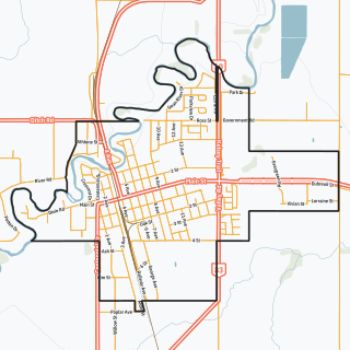
Swan River is a town in Manitoba, Canada. It is surrounded by the Municipality of Swan Valley West in the Swan River Valley region. According to the 2021 Canadian Census, Swan River had a population of 4,049, making it Manitoba's 18th largest in population.

Parkland is an informal geographic region of the Canadian province of Manitoba, located between Lakes Manitoba and Winnipegosis on the east and the Manitoba–Saskatchewan border on the west.

Benito is an unincorporated urban community in the Municipality of Swan Valley West, Manitoba, Canada.
Birch River is a local urban district in the northern portion of the Rural Municipality of Mountain, Manitoba, Canada. It is around 40 kilometers from Swan River, Manitoba.
Minitonas is an unincorporated urban community in the Municipality of Minitonas – Bowsman, Manitoba, Canada. It is surrounded by the Swan Valley and is located 15 km east of the Town of Swan River. The community is close to the Duck Mountain Provincial Park.

Duck Mountain Provincial Park is a provincial park, located in the Canadian province of Saskatchewan 14 kilometres (8.7 mi) east of the town of Kamsack and stretches about 12 kilometres (7.5 mi) eastward to the Saskatchewan / Manitoba boundary. The park covers approximately 150 km2 (58 sq mi). Road access to the park is via Highway 57, which connects Saskatchewan Highway 5 to Manitoba Highway 83.
The Rural Municipality of Edward is a former rural municipality (RM) in the Canadian province of Manitoba. It was originally incorporated as a rural municipality on December 1, 1905. It ceased on January 1, 2015 as a result of its provincially mandated amalgamation with the RM of Albert and the RM of Arthur to form the Municipality of Two Borders.
The Rural Municipality of Winchester is a former rural municipality (RM) in the Canadian province of Manitoba. It was originally incorporated as a rural municipality on November 1, 1890. It ceased on January 1, 2015 as a result of its provincially mandated amalgamation with the Town of Deloraine to form the Municipality of Deloraine – Winchester.

The Rural Municipality of Mountain is a rural municipality (RM) in the Parkland Region of Manitoba, western Canada.

The Rural Municipality of Fertile Valley No. 285 is a rural municipality (RM) in the Canadian province of Saskatchewan within Census Division No. 12 and SARM Division No. 5. It is located in the southwest portion of the province.
The Porcupine Hills refer to various groups of hills and uplands located in the prairie provinces of Canada, specifically the provinces of Saskatchewan and Manitoba. They are part of the Manitoba Escarpment, which was the shoreline of the ancient glacial Lake Agassiz. The hills are located north-west of Swan River, Manitoba, and are the headwaters of the Swan River. The highest elevation in the Porcupine Hills is Hart Mountain, at an elevation of 823 metres (2,700 ft), which makes it Manitoba's second-highest point. The Porcupine Provincial Forest surrounds the area.
The Rural Municipality of Swan River is a former rural municipality (RM) in the Canadian province of Manitoba. It was originally incorporated as a rural municipality on May 1, 1901. It ceased on January 1, 2015 as a result of its provincially mandated amalgamation with the Village of Benito to form the Municipality of Swan Valley West.
Welwyn is a special service area in the Rural Municipality of Moosomin No. 121, Saskatchewan, Canada that held village status prior to May 2018. It is located in the southeastern portion of Saskatchewan, near the Manitoba border. The community was named for Welwyn, in Hertfordshire, England at the suggestion of James Wake, who homesteaded just across the Manitoba border. In 2016, the population was 133.

The Rural Municipality of Moose Mountain No. 63 is a rural municipality (RM) in the Canadian province of Saskatchewan within Census Division No. 1 and SARM Division No. 1. It is located in the south-east portion of the province.
The Tootinaowaziibeeng Treaty Reserve is a First Nation located 35 km east of Roblin, Manitoba, 74 km west of Dauphin, Manitoba, and approximately 5 km north of PTH #5. Tootinaowaziibeeng is a Treaty 4 First Nation.
Manitoba's Porcupine Provincial Forest lies adjacent to the province's western border. The forest has an area of 2,090 km2 and is located mostly in an unorganized part of Census Division No. 20, with small parts of it extending southward into the Rural Municipality of Swan River, and eastward into the Rural Municipality of Mountain, both of which are in the same census division.
Manitoba's Swan-Pelican Provincial Forest lies just west of Lake Winnipegosis, and is named for the two smaller lakes in the area, Swan Lake and Pelican Lake. The forest has an area of 3,705 km2, and is the second-largest provincial forest in Manitoba. Most of the forest is located within the unorganized portion of Census Division No. 19, but its southernmost reaches extend into the Rural Municipality of Mountain (South). A fairly newly established forest, it was not officially recognized as a provincial forest until 1987.

The Municipality of Swan Valley West (MSVW) is a rural municipality (RM) in the Parkland Region of Manitoba, Canada. It is located in the far western portion of Manitoba, along the provincial border with Saskatchewan.
References
- ↑ Government of Canada, Natural Resources Canada. "Place names - Duck Mountain Provincial Forest". www4.rncan.gc.ca.