McKinley, St. Louis County, Minnesota

Last updated

McKinley, Minnesota
St. Louis County Minnesota Incorporated and Unincorporated areas McKinley Highlighted.svg
Location of the city of McKinley
within Saint Louis County, Minnesota
Coordinates: 47°30′46″N92°24′40″W / 47.51278°N 92.41111°W / 47.51278; -92.41111
CountryUnited States
State Minnesota
County St. Louis
Founded1890
Incorporated 1892
Government
   Mayor Tony Nygaard
Area
[1]
  Total1.571 sq mi (4.070 km2)
  Land1.426 sq mi (3.692 km2)
  Water0.147 sq mi (3.812 km2)
Elevation
[2]
1,480 ft (451 m)
Population
 (2020) [3]
  Total103
  Estimate 
(2022) [4]
104
  Density72.23/sq mi (27.90/km2)
Time zone UTC–6 (Central (CST))
  Summer (DST) UTC–5 (CDT)
ZIP Code
55741
Area code 218
FIPS code 27-39140
GNIS feature ID0661888 [2]
Sales tax 7.375% [5]

McKinley is a city in Saint Louis County, Minnesota, United States; located within the Iron Range region of Minnesota. The population was 103 at the 2020 census. [3]

Contents

State Highway 135 (MN 135), Saint Louis County Road 20 (CR 20), and Main Street are three of the main routes in McKinley. [6]

McKinley is located seven miles east of the city of Virginia. Gilbert and Biwabik are nearby.

History

A post office called McKinley was established in 1892, and remained in operation until 1991. [7] The city was named for three McKinley brothers (Duncan, John, and William) who were businessmen in the mining industry. [8] McKinley was incorporated in 1892. [8]

Geography

According to the United States Census Bureau, the city has a total area of 1.571 square miles (4.07 km2); 1.426 square miles (3.69 km2) is land and 0.147 square miles (0.38 km2) is water. [1]

Demographics

Historical population
CensusPop.Note
1900 262
1910 41156.9%
1920 395−3.9%
1930 304−23.0%
1940 235−22.7%
1950 196−16.6%
1960 408108.2%
1970 317−22.3%
1980 230−27.4%
1990 116−49.6%
2000 80−31.0%
2010 12860.0%
2020 103−19.5%
2022 (est.)104 [4] 1.0%
U.S. Decennial Census [9]
2020 Census [3]

2010 census

As of the 2010 census, there were 128 people, 56 households, and 36 families living in the city. The population density was 87.7 inhabitants per square mile (33.9/km2). There were 67 housing units at an average density of 45.9 per square mile (17.7/km2). The racial makeup of the city was 93.8% White, 4.7% from other races, and 1.6% from two or more races. Hispanic or Latino of any race were 6.3% of the population.

There were 56 households, of which 28.6% had children under the age of 18 living with them, 48.2% were married couples living together, 12.5% had a female householder with no husband present, 3.6% had a male householder with no wife present, and 35.7% were non-families. 32.1% of all households were made up of individuals, and 21.4% had someone living alone who was 65 years of age or older. The average household size was 2.29 and the average family size was 2.92.

The median age in the city was 42.5 years. 25.8% of residents were under the age of 18; 5.5% were between the ages of 18 and 24; 19.5% were from 25 to 44; 29.7% were from 45 to 64; and 19.5% were 65 years of age or older. The gender makeup of the city was 43.8% male and 56.3% female.

2000 census

As of the 2000 census, there were 80 people, 37 households, and 25 families living in the city. The population density was 103.3 inhabitants per square mile (39.9/km2). There were 43 housing units at an average density of 55.5 per square mile (21.4/km2). The racial makeup of the city was 97.50% White, and 2.50% from two or more races. 28.6% were of Slovene, 14.3% German, 11.9% English, 9.5% Norwegian and 7.1% Austrian ancestry.

There were 37 households, out of which 24.3% had children under the age of 18 living with them, 62.2% were married couples living together, 2.7% had a female householder with no husband present, and 32.4% were non-families. 32.4% of all households were made up of individuals, and 16.2% had someone living alone who was 65 years of age or older. The average household size was 2.16 and the average family size was 2.68.

In the city, the population was spread out, with 20.0% under the age of 18, 6.3% from 18 to 24, 28.8% from 25 to 44, 16.3% from 45 to 64, and 28.8% who were 65 years of age or older. The median age was 43 years. For every 100 females, there were 110.5 males. For every 100 females age 18 and over, there were 93.9 males.

The median income for a household in the city was $28,750, and the median income for a family was $48,750. Males had a median income of $36,250 versus $20,313 for females. The per capita income for the city was $14,384. There were 16.7% of families and 30.5% of the population living below the poverty line, including 80.0% of under eighteens and none of those over 64.

Related Research Articles

<span class="mw-page-title-main">McGrath, Minnesota</span> City in Minnesota, United States

McGrath is a city in Aitkin County, Minnesota, United States. The population was 80 at the 2010 census.

<span class="mw-page-title-main">McGregor, Minnesota</span> City in Minnesota, United States

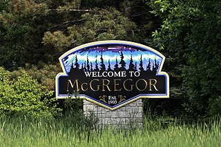
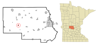
McGregor is a city in Aitkin County, Minnesota, United States. The population was 391 at the 2010 census.

Bull Moose Township is a township in Cass County, Minnesota, United States. The population was 107 as of the 2000 census. This township was named after the Bull Moose Party.

Bungo Township is a township in Cass County, Minnesota, United States. The population was 111 as of the 2000 census. Bungo Township was named for the family of George Bonga.

McKinley Township is a township in Cass County, Minnesota, United States. The population was 130 at the 2000 census. McKinley Township was named for William McKinley, 25th President of the United States.

<span class="mw-page-title-main">Isanti, Minnesota</span> City in the United States

Isanti is a city in Isanti County, Minnesota, United States. The population was 6,804 at the 2020 census. The name Isanti is composed of two Dakota words: isan ("knife") and ati ("camp"), and refers to the Santee Dakota people.

<span class="mw-page-title-main">Harding, Minnesota</span> City in Minnesota, United States

Harding is a city in Morrison County, Minnesota, United States, along the Platte River. The population was 123 at the 2020 census.

<span class="mw-page-title-main">Bluffton, Minnesota</span> City in Minnesota, United States

Bluffton is a city in Otter Tail County, Minnesota, United States, along the Leaf River. The population was 210 at the 2020 census.

<span class="mw-page-title-main">Clitherall, Minnesota</span> City in Minnesota, United States

Clitherall is a city in Otter Tail County, Minnesota, United States. The population was 62 at the 2020 census.

<span class="mw-page-title-main">Deer Creek, Minnesota</span> City in Minnesota, United States

Deer Creek is a city in Otter Tail County, Minnesota, United States. The population was 330 at the 2020 census.

<span class="mw-page-title-main">Henning, Minnesota</span> City in Minnesota, United States

Henning is a city in Otter Tail County, Minnesota, United States. The population was 854 at the 2020 census.

<span class="mw-page-title-main">Richville, Minnesota</span> City in Minnesota, United States

Richville is a city in Otter Tail County, Minnesota, United States. The population was 77 as of the 2020 census.

<span class="mw-page-title-main">Urbank, Minnesota</span> City in Minnesota, United States

Urbank is a city in Otter Tail County, Minnesota, United States. The population was 52 at the 2020 census.

<span class="mw-page-title-main">McIntosh, Minnesota</span> City in Minnesota, United States

McIntosh is a city in Polk County, Minnesota, United States. It is part of the Grand Forks, ND-MN Metropolitan Statistical Area. The population was 606 at the 2020 census.

<span class="mw-page-title-main">Gilbert, Minnesota</span> City in Minnesota, United States

Gilbert is a city in St. Louis County, Minnesota, United States. The population was 1,799 at the 2010 census. State Highway 37 and State Highway 135 are two of the main routes in Gilbert. Gilbert is part of the Quad Cities, with Virginia, Eveleth, and Mountain Iron. The city is named for Giles Gilbert, who led the exploration of the McKinley mine property in the 1890s.

<span class="mw-page-title-main">Tower, Minnesota</span> City in Minnesota, United States

Tower is a city located in Saint Louis County, Minnesota, United States. As of the 2020 census, the city had a total population of 430. State Highways 1, 169, and 135 are three of the main routes in Tower. Tower is located on the southern shore of Lake Vermilion.

<span class="mw-page-title-main">Federal Dam, Minnesota</span> City in Minnesota, United States

Federal Dam is a city in Cass County, Minnesota, United States, near Leech Lake. The population was 110 at the 2010 census. It is part of the Brainerd Micropolitan Statistical Area.

<span class="mw-page-title-main">Spring Hill, Minnesota</span> City in Minnesota, United States

Spring Hill is a city in Stearns County, Minnesota, United States. The population was 85 at the 2010 census. It is part of the St. Cloud Metropolitan Statistical Area.

<span class="mw-page-title-main">Minnesota Lake, Minnesota</span> City in Minnesota, United States

Minnesota Lake is a city in Blue Earth and Faribault counties in the State of Minnesota. The population was 661 at the 2020 census. The bulk of the city is in Faribault County; a small part extends into Blue Earth County.

McKinley is an unorganized territory in Kittson County, Minnesota, United States. The population was 42 at the 2000 census.

References

  1. 1 2 "2023 U.S. Gazetteer Files". United States Census Bureau. Retrieved July 24, 2022.
  2. 1 2 U.S. Geological Survey Geographic Names Information System: McKinley, St. Louis County, Minnesota
  3. 1 2 3 "Explore Census Data". United States Census Bureau . Retrieved January 23, 2024.
  4. 1 2 "City and Town Population Totals: 2020-2022". United States Census Bureau. January 23, 2024. Retrieved January 23, 2024.
  5. "McKinley (MN) sales tax rate" . Retrieved January 23, 2024.
  6. Source: Official State of Minnesota Highway Map - 2007/2008 edition
  7. "St. Louis County". Jim Forte Postal History. Retrieved August 7, 2015.
  8. 1 2 Upham, Warren (1920). Minnesota Geographic Names: Their Origin and Historic Significance. Minnesota Historical Society. p.  485.
  9. United States Census Bureau. "Census of Population and Housing" . Retrieved June 4, 2015.