Van Buren Township, St. Louis County, Minnesota

Last updated

Van Buren Township, Minnesota
USA Minnesota location map.svg
Red pog.svg
Van Buren Township, Minnesota
Location within the state of Minnesota
Usa edcp location map.svg
Red pog.svg
Van Buren Township, Minnesota
Van Buren Township, Minnesota (the United States)
Coordinates: 46°58′32″N92°50′31″W / 46.97556°N 92.84194°W / 46.97556; -92.84194
Country United States
State Minnesota
County Saint Louis
Area
  Total35.6 sq mi (92.2 km2)
  Land35.3 sq mi (91.4 km2)
  Water0.3 sq mi (0.8 km2)
Elevation
1,257 ft (383 m)
Population
 (2010)
  Total189
  Density5.3/sq mi (2.0/km2)
Time zone UTC-6 (Central (CST))
  Summer (DST) UTC-5 (CDT)
FIPS code 27-66586 [1]
GNIS feature ID0665851 [2]

Van Buren Township is a township in Saint Louis County, Minnesota, United States. It was named for Martin Van Buren, the eighth President of the United States. [3] The population was 189 at the 2010 census. [4]

Contents

State Highway 73 (MN 73) and Saint Louis County Road 29 (CR 29) are two of the main routes in the township. Floodwood is nearby.

Geography

According to the United States Census Bureau, the township has a total area of 35.6 square miles (92 km2); 35.3 square miles (91 km2) is land and 0.3 square miles (0.78 km2), or 0.87%, is water.

The Saint Louis River flows through the southern and east–central portions of Van Buren Township.

The Whiteface River briefly enters the east–central part of the township.

The Floodwood River flows through the western portion of Van Buren Township.

Adjacent townships, cities, and communities

The following are adjacent to Van Buren Township :

Demographics

At the 2000 census there were 175 people, 66 households, and 48 families living in the township. The population density was 5.0 people per square mile (1.9/km2). There were 89 housing units at an average density of 2.5/sq mi (1.0/km2). The racial makeup of the township was 98.86% White, 0.57% Native American and 0.57% Asian. [1] Of the 66 households 33.3% had children under the age of 18 living with them, 69.7% were married couples living together, and 25.8% were non-families. 21.2% of households were one person and 7.6% were one person aged 65 or older. The average household size was 2.65 and the average family size was 3.08.

The age distribution was 25.7% under the age of 18, 6.9% from 18 to 24, 26.9% from 25 to 44, 28.0% from 45 to 64, and 12.6% 65 or older. The median age was 40 years. For every 100 females, there were 127.3 males. For every 100 females age 18 and over, there were 120.3 males.

The median household income was $33,250 and the median family income was $39,063. Males had a median income of $36,250 versus $36,875 for females. The per capita income for the township was $16,509. About 11.1% of families and 16.8% of the population were below the poverty line, including 17.5% of those under the age of eighteen and 46.7% of those sixty five or over.

Related Research Articles

<span class="mw-page-title-main">St. Louis County, Minnesota</span> County in Minnesota, United States

St. Louis County is a county located in the Arrowhead Region of the U.S. state of Minnesota. As of the 2020 census, the population was 200,231. Its county seat is Duluth. It is the largest county in Minnesota by land area, and the largest in the United States by total area east of the Mississippi River, ahead of Aroostook County, Maine.

Alborn Township is a township in Saint Louis County, Minnesota, United States. At the 2010 census, the population was 460.

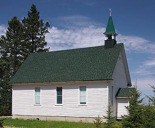
Arrowhead Township is a township in Saint Louis County, Minnesota, United States. The population was 223 at the 2010 census.

Cedar Valley Township is a township in Saint Louis County, Minnesota, United States. Cedar Valley Township was named for the white cedar in the valley of the Floodwood River. The population was 195 at the 2010 census.

Cotton Township is a township in Saint Louis County, Minnesota, United States. The population was 445 at the 2010 census.

<span class="mw-page-title-main">Elmer Township, St. Louis County, Minnesota</span> Township in Minnesota, United States

Elmer Township is a township in Saint Louis County, Minnesota, United States. The population was 151 at the 2010 census.

Fine Lakes Township is a township in Saint Louis County, Minnesota, United States. The population was 134 at the 2010 census.

<span class="mw-page-title-main">Floodwood, Minnesota</span> City in Minnesota, United States

Floodwood is a city in Saint Louis County, Minnesota, United States. The population was 528 at the 2010 census.

Floodwood Township is a township in Saint Louis County, Minnesota, United States. The population was 280 at the 2010 census. The township took its name from the Floodwood River.

French Township is a township in Saint Louis County, Minnesota, United States. The population was 567 at the 2010 census.

Halden Township is a township in Saint Louis County, Minnesota, United States. The population was 129 at the 2010 census.

Kelsey Township is a township in Saint Louis County, Minnesota, United States. The population was 140 at the 2010 census.

<span class="mw-page-title-main">Meadowlands Township, St. Louis County, Minnesota</span> Township in Minnesota, United States

Meadowlands Township is a township in Saint Louis County, Minnesota, United States. The population was 304 at the 2010 census.

Ness Township is a township in Saint Louis County, Minnesota, United States. The population was 62 at the 2010 census.

New Independence Township is a township in Saint Louis County, Minnesota, United States. The population was 299 at the 2010 census.

Northland Township is a township in Saint Louis County, Minnesota, United States. The population was 169 at the 2010 census.

Prairie Lake Township is a township in Saint Louis County, Minnesota, United States. The population was 50 at the 2010 census.

Toivola Township is a township in Saint Louis County, Minnesota, United States. At the 2010 census, the population was 170. Toivola is a name Finnish in origin.

<span class="mw-page-title-main">Meadowlands, Minnesota</span> City in Minnesota, United States

Meadowlands is a city in Saint Louis County, Minnesota, United States. The population was 134 at the 2010 census.

Potshot Lake is an unorganized territory in Saint Louis County, Minnesota, United States, located near Floodwood. The population was 73 at the 2000 census.

References

  1. 1 2 "U.S. Census website". United States Census Bureau . Retrieved January 31, 2008.
  2. "US Board on Geographic Names". United States Geological Survey. October 25, 2007. Retrieved January 31, 2008.
  3. Upham, Warren (1920). Minnesota Geographic Names: Their Origin and Historic Significance. Minnesota Historical Society. p.  491.
  4. "Race, Hispanic or Latino, Age, and Housing Occupancy: 2010 Census Redistricting Data (Public Law 94-171) Summary File (QT-PL), Van Buren township, St. Louis County, Minnesota". United States Census Bureau . Retrieved October 26, 2011.