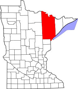
Soudan, Minnesota

Last updated

Soudan
USA Minnesota location map.svg
Red pog.svg
Soudan
Location of the community of Soudan
within Breitung Township, Saint Louis County
Coordinates: 47°48′57″N92°14′16″W / 47.81583°N 92.23778°W / 47.81583; -92.23778
Country United States
State Minnesota
County Saint Louis
Township Breitung Township
Area
[1]
  Total0.68 sq mi (1.76 km2)
  Land0.68 sq mi (1.76 km2)
  Water0.00 sq mi (0.00 km2)
Elevation
[2]
1,437 ft (438 m)
Population
 (2020)
  Total385
  Density566.18/sq mi (218.61/km2)
Time zone UTC-6 (Central (CST))
  Summer (DST) UTC-5 (CDT)
ZIP codes
55782
Area code 218
GNIS feature ID662492 [2]

Soudan is an unincorporated community and census-designated place (CDP) in Breitung Township, Saint Louis County, Minnesota, United States. As of the 2010 census, its population was 446. [3]

Contents

The community is located immediately east of the city of Tower on State Highway 1 (MN 1) and State Highway 169 (MN 169).

It is the home of McKinley Park, a park and campground operated by Breitung Township, [4] named in honor of former President of the United States, William McKinley, who was in office from 1897 to 1901.

The Soudan Underground Mine State Park is located nearby. The park contains the University of Minnesota's Soudan Underground Laboratory which houses detectors, including MINOS, over 700 meters below the surface of the Earth. Both the mine and the underground laboratory are open for tours.

It has a post office with the ZIP code 55782. [5]

Demographics

Historical population
CensusPop.Note
2020 385
U.S. Decennial Census [6]

History

The village of Soudan was established March 3, 1885. Soudan obtained its name from D. H. Bacon, general manager of the Soudan Underground mine. Bacon said that the severe winter cold is a strong contrast with the tropical heat of the Soudan (or Sudan) region in Africa, according to the online resource "Minnesota Place Names" from the Minnesota Historical Society. [7] The village had a post office, established as Tower Mines in 1887 and changed to Soudan in 1888; associated with Tower Junction. [8] Soudan has since returned to being an unincorporated community.

The first mining exploration of the area took place in 1865. [9]

According to the 1905 Legislative Manual of the State of Minnesota, the first mining done in northern Minnesota took place at Soudan in 1882. The Duluth & Iron Range Railroad had been built to the area. In 1886 the road was sold to the Minnesota Iron Company, which was absorbed into the Federal Steel Company and then into the United States Steel Corporation (operated by the Oliver Mining Company). [10]

In 1903, the town was described as being located on the property of the mining company and no stores or saloons were allowed. The number of mine workers varied between 500 and 700 men. [11]

Darby Nelson (1940-2022), writer and politician, was born in Soudan. [12]

See also

Related Research Articles

<span class="mw-page-title-main">St. Louis County, Minnesota</span> County in Minnesota, United States

St. Louis County is a county located in the Arrowhead Region of the U.S. state of Minnesota. As of the 2020 census, the population was 200,231. Its county seat is Duluth. It is the largest county in Minnesota by land area, and the largest in the United States by total area east of the Mississippi River, ahead of Aroostook County, Maine.

<span class="mw-page-title-main">Lake County, Minnesota</span> County in Minnesota, United States

Lake County is a county in the U.S. state of Minnesota. As of the 2020 census, the population was 10,905. Its county seat is Two Harbors.

<span class="mw-page-title-main">Trout Lake Township, Itasca County, Minnesota</span> Township in Minnesota, United States

Trout Lake Township is located in north central Minnesota in Itasca County, United States. It is bordered by the City of Coleraine to the west and north, City of Bovey on the north, an unorganized township on the east, and Blackberry Township to the south. Town government was adopted on March 6, 1894. The population was 1,056 at the 2020 census.

Breitung Township is a township in Saint Louis County, Minnesota, United States. The population was 605 at the 2010 census.

Eagles Nest Township is a township in Saint Louis County, Minnesota, United States. The population was 242 at the 2010 census.

<span class="mw-page-title-main">Gilbert, Minnesota</span> City in Minnesota, United States

Gilbert is a city in St. Louis County, Minnesota, United States. The population was 1,799 at the 2010 census. State Highway 37 and State Highway 135 are two of the main routes in Gilbert. Gilbert is part of the Quad Cities, with Virginia, Eveleth, and Mountain Iron. The city is named for Giles Gilbert, who led the exploration of the McKinley mine property in the 1890s.

Kugler Township is a township in Saint Louis County, Minnesota, United States. The population was 175 at the 2010 census.

<span class="mw-page-title-main">McKinley, St. Louis County, Minnesota</span> City in Minnesota, United States

McKinley is a city in Saint Louis County, Minnesota, United States; located within the Iron Range region of Minnesota. The population was 128 at the 2010 census.

<span class="mw-page-title-main">Tower, Minnesota</span> City in Minnesota, United States

Tower is a city located in Saint Louis County, Minnesota, United States. As of the 2020 census, the city had a total population of 430. State Highways 1, 169, and 135 are three of the main routes in Tower. Tower is located on the southern shore of Lake Vermilion.

Vermilion Lake Township is a township in Saint Louis County, Minnesota, United States. The population was 278 at the 2010 census.

<span class="mw-page-title-main">Iron Range</span> Iron-ore mining districts around Lake Superior in the United States and Canada

The Iron Range is collectively or individually a number of elongated iron-ore mining districts around Lake Superior in the United States and Canada. Much of the ore-bearing region lies alongside the range of granite hills formed by the Giants Range batholith. These cherty iron ore deposits are Precambrian in the Vermilion Range and middle Precambrian in the Mesabi and Cuyuna ranges, all in Minnesota. The Gogebic Range in Wisconsin and the Marquette Iron Range and Menominee Range in Michigan have similar characteristics and are of similar age. Natural ores and concentrates were produced from 1848 until the mid-1950s, when taconites and jaspers were concentrated and pelletized, and started to become the major source of iron production.

Edward Breitung was a politician from the U.S. state of Michigan. He served one term in the United States House of Representatives from 1883 to 1885.

<span class="mw-page-title-main">Lake Vermilion</span> Lake in the state of Minnesota, United States

Lake Vermilion is a shallow freshwater lake in northeastern Minnesota, United States. The Ojibwe originally called the lake Onamanii-zaaga'iganiing, which means “the evening sun tinting the water a reddish color”. French fur traders translated this to the Latin word Vermilion, which is a red pigment. Lake Vermilion is located between the towns of Tower on the east and Cook on the west, in the heart of Minnesota's Arrowhead Region at Vermilion Iron Range. The area was mined from the late 19th century until the 1960s, and the Soudan Mine operated just south of the lake.

<span class="mw-page-title-main">Lake Vermilion-Soudan Underground Mine State Park</span> United States historic place

The Lake Vermilion-Soudan Underground Mine State Park is a Minnesota state park at the site of the Soudan Underground Mine, on the south shore of Lake Vermilion, in the Vermilion Range (Minnesota). The mine is known as Minnesota's oldest, deepest, and richest iron mine, and now hosts the Soudan Underground Laboratory. As the Soudan Iron Mine, it has been designated a U.S. National Historic Landmark.

McComber is an unincorporated community in Eagles Nest Township, Saint Louis County, Minnesota, United States.

Brunswick is an unincorporated community in Brunswick Township, Kanabec County, Minnesota, United States. The community is located between Mora and Rock Creek at the junction of State Highway 65 and State Highway 70.

Goodland is an unincorporated community in Goodland Township, Itasca County, Minnesota, United States.

Lake George is an unincorporated community and census-designated place (CDP) in Lake George Township, Hubbard County, Minnesota, United States. As of the 2010 census, its population was 230.

<span class="mw-page-title-main">Elcor, Minnesota</span> Ghost town in Minnesota, United States

Elcor is a ghost town, or more properly, an extinct town, in the U.S. state of Minnesota that was inhabited between 1897 and 1956. It was built on the Mesabi Iron Range near the city of Gilbert in St. Louis County. Elcor was its own unincorporated community before it was abandoned and was never a neighborhood proper of the city of Gilbert. Not rating a figure in the national census, the people of Elcor were only generally considered to be citizens of Gilbert. The area where Elcor was located was annexed by Gilbert when its existing city boundaries were expanded after 1969.

<span class="mw-page-title-main">Stuntz Bay Boathouse Historic District</span> Historic district in Minnesota, United States

The Stuntz Bay Boathouse Historic District comprises a row of 143 boathouses on Lake Vermilion in Breitung Township, Minnesota, United States. They were mostly built in the first half of the 20th century by employees of the adjacent Soudan Iron Mine. The mining company provided the lots to employees as a reward for their years of service, and the miners did their own construction. Most of the boathouses were built with tamarack logs and scrap corrugated metal from the mine property. Boating and fishing were major pastimes for the mine employees and their families in their leisure hours, and the mining company promoted access to outdoor recreation as a perk of employment. The Stuntz Bay Boathouses were listed as a historic district on the National Register of Historic Places in 2007 for their local significance in the themes of architecture, entertainment/recreation, industry, and social history. They were nominated for illustrating the personal lives of the miners and vernacular metal architecture.

References

  1. "2020 U.S. Gazetteer Files". United States Census Bureau. Retrieved July 24, 2022.
  2. 1 2 "Soudan, Minnesota". Geographic Names Information System . United States Geological Survey, United States Department of the Interior.
  3. "U.S. Census website". United States Census Bureau . Retrieved May 14, 2011.
  4. McKinley Park Campground http://www.mckinleypark.us
  5. Zip Code Lookup
  6. "Census of Population and Housing". Census.gov. Retrieved June 4, 2016.
  7. Upham, Warren (1920). Minnesota Geographic Names: Their Origin and Historic Significance. Minnesota Historical Society. p.  490.
  8. Minnesota Place Names: A Geographical Encyclopedia. Minnesota Historical Society website. "Minnesota Place Names - Home Page". Archived from the original on June 20, 2007. Retrieved June 24, 2007.
  9. Minnesota, A State Guide. By Minnesota Federal Writers' Project of the Works Progress Administration. New York: Viking Press, 1938.
  10. Legislative Manual of the State of Minnesota. By Minnesota Legislature, Secretary of State, 1905 p. 320.
  11. Biennial report of the Bureau of Labor of the State of Minnesota. By Minnesota Bureau of Labor. St. Paul: Pioneer Press Company, 1902. p. 363
  12. Darby Miles Nelson-obituary