
Great Scott Township is a township in Saint Louis County, Minnesota, United States. The population was 561 at the 2010 census.
Rollins is an unincorporated community in Ault Township, Saint Louis County, Minnesota, United States.
Collegeville is an unincorporated community in St. Wendel Township, Stearns County, Minnesota, United States, near St. Joseph. The community is located near the junction of Collegeville Road and Old Collegeville Road. Nearby is Saint John's Abbey, a large Benedictine monastery.
Fairbanks is an unincorporated community in Fairbanks Township, Saint Louis County, Minnesota, United States; located within the Superior National Forest.
Greaney is an unincorporated community in Saint Louis County, Minnesota, United States. Greaney is located within ZIP code 55771, based in Orr.
Kelsey is an unincorporated community in Kelsey Township, Saint Louis County, Minnesota, United States.
Peary is an unincorporated community in Saint Louis County, Minnesota, United States.
Payne is an unincorporated community in Meadowlands Township, Saint Louis County, Minnesota, United States.
Culver is an unincorporated community in Saint Louis County, Minnesota, United States.
Angora is an unincorporated community in Angora Township, Saint Louis County, Minnesota, United States.
Shaw is an unincorporated community in Saint Louis County, Minnesota, United States; located on Saint Louis County Road 15, near Saint Louis County Road 49.
Taft is an unincorporated community in Grand Lake Township, Saint Louis County, Minnesota, United States.
Skibo is an unincorporated community in Bassett Township, Saint Louis County, Minnesota, United States.
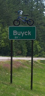
Buyck is an unincorporated community in Portage Township, Saint Louis County, Minnesota, United States.
Keenan is an unincorporated community in Clinton Township, Saint Louis County, Minnesota, United States.
Peyla is an unincorporated community in Vermilion Lake Township, Saint Louis County, Minnesota, United States.
Fermoy is an abandoned townsite in McDavitt Township, Saint Louis County, Minnesota, United States. It was located near the communities of Sax and Kelsey. Fermoy was near the intersection of Kolu Road, Cranberry Lane, and Admiral Road South. Saint Louis County Highway 7 is nearby.
Cedar is a neighborhood of Oak Grove, Anoka County, Minnesota, United States. It was formally absorbed into the city of Oak Grove in 1993. Nearby places include the city of East Bethel. Cedar is located along Cedar Drive, on the south side of Viking Boulevard. Cedar Creek flows nearby.

The following outline is provided as an overview of and topical guide to the U.S. state of Minnesota:
Wahlsten is an unincorporated community in Kugler Township, Saint Louis County, Minnesota, United States.

