
St. Louis County is a county located in the Arrowhead Region of the U.S. state of Minnesota. As of the 2020 census, the population was 200,231. Its county seat is Duluth. It is the largest county in Minnesota by land area, and the largest in the United States by total area east of the Mississippi River, ahead of Aroostook County, Maine.
Duluth Township is a township in Saint Louis County, Minnesota, United States. The population was 1,941 at the 2010 census.
Gnesen Township is a township in Saint Louis County, Minnesota, United States. The population was 1,683 at the 2010 census.

Hermantown is a city in Saint Louis County, Minnesota, United States. The population was 10,221 at the 2020 census. A suburb of Duluth, it was at one point the county's only city to grow in population, as much of the area's residential and commercial expansion occurred there. Hermantown is near the tip of Lake Superior.
Lakewood Township is a township in Saint Louis County, Minnesota, United States. The population was 2,252 in 2018 as estimated by the Minnesota State Demographic Center.
Midway Township is a township in Saint Louis County, Minnesota, United States. The population was 1,399 at the 2010 census.
Rice Lake is a city in Saint Louis County, Minnesota, United States. The population was 4,112 at the 2020 census.
Brimson is an unincorporated community in Ault Township, Saint Louis County, Minnesota, United States.
Rollins is an unincorporated community in Ault Township, Saint Louis County, Minnesota, United States.
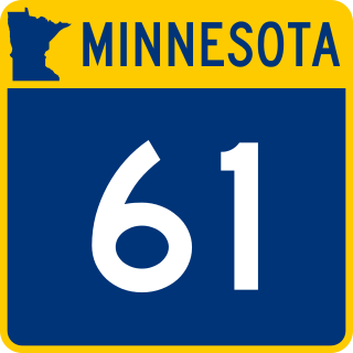
Minnesota State Highway 61 is a 148.843-mile-long (239.540 km) highway in northeast Minnesota, which runs from a junction with Interstate 35 (I-35) in Duluth at 26th Avenue East, and continues northeast to its northern terminus at the Canadian border near Grand Portage, connecting to Ontario Highway 61 at the Pigeon River Bridge. The route is a scenic highway, following the North Shore of Lake Superior, and is part of the Lake Superior Circle Tour designation that runs through Minnesota, Ontario, Michigan, and Wisconsin.

Embarrass is an unincorporated community in Embarrass Township, Saint Louis County, Minnesota, United States.
Knife River is an unincorporated community in Lake County, Minnesota, United States; located on the North Shore of Lake Superior.
Markham is an unincorporated community in Colvin Township, Saint Louis County, Minnesota, United States.
Cotton is an unincorporated community in Cotton Township, Saint Louis County, Minnesota, United States.
Independence is an unincorporated community in New Independence Township, Saint Louis County, Minnesota, United States.
Taft is an unincorporated community in Grand Lake Township, Saint Louis County, Minnesota, United States.
French River is an unincorporated community in Duluth Township, Saint Louis County, Minnesota, United States; located on the North Shore of Lake Superior.

Palmers is an unincorporated community in Duluth Township, Saint Louis County, Minnesota, United States; located on the North Shore of Lake Superior.

The Cloquet Valley State Forest encompasses 327,098 acres (1,323.7 km2); 48,384 acres (195.8 km2) of which are Minnesota Department of Natural Resources forestry administered lands.


