Mount Cory (Alberta)

Last updated
Mount Cory
Mount Cory (30006908068).jpg
Highest point
Elevation 2,802 m (9,193 ft) [1] [2]
Prominence 287 m (942 ft) [3]
Parent peak Mystic Peak [3]
Listing Mountains of Alberta
Coordinates 51°12′05″N115°41′20″W / 51.20139°N 115.68889°W / 51.20139; -115.68889 Coordinates: 51°12′05″N115°41′20″W / 51.20139°N 115.68889°W / 51.20139; -115.68889 [1]
Geography
Canada Alberta relief location map - transverse mercator proj.svg
Red triangle with thick white border.svg
Mount Cory
Location in Alberta
Location Alberta, Canada
Parent range Sawback Range
Topo map NTS 82O4 Banff
Climbing
Easiest route Easy/Moderate Scramble [2]

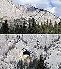
Mount Cory is a mountain located in the Bow River Valley in southeast Banff National Park, just north of Banff, Alberta, Canada. The mountain was named in 1923 after William Wallace Cory, deputy minister of the Interior from 1905 to 1930. [1]

The "Hole in the Wall"

Mount Cory's "Hole in the Wall" Mount Cory Alberta Canada "Hole in the Wall" natural cave.jpg
Mount Cory's "Hole in the Wall"

The gaping "Hole in the Wall" cave is located in the upper portion of the western side of Mount Cory. The cave is a landmark easily viewed from the nearby Trans-Canada Highway. The formation is natural, despite the seemingly regular pentagonal shape of its entrance as seen from a distance. The cave is about 60 feet high and 100 feet deep and has often been visited by climbers. [4]

Related Research Articles

Jasper National Park National park in Alberta, Canada

Jasper National Park is a national park in Alberta, Canada. It is the largest national park within Alberta's Rocky Mountains spanning 11,000 km2 (4,200 sq mi). Its location is north of Banff National Park and west of Edmonton. The park contains the glaciers of the Columbia Icefield, springs, lakes, waterfalls and mountains.

Banff National Park National park in Alberta, Canada

Banff National Park is Canada's oldest national park, established in 1885. Located in Alberta's Rocky Mountains, 110–180 kilometres (68–112 mi) west of Calgary, Banff encompasses 6,641 square kilometres (2,564 sq mi) of mountainous terrain, with many glaciers and ice fields, dense coniferous forest, and alpine landscapes. The Icefields Parkway extends from Lake Louise, connecting to Jasper National Park in the north. Provincial forests and Yoho National Park are neighbours to the west, while Kootenay National Park is located to the south and Kananaskis Country to the southeast. The main commercial centre of the park is the town of Banff, in the Bow River valley.

Lake Louise, Alberta Hamlet in Alberta, Canada

Lake Louise is a hamlet within Banff National Park in Alberta, Canada. Named after Princess Louise, Duchess of Argyll, it lies in Alberta's Rockies on the Bow River, 3 km (1.9 mi) northeast of the lake that shares its name. Initially settled in 1884 as an outpost for the Canadian Pacific Railway, Lake Louise sits at an elevation of 1,600 m (5,200 ft), making it Canada's highest community. The nearby lake, framed by mountains, is one of the most famous mountain vistas in the world; the famous Chateau Lake Louise also overlooks the lake.

Canadian Rocky Mountain Parks World Heritage Site

The Canadian Rocky Mountain Parks World Heritage Site is located in the Canadian Rockies. It consists of seven contiguous parks including four national parks:

Banff, Alberta Town in Alberta, Canada

Banff is a town within Banff National Park in Alberta, Canada. It is located in Alberta's Rockies along the Trans-Canada Highway, approximately 126 km (78 mi) west of Calgary and 58 km (36 mi) east of Lake Louise. At 1,400 to 1,630 m above sea level, Banff is the community with the second highest elevation in Alberta, after Lake Louise.

Mount Temple (Alberta) Mountain in Banff NP, Canada

Mount Temple is a mountain in Banff National Park of the Canadian Rockies of Alberta, Canada.

Kootenay National Park National park in British Columbia, Canada

Kootenay National Park is a national park of Canada located in southeastern British Columbia. The park consists of 1,406 km2 (543 sq mi) of the Canadian Rockies, including parts of the Kootenay and Park mountain ranges, the Kootenay River and the entirety of the Vermilion River. While the Vermilion River is completely contained within the park, the Kootenay River has its headwaters just outside the park boundary, flowing through the park into the Rocky Mountain Trench and eventually joining the Columbia River. The park ranges in elevation from 918 m (3,012 ft) at the southwestern park entrance to 3,424 m (11,234 ft) at Deltaform Mountain.

Mount Rundle Mountain in Banff National Park, Canada

Mount Rundle is a mountain in Canada's Banff National Park overlooking the towns of Banff and Canmore, Alberta. The Cree name was Waskahigan Watchi or house mountain. In 1858 John Palliser renamed the mountain after Reverend Robert Rundle, a Methodist invited by the Hudson's Bay Company to do missionary work in western Canada in the 1840s. He introduced syllabics there—a written language developed for the Cree, as part of his missionary work. He only visited the Stoney-Nakoda of the area around what is now called Mount Rundle in 1844 and 1847.

Mount Louis Mountain in Banff NP, Canada

Mount Louis is a 2,682-metre (8,799-foot) mountain summit located in southeast Banff National Park in Alberta, Canada. It is part of the Sawback Range which is a subset of the Canadian Rockies.

Castle Mountain Mountain in Alberta, Canada

Castle Mountain is a mountain located within Banff National Park in the Canadian Rockies, approximately halfway between Banff and Lake Louise. It is the easternmost mountain of the Main Ranges in the Bow Valley and sits astride the Castle Mountain Fault which has thrust older sedimentary and metamorphic rocks forming the upper part of the mountain over the younger rocks forming its base. The mountain's castellated, or castle-like, appearance is a result of erosive processes acting at different rates on the peak's alternating layers of softer shale and harder limestone, dolomite and quartzite.

Mount Saskatchewan (Alberta) Mountain in Banff National Park, Alberta, Canada

Mount Saskatchewan is a mountain located in the North Saskatchewan River valley of Banff National Park, in the Canadian Rockies of Alberta, Canada.

Mount Hector (Alberta) Mountain in Banff National Park, Alberta, Canada

Mount Hector is a 3,394-metre (11,135-foot) mountain summit located in the Bow River valley of Banff National Park, in the Canadian Rockies of Alberta, Canada. The mountain was named in 1884 by George M. Dawson after James Hector, a geologist on the Palliser expedition. The mountain is located beside the Icefields Parkway, 17 km (11 mi) north of Lake Louise.

Banff Sunshine Ski resort in Alberta, Canada

Banff Sunshine Village is a ski resort in western Canada, located on the Continental Divide of the Canadian Rockies within Banff National Park in Alberta and Mt Assiniboine Provincial Park in British Columbia. It is one of three major ski resorts located in the Banff National Park. Because of its location straddling the Continental Divide, Sunshine receives more snow than the neighbouring ski resorts. The Sunshine base area is located 15 km (9 mi) southwest of the town of Banff. By car, it is about a ninety-minute drive from the city of Calgary; the Sunshine exit on the Trans Canada Highway is 8 km (5 mi) west of the town of Banff.

Mount Assiniboine Provincial Park Provincial park in British Columbia, Canada

Mount Assiniboine Provincial Park is a provincial park in British Columbia, Canada, located around Mount Assiniboine.

Mt Norquay Ski resort in Alberta, Canada

Mt. Norquay is a mountain and ski resort in Banff National Park, Canada that lies directly northwest of the Town of Banff. The regular ski season starts early December and ends mid-April. Mount Norquay is one of three major ski resorts located in the Banff National Park.

Cave and Basin National Historic Site Historic site in Banff, Alberta, Canada

The Cave and Basin National Historic Site of Canada is located in the town of Banff, Alberta, within the Canadian Rocky Mountains, at the site of natural thermal mineral springs around which Canada's first national park, Banff National Park, was established.

Albertas Rockies Rocky Mountains in Alberta, Canada

Alberta's Rockies comprise the Canadian Rocky Mountains in Alberta, Canada. On the southwestern part of the province along the British Columbia border, the region covers all but the south of Census Division 15.

Banff Formation

The Banff Formation is a stratigraphical unit of Devonian age in the Western Canadian Sedimentary Basin.

Cirrus Mountain

Cirrus Mountain is a 3,270-metre (10,730-foot) mountain summit located in the upper North Saskatchewan River valley on the shared boundary between Banff National Park and White Goat Wilderness Area, in the Canadian Rockies of Alberta, Canada. Its nearest higher peak is Mount Stewart, 5.92 km (3.68 mi) to the north-northeast. Cirrus Mountain is situated along the east side the Icefields Parkway midway between Saskatchewan Crossing and Sunwapta Pass.

Pinnacle Mountain (Alberta) Mountain in Banff NP, Canada

Pinnacle Mountain is a 3,070-metre (10,070-foot) mountain summit in Banff National Park in Alberta, Canada. It's part of the Bow Range, which is a sub-range of the Canadian Rockies. The nearest higher peak is Eiffel Peak, 1.0 km (0.62 mi) to the southwest. Mount Temple is situated immediately northeast of Pinnacle Mountain, with Sentinel Pass as the low point between the two.

References

  1. 1 2 3 "Mount Cory". PeakFinder.com. Retrieved 2004-10-24.
  2. 1 2 Kane, Alan (1999). "Mount Cory". Scrambles in the Canadian Rockies . Calgary: Rocky Mountain Books. p. 203. ISBN   0-921102-67-4.
  3. 1 2 "Mount Cory". Bivouac.com. Retrieved 2010-02-20.
  4. "Historical image of hikers in entrance to Mount Cory "Hole in the Wall"". albertaonrecord.ca. Society of Alberta Archives. Retrieved 2019-06-11.