Ram Range

Last updated
Ram Range
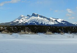
Kista Peak from Abraham Lake.jpg
Kista Peak from Abraham Lake
Highest point
Peak Canary Peak
Elevation 2,844 m (9,331 ft) [1] [2]
Prominence 726 m (2,382 ft) [1]
Listing Mountains of Alberta
Coordinates 52°01′26″N116°09′32″W / 52.02382°N 116.15879°W / 52.02382; -116.15879 [1]
Dimensions
Length35 km (22 mi)EW [3]
Width31 km (19 mi)NS [3]
Area558 km2 (215 sq mi) [3]
Geography
Canada Alberta relief location map - transverse mercator proj.svg
Red triangle with thick white border.svg
Country Canada
Province Alberta
Range coordinates 52°03′N116°10′W / 52.050°N 116.167°W / 52.050; -116.167 [4]
Parent range Canadian Rockies
Topo map NTS 83C1 Whiterabbit Creek [4]

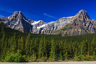
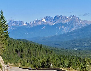
The Ram Range is a mountain range of the Canadian Rockies located in David Thompson Country , Canada. The range extends southeast from Abraham Lake to the Ram River. It is bounded on the southwest by Whiterabbit Creek.

Contents

List of mountains

This range includes the following mountains and peaks:

Mountain/PeakElevationCoordinates
mft
Canary Peak 2,8449,331
Mount Bramwell [5] 2,7589,049
Wingnut Peak [6] 2,7589,049
Mount William Booth 2,7288,950 52°5′24″N116°19′18″W / 52.09000°N 116.32167°W / 52.09000; -116.32167
Finch Peak [7] 2,6068,550
Hummingbird Peak [8] 2,5948,510
Kista Peak 2,5768,451 52°13′49″N116°13′59″W / 52.23028°N 116.23306°W / 52.23028; -116.23306
Mount Michener 2,5458,350 52°12′24″N116°23′26″W / 52.20667°N 116.39056°W / 52.20667; -116.39056
Map this section's coordinates using: OpenStreetMap

Related Research Articles

<span class="mw-page-title-main">Mount Logan</span> Highest mountain in Canada

Mount Logan is the highest mountain in Canada and the second-highest peak in North America after Denali. The mountain was named after Sir William Edmond Logan, a Canadian geologist and founder of the Geological Survey of Canada (GSC). Mount Logan is located within Kluane National Park Reserve in southwestern Yukon, less than 40 kilometres (25 mi) north of the Yukon–Alaska border. Mount Logan is the source of the Hubbard and Logan glaciers. Although many shield volcanoes are much larger in size and mass, Mount Logan is believed to have the largest base circumference of any non-volcanic mountain on Earth, including a massif with eleven peaks over 5,000 metres (16,400 ft).

<span class="mw-page-title-main">Fourteener</span> Mountain peak of at least 14,000 ft.

In the mountaineering parlance of the Western United States, a fourteener is a mountain peak with an elevation of at least 14,000 ft (4267 m). The 96 fourteeners in the United States are all west of the Mississippi River. Colorado has the most (53) of any single state; Alaska is second with 29. Many peak baggers try to climb all fourteeners in the contiguous United States, one particular state, or another region.

<span class="mw-page-title-main">Slate Range (Alberta)</span> Mountain range in Alberta, Canada

The Slate Range is a mountain range of the Canadian Rockies, located in Banff National Park, Canada. The range is named after slate, the primary composition of the mountains in the area.

The Victoria Cross Ranges are a set of mountain ranges in the Canadian Rockies, located to the northwest of Jasper. Of the 19 peaks contained within this range, five are named after Canadian recipients of the Victoria Cross. The area of the ranges is 678 square kilometres (262 sq mi).

<span class="mw-page-title-main">Beaverfoot Range</span> Mountain range in British Columbia, Canada

The Beaverfoot Range is a mountain range of the Canadian Rockies, located in southeastern British Columbia. The range extends from Cedared Creek near Spillimacheen north to the Kicking Horse River.

<span class="mw-page-title-main">Maligne Range</span> Subrange of the Front Ranges in Alberta, Canada

The Maligne Range is a mountain range of the Canadian Rockies located directly southeast of Jasper townsite in Jasper National Park, Canada. The southern tail-end of the range finishes at Endless Chain Ridge.

<span class="mw-page-title-main">Mountain peaks of Canada</span>

This article comprises three sortable tables of major mountain peaks of Canada.

<span class="mw-page-title-main">Sundance Range</span> Mountain range in Alberta and British Columbia, Canada

The Sundance Range is a mountain range in the Canadian Rockies, south of the town of Banff. It is located on the Continental Divide, which forms the boundary between British Columbia and Alberta in this region.

<span class="mw-page-title-main">Seven Sisters Peaks</span>

Seven Sisters Peaks is a 2,747-metre (9,012-foot) multi-summit massif located in the Bulkley Ranges of the Interior Mountains in British Columbia, Canada. The massif is situated within Seven Sisters Provincial Park and Protected Area, 10 km (6 mi) southeast of Cedarvale, south of Orion Peak, and surrounded by Seven Sisters Glacier. The highest peak of the seven is called Weeskinisht Peak. Precipitation runoff from the mountain and meltwater from the glacier drains into tributaries of the Skeena River. The nearest higher peak is Howson Peak, 68.8 km (43 mi) to the south-southeast.

References

  1. 1 2 3 "Canary Peak". Bivouac.com. Retrieved 2023-12-22.
  2. "Topographic map of Canary Peak". opentopomap.org. Retrieved 2023-12-22.
  3. 1 2 3 "Ram Range". Peakbagger.com. Retrieved 2023-12-22.
  4. 1 2 "Ram Range". Geographical Names Data Base . Natural Resources Canada . Retrieved 2023-12-22.
  5. "Mount Bramwell". Bivouac.com. Retrieved 2023-12-22.
  6. "Wingnut Peak". Bivouac.com. Retrieved 2023-12-22.
  7. "Finch Peak". Bivouac.com. Retrieved 2023-12-22.
  8. "Hummingbird Peak". Bivouac.com. Retrieved 2023-12-22.