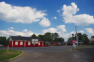
Pisgah is a town in Jackson County, Alabama, United States, and is included in the Huntsville-Decatur Combined Statistical Area. It incorporated in 1947. As of the 2010 census, the population of the town was 722, up from 706 in 2000. Pisgah is located atop Sand Mountain.
Mount Pisgah is the name of several mountains and places:

The Monadnock Region is a region in southwestern New Hampshire. It is named after Mount Monadnock, a 3,165 foot isolated mountain, which is the dominant geographic landmark in the region. Although it has no specific borders, the Monadnock Region is generally thought of comprising all of Cheshire County and the western portion of Hillsborough County.
Some translators of the biblical book of Deuteronomy translate Pisgah as a name of a mountain, usually referring to Mount Nebo. The word פִּסְגָּה literally means "summit". The region lies directly east of the Jordan River and just northeast of the Dead Sea. Mount Nebo is the highest among a handful of Pisgah summits; an arid cluster of hilltops on the western edge of the Trans-Jordanian Plateau. Arabic names for Pisgah include: Fasga (Phasga), Jabal Siyāgha, Rās as-Siyāgha and Rujm Siyāgha.
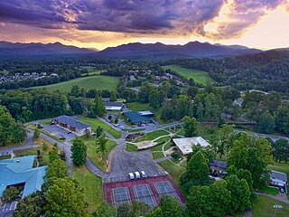
Mount Pisgah Academy is a four-year secondary education boarding and day school located in Candler, North Carolina, United States, near Asheville. The academy is named after the Mount Pisgah of biblical reference as well as its proximity to Mount Pisgah in the Blue Ridge Mountains.

Mount Pisgah is a mountain in the Appalachian Mountain Range and part of the Blue Ridge Mountains of North Carolina, United States. The mountain's height is 5,721 feet above sea level, and it sits approximately 15 miles southwest of Asheville, near the crossing of the boundaries of Buncombe, Haywood, Henderson and Transylvania counties. It is located on the border of Buncombe and Haywood counties, close to the point where Henderson and Transylvania meet them, but not actually within the latter two counties. The mountain is easily accessible via a hiking trail from the Blue Ridge Parkway, near the Pisgah Inn.

Pisgah National Forest is a National Forest in the Appalachian Mountains of western North Carolina. It is administered by the United States Forest Service, part of the United States Department of Agriculture. The Pisgah National Forest is completely contained within the state of North Carolina. The forest is managed together with the other three North Carolina National Forests from common headquarters in Asheville, North Carolina. There are local ranger district offices located in Pisgah Forest, Mars Hill, and Nebo.

The Mountains-to-Sea State Trail (MST) is a long-distance trail for hiking and backpacking, that traverses North Carolina from the Great Smoky Mountains to the Outer Banks. The trail's western endpoint is at Clingman's Dome, where it connects to the Appalachian Trail in the Great Smoky Mountains National Park. Its eastern endpoint is in Jockey's Ridge State Park on the tallest sand dune on the east coast. The trail is envisioned as a scenic backbone of an interconnected trail system spanning the state. As such, the trail's route attempts to connect as many trail systems and natural scenic areas as practicable. A little over half of the trail is complete in multiple segments across the state.

Mount Snow is a mountain resort and ski area in southern Vermont located in the Green Mountains. It is Vermont's closest big mountain to many Northeast metropolitan areas.

Black Balsam Knob, also known as Black Balsam Bald, is in the Pisgah National Forest southwest of Asheville, North Carolina, near milepost 420 on the Blue Ridge Parkway. It is the second highest mountain in the Great Balsam Mountains. The Great Balsams are within the Blue Ridge Mountains, which are part of the Appalachian Mountains. It is the 23rd highest of the 40 mountains in North Carolina over 6000 feet.

Mount Pisgah is a mountain in Westmore, Vermont. It is located on the east side of Lake Willoughby and constitutes the eastern side of "Willoughby Gap". It is part of the Northeastern Highlands of Vermont. There are hiking trails in Willoughby State Forest.

Mount Hor is a mountain in Sutton, Vermont. It is part of the Northeastern Highlands of Vermont. It is located on the west side of Lake Willoughby and constitutes the west side of "Willoughby Notch". There are hiking trails in Willoughby State Forest.

Mount Craig, 6,647 feet (2,026 m), is the second highest peak of the Appalachian Mountains and second only to 6,684 feet (2,037 m) Mount Mitchell in eastern North America. It is located in the Black Mountains in Yancey County, North Carolina. The mountain lies about a mile (2 km) north of Mount Mitchell and is within Mount Mitchell State Park and the Pisgah National Forest.

Pisgah Mountain or Pisgah Ridge is a ridgeline running 12.5 miles (20.1 km) from Tamaqua to Jim Thorpe, Pennsylvania. It is oriented north-northeast to south-southwest, and its north-side valley is followed by U.S. Route 209 from river gap to river gap. The ridge is a succession of peaks exceeding 1,440 feet (438.9 m) rising 300 to 540 feet above the boroughs of Lansford, Coaldale, and Tamaqua in the Panther Creek valley. The highest point on Pisgah Mountain is at 1,611 feet (491 m) in the borough of Summit Hill, which sits atop the ridge. Near Summit Hill was the "Sharpe Mountain" (peak) where in 1791 Phillip Ginter is documented as having discovered anthracite, leading to the formation of the Lehigh Coal Mine Company. In 1818 the Lehigh Coal Company took over the mines, and the mining camp gradually became a settlement and grew into Summit Hill.
Mount Pisgah is a peak in Carbon County, Pennsylvania situated north-northwest from and looming over the right bank business district in downtown Jim Thorpe.

Mount Pisgah is a mountain located in the Catskill Mountains of New York southeast of Bovina Center. Grays Mountain, Fords Hill, and Dingle Hill are located south of Mount Pisgah.

Richtmyer Peak is a mountain in Greene County, New York and partly in Schoharie County, New York. It is located in the Catskill Mountains southwest of West Durham. Mount Pisgah is located east, and Richmond Mountain is located southwest of Richtmyer Peak.

Mount Pisgah is a mountain located in the town of Winthrop, Maine. Its summit is the fifth highest in Kennebec County.

Mount Pisgah is a mountain on the border between the Canadian province of Quebec, in the region of Estrie, and the American state of Maine, which is part of the Appalachian Mountains; it rises to 1,023 metres (3,356 ft) of altitude.

