Related Research Articles

The Lewis and Clark Expedition from August 31, 1803, to September 25, 1806, also known as the Corps of Discovery Expedition, was the United States expedition to cross the newly acquired western portion of the country after the Louisiana Purchase. The Corps of Discovery was a select group of U.S. Army and civilian volunteers under the command of Captain Meriwether Lewis and his close friend Second Lieutenant William Clark. The expedition made its way westward, and crossed the Continental Divide of the Americas before reaching the Pacific Coast.
Jefferson may refer to:

Mount Vernon is a city in and the county seat of Jefferson County, Illinois, United States. The population was 14,600 at the 2020 census.

Jefferson is a town in Schoharie County, New York, United States. The population was 1,285 at the 2000 census. The town is on the southwestern border of the county and is east of Oneonta.
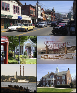
Port Jefferson is an incorporated village in the Town of Brookhaven in Suffolk County, New York, on the North Shore of Long Island. Officially known as the Incorporated Village of Port Jefferson, the population was 7,962 as of the 2020 United States census.
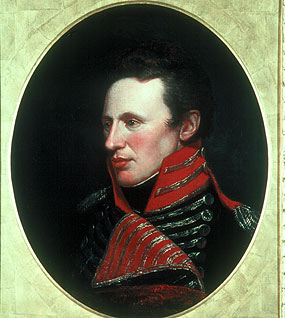
Zebulon Montgomery Pike was an American brigadier general and explorer for whom Pikes Peak in Colorado was named. As a U.S. Army officer he led two expeditions under authority of President Thomas Jefferson through the Louisiana Purchase territory, first in 1805–1806 to reconnoiter the upper northern reaches of the Mississippi River, and then in 1806–1807 to explore the southwest to the fringes of the northern Spanish-colonial settlements of New Mexico and Texas. Pike's expeditions coincided with other Jeffersonian expeditions, including the Lewis and Clark Expedition and the Red River Expedition in 1806.

The Presidential Range is a mountain range located in the White Mountains of the U.S. state of New Hampshire. Containing the highest peaks of the Whites, its most notable summits are named for American presidents, followed by prominent public figures of the 18th and 19th centuries. The Presidential Range is notorious for having some of the worst weather on Earth, mainly because of the unpredictability of high wind speeds and whiteout conditions on the higher summits. Because of the poor weather conditions, the Presidential Range is often used for mountaineering training for those who go on to climb some of the world's highest mountains, including K2 and Everest.

The Warm Springs Indian Reservation consists of 1,019 square miles (2,640 km2) in north-central Oregon, in the United States, and is occupied and governed by the Confederated Tribes of Warm Springs.

Mount Jefferson is a stratovolcano in the Cascade Volcanic Arc, part of the Cascade Range in the U.S. state of Oregon. The second highest mountain in Oregon, it is situated within Linn County, Jefferson County, and Marion County and forms part of the Mount Jefferson Wilderness. Due to the ruggedness of its surroundings, the mountain is one of the hardest volcanoes to reach in the Cascades. It is also a popular tourist destination despite its remoteness, with recreational activities including hiking, backpacking, mountaineering, and photography. Vegetation at Mount Jefferson is dominated by Douglas fir, silver fir, mountain hemlock, ponderosa pine, lodgepole pine, and several cedar species. Carnivores, insectivores, bats, rodents, deer, birds, and various other species inhabit the area.

Mount Jefferson is a mountain located on the Continental Divide between Fremont County of northeastern Idaho and Beaverhead County of southwestern Montana. Mount Jefferson is the highest point of the Centennial Mountains, whose crest runs along the Continental Divide and can be climbed using a class 2 route (scramble) from the access road to neighboring Sawtell Peak.

The North Santiam River is a 92-mile (148 km) tributary of the Santiam River in western Oregon in the United States. It drains 766 square miles (1,980 km2) of the Cascade Range on the eastern side of the Willamette Valley east of Salem.
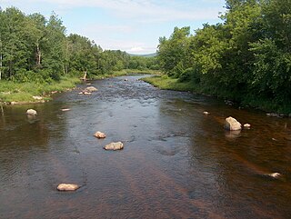
The Israel River, sometimes referred to as Israel's River, is a 23.2-mile-long (37.3 km) river in the White Mountains of New Hampshire, in the United States. It rises in the township of Low and Burbank's Grant and runs generally northwest along U.S. Route 2, traversing the towns of Jefferson and Lancaster, before joining the Connecticut River.

The George Washington and Jefferson National Forests is an administrative entity combining two U.S. National Forests into one of the largest areas of public land in the Eastern United States. The forests cover 1.8 million acres (7,300 km2) of land in the Appalachian Mountains of Virginia, West Virginia, and Kentucky. Approximately 1 million acres (4,000 km2) of the forest are remote and undeveloped and 139,461 acres (564 km2) have been designated as wilderness areas, which prohibits future development.

Kilkenny is a township in Coös County, New Hampshire, United States. It lies entirely within the White Mountain National Forest. As of the 2020 census, the township had a population of zero.
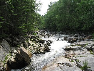
The West Branch of the Peabody River is a 5.8-mile-long (9.3 km) river in the White Mountains of New Hampshire in the United States. It is a tributary of the Peabody River, which flows into the Androscoggin River, which in turn flows east and south into Maine, joining the Kennebec River near the Atlantic Ocean. The West Branch of the Peabody is within the Great Gulf Wilderness of the White Mountain National Forest for most of its length. It is paralleled by the Great Gulf Trail, a popular route for backpackers.
The South Branch of the Israel River is a 6.8-mile-long (10.9 km) river in the White Mountains of New Hampshire in the United States. It is a tributary of the Israel River and part of the Connecticut River watershed. For most of its length, it is within the White Mountain National Forest.
Mount Marshall is a mountain located in Essex County, New York. Originally named for Governor DeWitt Clinton, and then for Herbert Clark, it was renamed for wilderness activist Bob Marshall (1901–1939) after his death. Marshall is part of the MacIntyre Mountains. Mount Marshall is flanked to the northeast by Iroquois Peak, and faces Wallface Mountain to the northwest across Indian Pass.

The Dartmouth Range is a mountain range in the White Mountains of New Hampshire in the United States. The range lies in the township of Low and Burbank's Grant and the town of Carroll in Coos County.
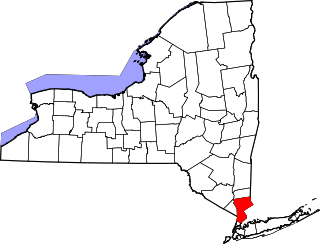
This is a list of the National Register of Historic Places listings in northern Westchester County, New York, excluding the city of Peekskill, which has its own list.

William Moore Davis was an American painter best known for his landscapes. A native of Long Island, he spent most of his life near Port Jefferson and has been praised as the greatest painter of that village. A contemporary of the Hudson River School, he was greatly influenced by fellow local painter William Sidney Mount.